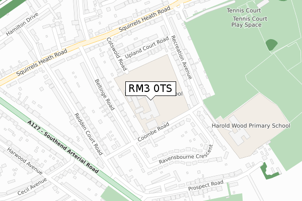
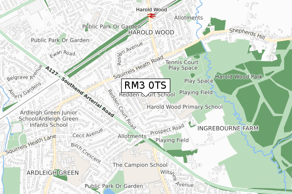
RM3 0TS is located in the Harold Wood electoral ward, within the London borough of Havering and the English Parliamentary constituency of Hornchurch and Upminster. The Sub Integrated Care Board (ICB) Location is NHS North East London ICB - A3A8R and the police force is Metropolitan Police. This postcode has been in use since January 1980.


GetTheData
Source: OS Open Zoomstack (Ordnance Survey)
Licence: Open Government Licence (requires attribution)
Attribution: Contains OS data © Crown copyright and database right 2024
Source: Open Postcode Geo
Licence: Open Government Licence (requires attribution)
Attribution: Contains OS data © Crown copyright and database right 2024; Contains Royal Mail data © Royal Mail copyright and database right 2024; Source: Office for National Statistics licensed under the Open Government Licence v.3.0
| Easting | 554725 |
| Northing | 189873 |
| Latitude | 51.586474 |
| Longitude | 0.231954 |
GetTheData
Source: Open Postcode Geo
Licence: Open Government Licence
| Country | England |
| Postcode District | RM3 |
| ➜ RM3 open data dashboard ➜ See where RM3 is on a map ➜ Where is London? | |
GetTheData
Source: Land Registry Price Paid Data
Licence: Open Government Licence
Elevation or altitude of RM3 0TS as distance above sea level:
| Metres | Feet | |
|---|---|---|
| Elevation | 40m | 131ft |
Elevation is measured from the approximate centre of the postcode, to the nearest point on an OS contour line from OS Terrain 50, which has contour spacing of ten vertical metres.
➜ How high above sea level am I? Find the elevation of your current position using your device's GPS.
GetTheData
Source: Open Postcode Elevation
Licence: Open Government Licence
| Ward | Harold Wood |
| Constituency | Hornchurch And Upminster |
GetTheData
Source: ONS Postcode Database
Licence: Open Government Licence
| June 2022 | Violence and sexual offences | On or near Coombe Road | 106m |
| June 2022 | Violence and sexual offences | On or near Coombe Road | 106m |
| June 2022 | Violence and sexual offences | On or near Coombe Road | 106m |
| ➜ Get more crime data in our Crime section | |||
GetTheData
Source: data.police.uk
Licence: Open Government Licence
| Rosslyn Avenue | Harold Wood | 270m |
| Recreation Avenue | Harold Wood | 282m |
| Rosslyn Avenue | Harold Wood | 314m |
| Harold Wood Neighbourhood Centre (Squirrels Heath Road) | Harold Wood | 370m |
| St Peter's Church (Rm3) (Gubbins Lane) | Harold Wood | 395m |
| Harold Wood Station | 0.7km |
| Gidea Park Station | 1.9km |
| Emerson Park Station | 2.1km |
GetTheData
Source: NaPTAN
Licence: Open Government Licence
GetTheData
Source: ONS Postcode Database
Licence: Open Government Licence


➜ Get more ratings from the Food Standards Agency
GetTheData
Source: Food Standards Agency
Licence: FSA terms & conditions
| Last Collection | |||
|---|---|---|---|
| Location | Mon-Fri | Sat | Distance |
| Cecil Avenue/Harwood | 17:15 | 11:45 | 433m |
| Wingletye Lane | 17:00 | 11:30 | 747m |
| Court Avenue | 17:15 | 12:30 | 819m |
GetTheData
Source: Dracos
Licence: Creative Commons Attribution-ShareAlike
| Facility | Distance |
|---|---|
| Redden Court School Cotswold Road, Romford Sports Hall, Grass Pitches, Studio | 0m |
| Harold Wood Primary School Recreation Avenue, Harold Wood, Romford Grass Pitches | 295m |
| Prospect Road Playing Field Prospect Road, Prospect Road, Hornchurch Grass Pitches | 381m |
GetTheData
Source: Active Places
Licence: Open Government Licence
| School | Phase of Education | Distance |
|---|---|---|
| Redden Court School Cotswold Road, Harold Wood, Romford, RM3 0TS | Secondary | 0m |
| Harold Wood Primary School Recreation Avenue, Harold Wood, Romford, RM3 0TH | Primary | 295m |
| The Campion School Wingletye Lane, Hornchurch, RM11 3BX | Secondary | 479m |
GetTheData
Source: Edubase
Licence: Open Government Licence
The below table lists the International Territorial Level (ITL) codes (formerly Nomenclature of Territorial Units for Statistics (NUTS) codes) and Local Administrative Units (LAU) codes for RM3 0TS:
| ITL 1 Code | Name |
|---|---|
| TLI | London |
| ITL 2 Code | Name |
| TLI5 | Outer London - East and North East |
| ITL 3 Code | Name |
| TLI52 | Barking & Dagenham and Havering |
| LAU 1 Code | Name |
| E09000016 | Havering |
GetTheData
Source: ONS Postcode Directory
Licence: Open Government Licence
The below table lists the Census Output Area (OA), Lower Layer Super Output Area (LSOA), and Middle Layer Super Output Area (MSOA) for RM3 0TS:
| Code | Name | |
|---|---|---|
| OA | E00011343 | |
| LSOA | E01002268 | Havering 010A |
| MSOA | E02000473 | Havering 010 |
GetTheData
Source: ONS Postcode Directory
Licence: Open Government Licence
| RM3 0TX | Coombe Road | 116m |
| RM3 0UH | Beltinge Road | 127m |
| RM3 0TJ | Recreation Avenue | 142m |
| RM3 0UJ | Beltinge Road | 154m |
| RM3 0TR | Cotswold Road | 173m |
| RM3 0TD | Recreation Avenue | 186m |
| RM3 0TT | Upland Court Road | 195m |
| RM3 0UD | Ravensbourne Crescent | 196m |
| RM3 0UA | Coombe Road | 203m |
| RM3 0UR | Redden Court Road | 230m |
GetTheData
Source: Open Postcode Geo; Land Registry Price Paid Data
Licence: Open Government Licence