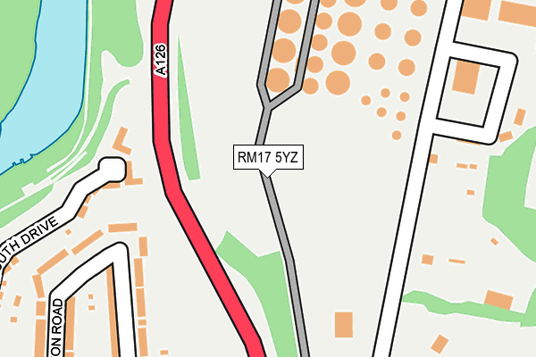
RM17 5YZ is located in the Grays Riverside electoral ward, within the unitary authority of Thurrock and the English Parliamentary constituency of Thurrock. The Sub Integrated Care Board (ICB) Location is NHS Mid and South Essex ICB - 07G and the police force is Essex. This postcode has been in use since January 1980.


GetTheData
Source: OS OpenMap – Local (Ordnance Survey)
Source: OS VectorMap District (Ordnance Survey)
Licence: Open Government Licence (requires attribution)
| Easting | 560240 |
| Northing | 178750 |
| Latitude | 51.485004 |
| Longitude | 0.306461 |
GetTheData
Source: Open Postcode Geo
Licence: Open Government Licence
| Country | England |
| Postcode District | RM17 |
➜ See where RM17 is on a map ➜ Where is Chafford Hundred? | |
GetTheData
Source: Land Registry Price Paid Data
Licence: Open Government Licence
Elevation or altitude of RM17 5YZ as distance above sea level:
| Metres | Feet | |
|---|---|---|
| Elevation | 10m | 33ft |
Elevation is measured from the approximate centre of the postcode, to the nearest point on an OS contour line from OS Terrain 50, which has contour spacing of ten vertical metres.
➜ How high above sea level am I? Find the elevation of your current position using your device's GPS.
GetTheData
Source: Open Postcode Elevation
Licence: Open Government Licence
| Ward | Grays Riverside |
| Constituency | Thurrock |
GetTheData
Source: ONS Postcode Database
Licence: Open Government Licence
| Warren Lane | Chafford Hundred | 290m |
| Maunder Close (Lancaster Road) | Chafford Hundred | 431m |
| Maunder Close (Lancaster Road) | Chafford Hundred | 464m |
| Warren Lane | Chafford Hundred | 485m |
| Medical Centre (Drake Road) | Chafford Hundred | 583m |
| Chafford Hundred Station | 1.3km |
| Grays Station | 1.4km |
| Swanscombe Station | 4km |
GetTheData
Source: NaPTAN
Licence: Open Government Licence
GetTheData
Source: ONS Postcode Database
Licence: Open Government Licence


➜ Get more ratings from the Food Standards Agency
GetTheData
Source: Food Standards Agency
Licence: FSA terms & conditions
| Last Collection | |||
|---|---|---|---|
| Location | Mon-Fri | Sat | Distance |
| Drake Road | 18:30 | 12:00 | 692m |
| Bankfoot/Badgers Dean | 17:30 | 12:00 | 887m |
| Hogg Lane | 16:30 | 12:00 | 1,104m |
GetTheData
Source: Dracos
Licence: Creative Commons Attribution-ShareAlike
| Risk of RM17 5YZ flooding from rivers and sea | Very Low |
| ➜ RM17 5YZ flood map | |
GetTheData
Source: Open Flood Risk by Postcode
Licence: Open Government Licence
The below table lists the International Territorial Level (ITL) codes (formerly Nomenclature of Territorial Units for Statistics (NUTS) codes) and Local Administrative Units (LAU) codes for RM17 5YZ:
| ITL 1 Code | Name |
|---|---|
| TLH | East |
| ITL 2 Code | Name |
| TLH3 | Essex |
| ITL 3 Code | Name |
| TLH32 | Thurrock |
| LAU 1 Code | Name |
| E06000034 | Thurrock |
GetTheData
Source: ONS Postcode Directory
Licence: Open Government Licence
The below table lists the Census Output Area (OA), Lower Layer Super Output Area (LSOA), and Middle Layer Super Output Area (MSOA) for RM17 5YZ:
| Code | Name | |
|---|---|---|
| OA | E00080653 | |
| LSOA | E01015955 | Thurrock 016A |
| MSOA | E02003311 | Thurrock 016 |
GetTheData
Source: ONS Postcode Directory
Licence: Open Government Licence
| RM16 6YG | Warren Lane | 246m |
| RM16 6YQ | Sylvan Close | 264m |
| RM16 6YH | Warren Heights | 272m |
| RM16 6QJ | Sachfield Drive | 277m |
| RM17 5HR | Meesons Lane | 355m |
| RM16 6EY | Frobisher Gardens | 376m |
| RM16 6QW | Sachfield Drive | 398m |
| RM16 6RZ | Carew Close | 404m |
| RM17 5HE | Button Road | 412m |
| RM16 6EJ | Frobisher Gardens | 421m |
GetTheData
Source: Open Postcode Geo; Land Registry Price Paid Data
Licence: Open Government Licence