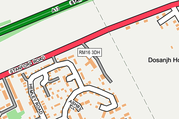
RM16 3DH is located in the Orsett electoral ward, within the unitary authority of Thurrock and the English Parliamentary constituency of South Basildon and East Thurrock. The Sub Integrated Care Board (ICB) Location is NHS Mid and South Essex ICB - 07G and the police force is Essex. This postcode has been in use since January 1980.


GetTheData
Source: OS OpenMap – Local (Ordnance Survey)
Source: OS VectorMap District (Ordnance Survey)
Licence: Open Government Licence (requires attribution)
| Easting | 566093 |
| Northing | 181415 |
| Latitude | 51.507258 |
| Longitude | 0.391905 |
GetTheData
Source: Open Postcode Geo
Licence: Open Government Licence
| Country | England |
| Postcode District | RM16 |
| ➜ RM16 open data dashboard ➜ See where RM16 is on a map ➜ Where is Southfields? | |
GetTheData
Source: Land Registry Price Paid Data
Licence: Open Government Licence
Elevation or altitude of RM16 3DH as distance above sea level:
| Metres | Feet | |
|---|---|---|
| Elevation | 30m | 98ft |
Elevation is measured from the approximate centre of the postcode, to the nearest point on an OS contour line from OS Terrain 50, which has contour spacing of ten vertical metres.
➜ How high above sea level am I? Find the elevation of your current position using your device's GPS.
GetTheData
Source: Open Postcode Elevation
Licence: Open Government Licence
| Ward | Orsett |
| Constituency | South Basildon And East Thurrock |
GetTheData
Source: ONS Postcode Database
Licence: Open Government Licence
| January 2024 | Violence and sexual offences | On or near Whitmore Close | 347m |
| December 2023 | Other theft | On or near Hemley Road | 167m |
| October 2023 | Vehicle crime | On or near Hemley Road | 167m |
| ➜ Get more crime data in our Crime section | |||
GetTheData
Source: data.police.uk
Licence: Open Government Licence
| Sandown Road (Stanford Road) | Orsett | 236m |
| Grosvenor Road (Stanford Road) | Orsett | 282m |
| Sandown Road (Stanford Road) | Orsett | 308m |
| Grosvenor Road (Stanford Road) | Orsett | 340m |
| Welling Road | Orsett | 521m |
| Stanford-le-Hope Station | 2.3km |
| East Tilbury Station | 2.9km |
| Grays Station | 6km |
GetTheData
Source: NaPTAN
Licence: Open Government Licence
GetTheData
Source: ONS Postcode Database
Licence: Open Government Licence


➜ Get more ratings from the Food Standards Agency
GetTheData
Source: Food Standards Agency
Licence: FSA terms & conditions
| Last Collection | |||
|---|---|---|---|
| Location | Mon-Fri | Sat | Distance |
| Sandown Road | 17:15 | 12:00 | 1,783m |
| Valmar Avenue | 16:15 | 11:30 | 1,824m |
| London Road | 16:15 | 11:30 | 2,125m |
GetTheData
Source: Dracos
Licence: Creative Commons Attribution-ShareAlike
| Facility | Distance |
|---|---|
| Orsett Golf Club Brentwood Road, Orsett, Grays Golf | 595m |
| Lofthall Brentwood Road, Orsett, Grays Grass Pitches | 929m |
| St Cleres Hall Golf Club London Road, Stanford-le-hope Golf | 1.5km |
GetTheData
Source: Active Places
Licence: Open Government Licence
| School | Phase of Education | Distance |
|---|---|---|
| Orsett Church of England Primary School School Lane, Orsett, Grays, RM16 3JR | Primary | 1.8km |
| St Clere's School Butts Lane, Stanford-le-Hope, SS17 0NW | Secondary | 1.9km |
| Horndon-On-the-Hill CofE Primary School Hillcrest Road, Horndon-on-the-Hill, Stanford-le-Hope, SS17 8LR | Primary | 2.3km |
GetTheData
Source: Edubase
Licence: Open Government Licence
The below table lists the International Territorial Level (ITL) codes (formerly Nomenclature of Territorial Units for Statistics (NUTS) codes) and Local Administrative Units (LAU) codes for RM16 3DH:
| ITL 1 Code | Name |
|---|---|
| TLH | East |
| ITL 2 Code | Name |
| TLH3 | Essex |
| ITL 3 Code | Name |
| TLH32 | Thurrock |
| LAU 1 Code | Name |
| E06000034 | Thurrock |
GetTheData
Source: ONS Postcode Directory
Licence: Open Government Licence
The below table lists the Census Output Area (OA), Lower Layer Super Output Area (LSOA), and Middle Layer Super Output Area (MSOA) for RM16 3DH:
| Code | Name | |
|---|---|---|
| OA | E00080791 | |
| LSOA | E01015979 | Thurrock 004C |
| MSOA | E02003299 | Thurrock 004 |
GetTheData
Source: ONS Postcode Directory
Licence: Open Government Licence
| RM16 3DQ | Hemley Road | 75m |
| RM16 3DW | Welling Road | 147m |
| RM16 3DX | Ashby Close | 156m |
| RM16 3DG | Hemley Road | 215m |
| RM16 3DY | Jason Close | 239m |
| RM16 3DZ | Alderton Road | 241m |
| RM16 3DF | Welling Road | 260m |
| RM16 3AQ | Sandown Close | 285m |
| RM16 3DN | Ellis Close | 299m |
| RM16 3DE | Borley Court | 318m |
GetTheData
Source: Open Postcode Geo; Land Registry Price Paid Data
Licence: Open Government Licence