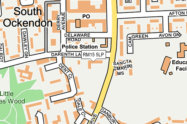
RM15 5LP is located in the Belhus electoral ward, within the unitary authority of Thurrock and the English Parliamentary constituency of Thurrock. The Sub Integrated Care Board (ICB) Location is NHS Mid and South Essex ICB - 07G and the police force is Essex. This postcode has been in use since January 1980.


GetTheData
Source: OS OpenMap – Local (Ordnance Survey)
Source: OS VectorMap District (Ordnance Survey)
Licence: Open Government Licence (requires attribution)
| Easting | 558523 |
| Northing | 181283 |
| Latitude | 51.508244 |
| Longitude | 0.282862 |
GetTheData
Source: Open Postcode Geo
Licence: Open Government Licence
| Country | England |
| Postcode District | RM15 |
| ➜ RM15 open data dashboard ➜ See where RM15 is on a map ➜ Where is South Ockendon? | |
GetTheData
Source: Land Registry Price Paid Data
Licence: Open Government Licence
Elevation or altitude of RM15 5LP as distance above sea level:
| Metres | Feet | |
|---|---|---|
| Elevation | 20m | 66ft |
Elevation is measured from the approximate centre of the postcode, to the nearest point on an OS contour line from OS Terrain 50, which has contour spacing of ten vertical metres.
➜ How high above sea level am I? Find the elevation of your current position using your device's GPS.
GetTheData
Source: Open Postcode Elevation
Licence: Open Government Licence
| Ward | Belhus |
| Constituency | Thurrock |
GetTheData
Source: ONS Postcode Database
Licence: Open Government Licence
| January 2024 | Other theft | On or near Danbury Crescent | 330m |
| December 2023 | Violence and sexual offences | On or near Eden Green | 258m |
| December 2023 | Violence and sexual offences | On or near Eden Green | 258m |
| ➜ Get more crime data in our Crime section | |||
GetTheData
Source: data.police.uk
Licence: Open Government Licence
| Darenth Lane (Daiglen Drive) | South Ockendon | 96m |
| Dawley Green (Darenth Lane) | South Ockendon | 149m |
| Derwent Parade (Daiglen Drive) | South Ockendon | 212m |
| Dawley Green (Darenth Lane) | South Ockendon | 251m |
| Derwent Parade (Daiglen Drive) | South Ockendon | 254m |
| Ockendon Station | 1.6km |
| Chafford Hundred Station | 2.5km |
| Purfleet Station | 4.4km |
GetTheData
Source: NaPTAN
Licence: Open Government Licence
GetTheData
Source: ONS Postcode Database
Licence: Open Government Licence


➜ Get more ratings from the Food Standards Agency
GetTheData
Source: Food Standards Agency
Licence: FSA terms & conditions
| Last Collection | |||
|---|---|---|---|
| Location | Mon-Fri | Sat | Distance |
| South Ockendon Post Office | 18:30 | 12:15 | 139m |
| Daiglen Drive | 16:45 | 11:30 | 427m |
| Barle Gardens | 17:30 | 11:30 | 443m |
GetTheData
Source: Dracos
Licence: Creative Commons Attribution-ShareAlike
| Facility | Distance |
|---|---|
| Beacon Hill Academy Erriff Drive, South Ockendon Sports Hall | 559m |
| Somers Heath Primary School Foyle Drive, South Ockendon Grass Pitches | 602m |
| Dilkes Academy Garron Lane, South Ockendon Grass Pitches, Sports Hall, Artificial Grass Pitch | 687m |
GetTheData
Source: Active Places
Licence: Open Government Licence
| School | Phase of Education | Distance |
|---|---|---|
| Holy Cross Catholic Primary School Daiglen Drive, South Ockendon, RM15 5RP | Primary | 256m |
| Shaw Primary Academy Avon Green, South Ockendon, RM15 5QJ | Primary | 291m |
| Somers Heath Primary School Foyle Drive, South Ockendon, RM15 5LX | Primary | 552m |
GetTheData
Source: Edubase
Licence: Open Government Licence
The below table lists the International Territorial Level (ITL) codes (formerly Nomenclature of Territorial Units for Statistics (NUTS) codes) and Local Administrative Units (LAU) codes for RM15 5LP:
| ITL 1 Code | Name |
|---|---|
| TLH | East |
| ITL 2 Code | Name |
| TLH3 | Essex |
| ITL 3 Code | Name |
| TLH32 | Thurrock |
| LAU 1 Code | Name |
| E06000034 | Thurrock |
GetTheData
Source: ONS Postcode Directory
Licence: Open Government Licence
The below table lists the Census Output Area (OA), Lower Layer Super Output Area (LSOA), and Middle Layer Super Output Area (MSOA) for RM15 5LP:
| Code | Name | |
|---|---|---|
| OA | E00080539 | |
| LSOA | E01015929 | Thurrock 007C |
| MSOA | E02003302 | Thurrock 007 |
GetTheData
Source: ONS Postcode Directory
Licence: Open Government Licence
| RM15 5QN | Cam Green | 119m |
| RM15 5EE | Derwent Parade | 126m |
| RM15 5EH | Daiglen Drive | 131m |
| RM15 5DS | Dent Close | 139m |
| RM15 5JA | Darenth Lane | 153m |
| RM15 5DT | Dunning Close | 173m |
| RM15 5QW | Cam Green | 181m |
| RM15 5EF | Derwent Parade | 183m |
| RM15 5DR | Dale Close | 187m |
| RM15 5LN | Darenth Lane | 188m |
GetTheData
Source: Open Postcode Geo; Land Registry Price Paid Data
Licence: Open Government Licence