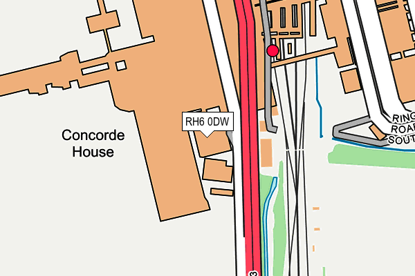
RH6 0DW is located in the Langley Green & Tushmore electoral ward, within the local authority district of Crawley and the English Parliamentary constituency of Crawley. The Sub Integrated Care Board (ICB) Location is NHS Sussex ICB - 70F and the police force is Sussex. This postcode has been in use since January 1992.


GetTheData
Source: OS OpenMap – Local (Ordnance Survey)
Source: OS VectorMap District (Ordnance Survey)
Licence: Open Government Licence (requires attribution)
| Easting | 528590 |
| Northing | 141120 |
| Latitude | 51.154896 |
| Longitude | -0.162678 |
GetTheData
Source: Open Postcode Geo
Licence: Open Government Licence
| Country | England |
| Postcode District | RH6 |
➜ See where RH6 is on a map | |
GetTheData
Source: Land Registry Price Paid Data
Licence: Open Government Licence
Elevation or altitude of RH6 0DW as distance above sea level:
| Metres | Feet | |
|---|---|---|
| Elevation | 60m | 197ft |
Elevation is measured from the approximate centre of the postcode, to the nearest point on an OS contour line from OS Terrain 50, which has contour spacing of ten vertical metres.
➜ How high above sea level am I? Find the elevation of your current position using your device's GPS.
GetTheData
Source: Open Postcode Elevation
Licence: Open Government Licence
| Ward | Langley Green & Tushmore |
| Constituency | Crawley |
GetTheData
Source: ONS Postcode Database
Licence: Open Government Licence
| South Terminal Bus Station (Upper Level) | Gatwick Airport | 236m |
| South Terminal Bus Station (Lower Forecourt) | Gatwick Airport | 271m |
| South Terminal Coach Station (Coach Road) | Gatwick Airport | 283m |
| Gatwick South Terminal (London Road) | Gatwick Airport | 292m |
| South Terminal Coach Station (Coach Road) | Gatwick Airport | 296m |
| Gatwick South Terminal Shuttle Station (South Terminal) | Gatwick Airport | 274m |
| Gatwick North Terminal Shuttle Station (North Terminal) | Gatwick Airport | 1,179m |
| Gatwick Airport Station | 0.2km |
| Horley Station | 1.5km |
| Three Bridges Station | 4.2km |
GetTheData
Source: NaPTAN
Licence: Open Government Licence
| Median download speed | 6.7Mbps |
| Average download speed | 18.7Mbps |
| Maximum download speed | 80.00Mbps |
| Median upload speed | 1.2Mbps |
| Average upload speed | 4.3Mbps |
| Maximum upload speed | 20.00Mbps |
GetTheData
Source: Ofcom
Licence: Ofcom Terms of Use (requires attribution)
GetTheData
Source: ONS Postcode Database
Licence: Open Government Licence


➜ Get more ratings from the Food Standards Agency
GetTheData
Source: Food Standards Agency
Licence: FSA terms & conditions
| Last Collection | |||
|---|---|---|---|
| Location | Mon-Fri | Sat | Distance |
| Gatwick South Ground Floor | 18:30 | 12:00 | 153m |
| Gatwick South Top Floor | 18:30 | 12:00 | 175m |
| Coppingham Arms | 17:00 | 09:15 | 1,019m |
GetTheData
Source: Dracos
Licence: Creative Commons Attribution-ShareAlike
| Risk of RH6 0DW flooding from rivers and sea | Medium |
| ➜ RH6 0DW flood map | |
GetTheData
Source: Open Flood Risk by Postcode
Licence: Open Government Licence
The below table lists the International Territorial Level (ITL) codes (formerly Nomenclature of Territorial Units for Statistics (NUTS) codes) and Local Administrative Units (LAU) codes for RH6 0DW:
| ITL 1 Code | Name |
|---|---|
| TLJ | South East (England) |
| ITL 2 Code | Name |
| TLJ2 | Surrey, East and West Sussex |
| ITL 3 Code | Name |
| TLJ28 | West Sussex (North East) |
| LAU 1 Code | Name |
| E07000226 | Crawley |
GetTheData
Source: ONS Postcode Directory
Licence: Open Government Licence
The below table lists the Census Output Area (OA), Lower Layer Super Output Area (LSOA), and Middle Layer Super Output Area (MSOA) for RH6 0DW:
| Code | Name | |
|---|---|---|
| OA | E00161017 | |
| LSOA | E01031575 | Crawley 001C |
| MSOA | E02006575 | Crawley 001 |
GetTheData
Source: ONS Postcode Directory
Licence: Open Government Licence
| RH6 7NU | The Crescent | 713m |
| RH6 7NX | The Crescent | 788m |
| RH6 7NT | The Crescent | 857m |
| RH6 7NS | The Crescent | 892m |
| RH6 7NY | Spiers Way | 929m |
| RH6 7NZ | The Crescent | 932m |
| RH6 9SJ | Balcombe Road | 974m |
| RH6 7PA | The Crescent | 976m |
| RH6 7NR | Crescent Court | 978m |
| RH6 7NP | The Crescent | 1010m |
GetTheData
Source: Open Postcode Geo; Land Registry Price Paid Data
Licence: Open Government Licence