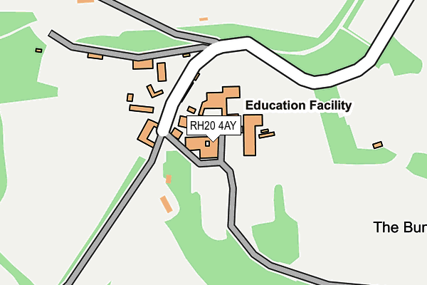
RH20 4AY is located in the Storrington & Washington electoral ward, within the local authority district of Horsham and the English Parliamentary constituency of Arundel and South Downs. The Sub Integrated Care Board (ICB) Location is NHS Sussex ICB - 70F and the police force is Sussex. This postcode has been in use since January 1980.


GetTheData
Source: OS OpenMap – Local (Ordnance Survey)
Source: OS VectorMap District (Ordnance Survey)
Licence: Open Government Licence (requires attribution)
| Easting | 511363 |
| Northing | 111242 |
| Latitude | 50.889932 |
| Longitude | -0.418039 |
GetTheData
Source: Open Postcode Geo
Licence: Open Government Licence
| Country | England |
| Postcode District | RH20 |
| ➜ RH20 open data dashboard ➜ See where RH20 is on a map | |
GetTheData
Source: Land Registry Price Paid Data
Licence: Open Government Licence
Elevation or altitude of RH20 4AY as distance above sea level:
| Metres | Feet | |
|---|---|---|
| Elevation | 110m | 361ft |
Elevation is measured from the approximate centre of the postcode, to the nearest point on an OS contour line from OS Terrain 50, which has contour spacing of ten vertical metres.
➜ How high above sea level am I? Find the elevation of your current position using your device's GPS.
GetTheData
Source: Open Postcode Elevation
Licence: Open Government Licence
| Ward | Storrington & Washington |
| Constituency | Arundel And South Downs |
GetTheData
Source: ONS Postcode Database
Licence: Open Government Licence
| Windlesham House School (A24) | North End | 446m |
| North Farm (London Road) | North End | 616m |
| North Farm (London Road) | North End | 668m |
| Washington Bostal (London Road) | Washington | 771m |
| North Farm (Highden Bridge) | North End | 798m |
GetTheData
Source: NaPTAN
Licence: Open Government Licence
GetTheData
Source: ONS Postcode Database
Licence: Open Government Licence


➜ Get more ratings from the Food Standards Agency
GetTheData
Source: Food Standards Agency
Licence: FSA terms & conditions
| Last Collection | |||
|---|---|---|---|
| Location | Mon-Fri | Sat | Distance |
| Washington P O | 16:45 | 10:00 | 1,696m |
| School Lane | 16:45 | 10:00 | 1,922m |
| Findon Post Office | 17:00 | 12:00 | 2,499m |
GetTheData
Source: Dracos
Licence: Creative Commons Attribution-ShareAlike
| Facility | Distance |
|---|---|
| Windlesham House School London Road, Washington, Pulborough Sports Hall, Swimming Pool, Grass Pitches, Artificial Grass Pitch, Outdoor Tennis Courts | 0m |
| St. Marys C Of E First School School Lane, Washington, Pulborough Swimming Pool, Grass Pitches | 1.8km |
| Washington Recreation Ground School Lane, Washington, Pulborough Grass Pitches | 2km |
GetTheData
Source: Active Places
Licence: Open Government Licence
| School | Phase of Education | Distance |
|---|---|---|
| Windlesham House School London Road, Washington, Pulborough, RH20 4AY | Not applicable | 31m |
| St Mary's CofE Primary School School Lane, Washington, Pulborough, RH20 4AP | Primary | 1.9km |
| St John the Baptist CofE Primary School School Hill, Findon, Worthing, BN14 0TR | Primary | 2.5km |
GetTheData
Source: Edubase
Licence: Open Government Licence
The below table lists the International Territorial Level (ITL) codes (formerly Nomenclature of Territorial Units for Statistics (NUTS) codes) and Local Administrative Units (LAU) codes for RH20 4AY:
| ITL 1 Code | Name |
|---|---|
| TLJ | South East (England) |
| ITL 2 Code | Name |
| TLJ2 | Surrey, East and West Sussex |
| ITL 3 Code | Name |
| TLJ28 | West Sussex (North East) |
| LAU 1 Code | Name |
| E07000227 | Horsham |
GetTheData
Source: ONS Postcode Directory
Licence: Open Government Licence
The below table lists the Census Output Area (OA), Lower Layer Super Output Area (LSOA), and Middle Layer Super Output Area (MSOA) for RH20 4AY:
| Code | Name | |
|---|---|---|
| OA | E00161289 | |
| LSOA | E01031628 | Horsham 015D |
| MSOA | E02006602 | Horsham 015 |
GetTheData
Source: ONS Postcode Directory
Licence: Open Government Licence
| RH20 4AX | Glaseby Lane | 816m |
| RH20 4AZ | London Road | 1187m |
| BN14 0RQ | 1250m | |
| RH20 4AU | Stocks Mead | 1614m |
| BN14 0RH | Northend Cottages | 1653m |
| RH20 4AS | The Street | 1681m |
| RH20 4AW | The Holt | 1763m |
| RH20 4AN | The Holt | 1780m |
| RH20 4BD | Frankland Mead | 1826m |
| RH20 4AR | Chanctonbury Close | 1843m |
GetTheData
Source: Open Postcode Geo; Land Registry Price Paid Data
Licence: Open Government Licence