RH19 2QF maps, stats, and open data
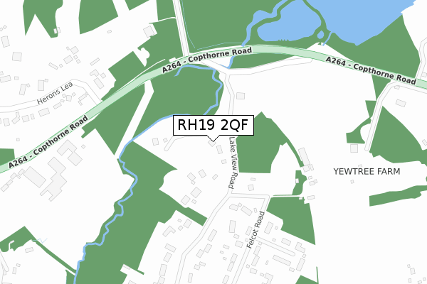
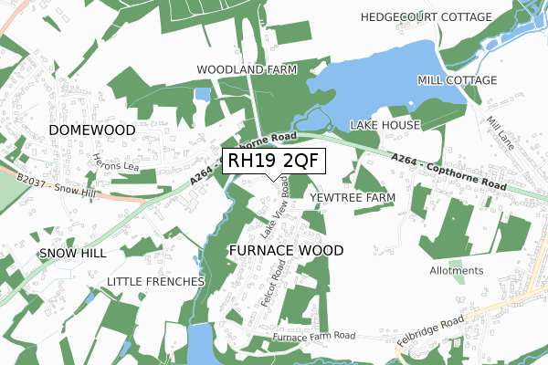
RH19 2QF lies on Lake View Road in Felbridge, East Grinstead. RH19 2QF is located in the Felbridge electoral ward, within the local authority district of Tandridge and the English Parliamentary constituency of East Surrey. The Sub Integrated Care Board (ICB) Location is NHS Surrey Heartlands ICB - 92A and the police force is Surrey. This postcode has been in use since January 1980.
RH19 2QF maps


Licence: Open Government Licence (requires attribution)
Attribution: Contains OS data © Crown copyright and database right 2025
Source: Open Postcode Geo
Licence: Open Government Licence (requires attribution)
Attribution: Contains OS data © Crown copyright and database right 2025; Contains Royal Mail data © Royal Mail copyright and database right 2025; Source: Office for National Statistics licensed under the Open Government Licence v.3.0
RH19 2QF geodata
| Easting | 535100 |
| Northing | 139906 |
| Latitude | 51.142487 |
| Longitude | -0.070102 |
Where is RH19 2QF?
| Street | Lake View Road |
| Locality | Felbridge |
| Town/City | East Grinstead |
| Country | England |
| Postcode District | RH19 |
RH19 2QF Elevation
Elevation or altitude of RH19 2QF as distance above sea level:
| Metres | Feet | |
|---|---|---|
| Elevation | 70m | 230ft |
Elevation is measured from the approximate centre of the postcode, to the nearest point on an OS contour line from OS Terrain 50, which has contour spacing of ten vertical metres.
➜ How high above sea level am I? Find the elevation of your current position using your device's GPS.
Politics
| Ward | Felbridge |
|---|---|
| Constituency | East Surrey |
House Prices
Sales of detached houses in RH19 2QF
2025 7 MAR £1,600,000 |
2023 24 MAR £1,000,000 |
SUNDORE, LAKE VIEW ROAD, FURNACE WOOD, EAST GRINSTEAD, RH19 2QF 2022 23 AUG £1,250,000 |
2021 24 NOV £860,000 |
SUNDORE, LAKE VIEW ROAD, FURNACE WOOD, EAST GRINSTEAD, RH19 2QF 2019 5 DEC £1,050,000 |
SUNDORE, LAKE VIEW ROAD, FURNACE WOOD, EAST GRINSTEAD, RH19 2QF 2019 5 DEC £1,050,000 |
2017 27 JAN £400,000 |
SUNDORE, LAKE VIEW ROAD, FURNACE WOOD, EAST GRINSTEAD, RH19 2QF 2015 2 OCT £890,000 |
BROOKNOOK, LAKE VIEW ROAD, FELBRIDGE, EAST GRINSTEAD, RH19 2QF 2001 27 APR £350,000 |
PINECROFT, LAKE VIEW ROAD, FELBRIDGE, EAST GRINSTEAD, RH19 2QF 1999 9 APR £295,000 |
Licence: Contains HM Land Registry data © Crown copyright and database right 2025. This data is licensed under the Open Government Licence v3.0.
Transport
Nearest bus stops to RH19 2QF
| Herons Lea (Copthorne Road) | Domewood | 233m |
| Herons Lea (Copthorne Road) | Domewood | 289m |
| Copthorne Road | Domewood | 318m |
| Copthorne Road | Domewood | 340m |
| Felbridge Nurseries (Felbridge Road) | Felbridge | 946m |
Nearest railway stations to RH19 2QF
| East Grinstead Station | 4.1km |
| Dormans Station | 4.8km |
| Lingfield Station | 5.8km |
Broadband
Broadband access in RH19 2QF (2020 data)
| Percentage of properties with Next Generation Access | 100.0% |
| Percentage of properties with Superfast Broadband | 87.5% |
| Percentage of properties with Ultrafast Broadband | 0.0% |
| Percentage of properties with Full Fibre Broadband | 0.0% |
Superfast Broadband is between 30Mbps and 300Mbps
Ultrafast Broadband is > 300Mbps
Broadband speed in RH19 2QF (2019 data)
Download
| Median download speed | 40.0Mbps |
| Average download speed | 47.4Mbps |
| Maximum download speed | 80.00Mbps |
Upload
| Median upload speed | 10.0Mbps |
| Average upload speed | 12.1Mbps |
| Maximum upload speed | 20.00Mbps |
Broadband limitations in RH19 2QF (2020 data)
| Percentage of properties unable to receive 2Mbps | 0.0% |
| Percentage of properties unable to receive 5Mbps | 0.0% |
| Percentage of properties unable to receive 10Mbps | 0.0% |
| Percentage of properties unable to receive 30Mbps | 12.5% |
Deprivation
19.6% of English postcodes are less deprived than RH19 2QF:Food Standards Agency
Three nearest food hygiene ratings to RH19 2QF (metres)


➜ Get more ratings from the Food Standards Agency
Nearest post box to RH19 2QF
| Last Collection | |||
|---|---|---|---|
| Location | Mon-Fri | Sat | Distance |
| Crawley Down Road East | 16:45 | 09:15 | 1,715m |
| Hobbs Barracks | 16:15 | 09:15 | 2,148m |
| Larches Way | 16:15 | 08:30 | 2,226m |
Environment
| Risk of RH19 2QF flooding from rivers and sea | Medium |
RH19 2QF ITL and RH19 2QF LAU
The below table lists the International Territorial Level (ITL) codes (formerly Nomenclature of Territorial Units for Statistics (NUTS) codes) and Local Administrative Units (LAU) codes for RH19 2QF:
| ITL 1 Code | Name |
|---|---|
| TLJ | South East (England) |
| ITL 2 Code | Name |
| TLJ2 | Surrey, East and West Sussex |
| ITL 3 Code | Name |
| TLJ26 | East Surrey |
| LAU 1 Code | Name |
| E07000215 | Tandridge |
RH19 2QF census areas
The below table lists the Census Output Area (OA), Lower Layer Super Output Area (LSOA), and Middle Layer Super Output Area (MSOA) for RH19 2QF:
| Code | Name | |
|---|---|---|
| OA | E00157162 | |
| LSOA | E01030823 | Tandridge 011E |
| MSOA | E02006438 | Tandridge 011 |
Nearest postcodes to RH19 2QF
| RH19 2PY | Chesterfield Close | 333m |
| RH19 2QB | Lake View Road | 363m |
| RH19 2QE | Lake View Road | 365m |
| RH19 2QA | Felcot Road | 378m |
| RH19 2PX | Felcot Road | 426m |
| RH10 3EG | Snow Hill | 584m |
| RH19 2QQ | Copthorne Road | 613m |
| RH10 3HF | Herons Close | 632m |
| RH10 3HE | Herons Lea | 675m |
| RH19 2PU | Furnace Farm Road | 686m |