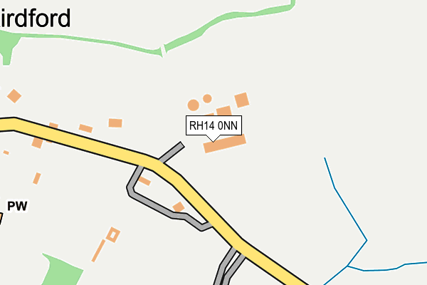
RH14 0NN is located in the Loxwood electoral ward, within the local authority district of Chichester and the English Parliamentary constituency of Arundel and South Downs. The Sub Integrated Care Board (ICB) Location is NHS Sussex ICB - 70F and the police force is Sussex. This postcode has been in use since January 1980.


GetTheData
Source: OS OpenMap – Local (Ordnance Survey)
Source: OS VectorMap District (Ordnance Survey)
Licence: Open Government Licence (requires attribution)
| Easting | 502175 |
| Northing | 126602 |
| Latitude | 51.029707 |
| Longitude | -0.544315 |
GetTheData
Source: Open Postcode Geo
Licence: Open Government Licence
| Country | England |
| Postcode District | RH14 |
| ➜ RH14 open data dashboard ➜ See where RH14 is on a map ➜ Where is Kirdford? | |
GetTheData
Source: Land Registry Price Paid Data
Licence: Open Government Licence
Elevation or altitude of RH14 0NN as distance above sea level:
| Metres | Feet | |
|---|---|---|
| Elevation | 20m | 66ft |
Elevation is measured from the approximate centre of the postcode, to the nearest point on an OS contour line from OS Terrain 50, which has contour spacing of ten vertical metres.
➜ How high above sea level am I? Find the elevation of your current position using your device's GPS.
GetTheData
Source: Open Postcode Elevation
Licence: Open Government Licence
| Ward | Loxwood |
| Constituency | Arundel And South Downs |
GetTheData
Source: ONS Postcode Database
Licence: Open Government Licence
| July 2021 | Violence and sexual offences | On or near Sports/Recreation Area | 252m |
| July 2021 | Violence and sexual offences | On or near Sports/Recreation Area | 252m |
| March 2021 | Anti-social behaviour | On or near Sports/Recreation Area | 252m |
| ➜ Get more crime data in our Crime section | |||
GetTheData
Source: data.police.uk
Licence: Open Government Licence
| Normandie Stud (Unnamed Road) | Kirdford | 178m |
| Normandie Stud (Unnamed Road) | Kirdford | 184m |
| Memorial (Townfield) | Kirdford | 441m |
| Memorial (Townfield) | Kirdford | 509m |
| Barkfold Manor (Unnamed Road) | Kirdford | 743m |
GetTheData
Source: NaPTAN
Licence: Open Government Licence
GetTheData
Source: ONS Postcode Database
Licence: Open Government Licence


➜ Get more ratings from the Food Standards Agency
GetTheData
Source: Food Standards Agency
Licence: FSA terms & conditions
| Last Collection | |||
|---|---|---|---|
| Location | Mon-Fri | Sat | Distance |
| Kirdford Post Office | 16:00 | 09:00 | 513m |
| Skiff Common | 16:45 | 09:15 | 1,874m |
| Crouchmans Crossroads | 16:15 | 08:45 | 1,946m |
GetTheData
Source: Dracos
Licence: Creative Commons Attribution-ShareAlike
| Facility | Distance |
|---|---|
| Kirdford Recreation Ground Petworth Road, Kirdford, Billingshurst Grass Pitches, Outdoor Tennis Courts | 296m |
| The Green Wisborough Green, Billingshurst Grass Pitches | 2.7km |
| Wisborough Green Primary School Newpound Lane, Wisborough Green, Billingshurst Swimming Pool, Grass Pitches | 3.1km |
GetTheData
Source: Active Places
Licence: Open Government Licence
| School | Phase of Education | Distance |
|---|---|---|
| Wisborough Green Primary School Newpound Lane, Wisborough Green, Billingshurst, RH14 0EE | Primary | 3.1km |
| Plaistow and Kirdford Primary School Plaistow, Billingshurst, RH14 0PX | Primary | 4.7km |
| Loxwood Primary School Nicholsfield, Loxwood, Billingshurst, RH14 0SR | Primary | 5.3km |
GetTheData
Source: Edubase
Licence: Open Government Licence
The below table lists the International Territorial Level (ITL) codes (formerly Nomenclature of Territorial Units for Statistics (NUTS) codes) and Local Administrative Units (LAU) codes for RH14 0NN:
| ITL 1 Code | Name |
|---|---|
| TLJ | South East (England) |
| ITL 2 Code | Name |
| TLJ2 | Surrey, East and West Sussex |
| ITL 3 Code | Name |
| TLJ27 | West Sussex (South West) |
| LAU 1 Code | Name |
| E07000225 | Chichester |
GetTheData
Source: ONS Postcode Directory
Licence: Open Government Licence
The below table lists the Census Output Area (OA), Lower Layer Super Output Area (LSOA), and Middle Layer Super Output Area (MSOA) for RH14 0NN:
| Code | Name | |
|---|---|---|
| OA | E00160873 | |
| LSOA | E01031544 | Chichester 002C |
| MSOA | E02006562 | Chichester 002 |
GetTheData
Source: ONS Postcode Directory
Licence: Open Government Licence
| RH14 0LU | Churchlands Cottages | 285m |
| RH14 0LT | 418m | |
| RH14 0LX | 452m | |
| RH14 0PP | School Court | 510m |
| RH14 0ND | 540m | |
| RH14 0LY | Townfield | 555m |
| RH14 0NB | 573m | |
| RH14 0NA | Townfield | 585m |
| RH14 0PR | Herons Farm Lane | 586m |
| RH14 0JH | 649m |
GetTheData
Source: Open Postcode Geo; Land Registry Price Paid Data
Licence: Open Government Licence