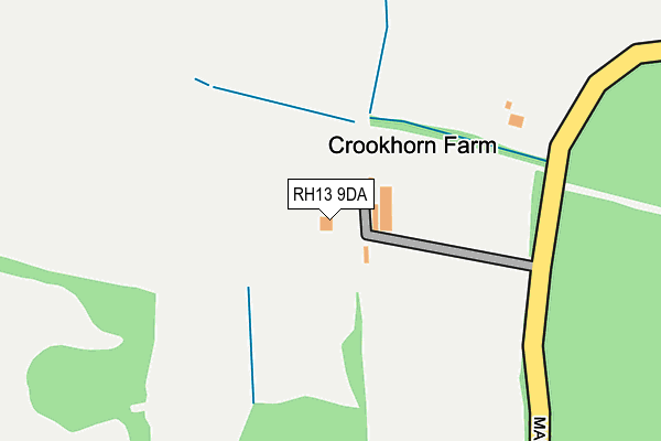
RH13 9DA is located in the Southwater South & Shipley electoral ward, within the local authority district of Horsham and the English Parliamentary constituency of Horsham. The Sub Integrated Care Board (ICB) Location is NHS Sussex ICB - 70F and the police force is Sussex. This postcode has been in use since June 2002.


GetTheData
Source: OS OpenMap – Local (Ordnance Survey)
Source: OS VectorMap District (Ordnance Survey)
Licence: Open Government Licence (requires attribution)
| Easting | 513896 |
| Northing | 125859 |
| Latitude | 51.020833 |
| Longitude | -0.377497 |
GetTheData
Source: Open Postcode Geo
Licence: Open Government Licence
| Country | England |
| Postcode District | RH13 |
| ➜ RH13 open data dashboard ➜ See where RH13 is on a map | |
GetTheData
Source: Land Registry Price Paid Data
Licence: Open Government Licence
Elevation or altitude of RH13 9DA as distance above sea level:
| Metres | Feet | |
|---|---|---|
| Elevation | 60m | 197ft |
Elevation is measured from the approximate centre of the postcode, to the nearest point on an OS contour line from OS Terrain 50, which has contour spacing of ten vertical metres.
➜ How high above sea level am I? Find the elevation of your current position using your device's GPS.
GetTheData
Source: Open Postcode Elevation
Licence: Open Government Licence
| Ward | Southwater South & Shipley |
| Constituency | Horsham |
GetTheData
Source: ONS Postcode Database
Licence: Open Government Licence
| One Oak (Trout Lane) | Brooks Green | 861m |
| One Oak (Trout Lane) | Brooks Green | 874m |
| Rosemont (Cross Lane) | Brooks Green | 924m |
| Rosemont (Cross Lane) | Brooks Green | 928m |
| Saxon Farm (Emms Lane) | Brooks Green | 949m |
| Christs Hospital Station | 3.5km |
GetTheData
Source: NaPTAN
Licence: Open Government Licence
| Percentage of properties with Next Generation Access | 100.0% |
| Percentage of properties with Superfast Broadband | 100.0% |
| Percentage of properties with Ultrafast Broadband | 100.0% |
| Percentage of properties with Full Fibre Broadband | 100.0% |
Superfast Broadband is between 30Mbps and 300Mbps
Ultrafast Broadband is > 300Mbps
| Percentage of properties unable to receive 2Mbps | 0.0% |
| Percentage of properties unable to receive 5Mbps | 0.0% |
| Percentage of properties unable to receive 10Mbps | 0.0% |
| Percentage of properties unable to receive 30Mbps | 0.0% |
GetTheData
Source: Ofcom
Licence: Ofcom Terms of Use (requires attribution)
GetTheData
Source: ONS Postcode Database
Licence: Open Government Licence


➜ Get more ratings from the Food Standards Agency
GetTheData
Source: Food Standards Agency
Licence: FSA terms & conditions
| Last Collection | |||
|---|---|---|---|
| Location | Mon-Fri | Sat | Distance |
| Cross Lane | 16:30 | 09:30 | 976m |
| Cedar Drive | 16:15 | 07:30 | 2,322m |
| Eastlands | 16:45 | 08:00 | 2,581m |
GetTheData
Source: Dracos
Licence: Creative Commons Attribution-ShareAlike
| Facility | Distance |
|---|---|
| Southwater Sports Club Church Lane, Southwater Grass Pitches, Outdoor Tennis Courts | 1.5km |
| Southwater Cricket Club Church Lane, Southwater, Horsham Grass Pitches | 1.6km |
| Barns Green Primary School The Hordens, Barns Green, Horsham Grass Pitches, Sports Hall | 1.7km |
GetTheData
Source: Active Places
Licence: Open Government Licence
| School | Phase of Education | Distance |
|---|---|---|
| Barns Green Primary School The Hordens, Barns Green, Horsham, RH13 0PJ | Primary | 1.6km |
| Southwater Infant Academy Worthing Road, Southwater, Horsham, RH13 9JH | Primary | 2km |
| Southwater Junior Academy Worthing Road, Southwater, Horsham, RH13 9JH | Primary | 2km |
GetTheData
Source: Edubase
Licence: Open Government Licence
The below table lists the International Territorial Level (ITL) codes (formerly Nomenclature of Territorial Units for Statistics (NUTS) codes) and Local Administrative Units (LAU) codes for RH13 9DA:
| ITL 1 Code | Name |
|---|---|
| TLJ | South East (England) |
| ITL 2 Code | Name |
| TLJ2 | Surrey, East and West Sussex |
| ITL 3 Code | Name |
| TLJ28 | West Sussex (North East) |
| LAU 1 Code | Name |
| E07000227 | Horsham |
GetTheData
Source: ONS Postcode Directory
Licence: Open Government Licence
The below table lists the Census Output Area (OA), Lower Layer Super Output Area (LSOA), and Middle Layer Super Output Area (MSOA) for RH13 9DA:
| Code | Name | |
|---|---|---|
| OA | E00161224 | |
| LSOA | E01031611 | Horsham 010A |
| MSOA | E02006597 | Horsham 010 |
GetTheData
Source: ONS Postcode Directory
Licence: Open Government Licence
| RH13 9BZ | Marlpost Road | 391m |
| RH13 9DB | Old House Lane | 715m |
| RH13 0TG | Cross Lane | 899m |
| RH13 0QF | Cross Lane | 901m |
| RH13 9BY | Marlpost Road | 928m |
| RH13 0JN | Trout Lane | 970m |
| RH13 0QD | Trout Lane | 986m |
| RH13 0PG | Two Mile Ash Road | 1051m |
| RH13 9BX | Shaws Lane | 1074m |
| RH13 0TR | Emms Lane | 1100m |
GetTheData
Source: Open Postcode Geo; Land Registry Price Paid Data
Licence: Open Government Licence