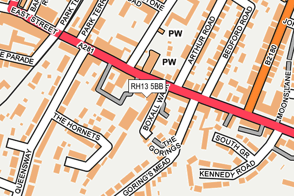
RH13 5BB is located in the Denne electoral ward, within the local authority district of Horsham and the English Parliamentary constituency of Horsham. The Sub Integrated Care Board (ICB) Location is NHS Sussex ICB - 70F and the police force is Sussex. This postcode has been in use since June 1998.


GetTheData
Source: OS OpenMap – Local (Ordnance Survey)
Source: OS VectorMap District (Ordnance Survey)
Licence: Open Government Licence (requires attribution)
| Easting | 517718 |
| Northing | 130266 |
| Latitude | 51.059676 |
| Longitude | -0.321598 |
GetTheData
Source: Open Postcode Geo
Licence: Open Government Licence
| Country | England |
| Postcode District | RH13 |
| ➜ RH13 open data dashboard ➜ See where RH13 is on a map ➜ Where is Horsham? | |
GetTheData
Source: Land Registry Price Paid Data
Licence: Open Government Licence
Elevation or altitude of RH13 5BB as distance above sea level:
| Metres | Feet | |
|---|---|---|
| Elevation | 50m | 164ft |
Elevation is measured from the approximate centre of the postcode, to the nearest point on an OS contour line from OS Terrain 50, which has contour spacing of ten vertical metres.
➜ How high above sea level am I? Find the elevation of your current position using your device's GPS.
GetTheData
Source: Open Postcode Elevation
Licence: Open Government Licence
| Ward | Denne |
| Constituency | Horsham |
GetTheData
Source: ONS Postcode Database
Licence: Open Government Licence
| January 2024 | Criminal damage and arson | On or near Copnall Way | 437m |
| January 2024 | Public order | On or near Copnall Way | 437m |
| January 2024 | Shoplifting | On or near Copnall Way | 437m |
| ➜ Get more crime data in our Crime section | |||
GetTheData
Source: data.police.uk
Licence: Open Government Licence
| Brighton Road | Horsham | 152m |
| Denne Road (Queen Street) | Horsham | 209m |
| Brighton Road (Clarence Road) | Oakhill | 239m |
| Brighton Road | Horsham | 258m |
| Denne Road (East Street) | Horsham | 262m |
| Horsham Station | 0.7km |
| Littlehaven Station | 2.4km |
| Christs Hospital Station | 3.1km |
GetTheData
Source: NaPTAN
Licence: Open Government Licence
| Median download speed | 14.3Mbps |
| Average download speed | 13.6Mbps |
| Maximum download speed | 18.54Mbps |
| Median upload speed | 1.1Mbps |
| Average upload speed | 1.1Mbps |
| Maximum upload speed | 1.26Mbps |
GetTheData
Source: Ofcom
Licence: Ofcom Terms of Use (requires attribution)
GetTheData
Source: ONS Postcode Database
Licence: Open Government Licence


➜ Get more ratings from the Food Standards Agency
GetTheData
Source: Food Standards Agency
Licence: FSA terms & conditions
| Last Collection | |||
|---|---|---|---|
| Location | Mon-Fri | Sat | Distance |
| New Street | 17:00 | 12:00 | 270m |
| Elm Grove | 17:00 | 12:00 | 424m |
| Clarence Road | 17:00 | 12:00 | 429m |
GetTheData
Source: Dracos
Licence: Creative Commons Attribution-ShareAlike
| Facility | Distance |
|---|---|
| Horsham Ymca Football Club Gorings Mead, Horsham Grass Pitches | 323m |
| Bennetts Field Recreation Ground Brighton Road, Horsham Grass Pitches | 563m |
| Pavilions In The Park Hurst Road, Horsham Swimming Pool, Health and Fitness Gym, Sports Hall, Studio | 765m |
GetTheData
Source: Active Places
Licence: Open Government Licence
| School | Phase of Education | Distance |
|---|---|---|
| St Mary's CofE (Aided) Primary School Normandy, Horsham, RH12 1JL | Primary | 599m |
| Littlehaven Educational Trust 24 Hernbrook Drive, Horsham, RH13 6EW | Not applicable | 742m |
| The Forest School Comptons Lane, Horsham, RH13 5NT | Secondary | 1km |
GetTheData
Source: Edubase
Licence: Open Government Licence
The below table lists the International Territorial Level (ITL) codes (formerly Nomenclature of Territorial Units for Statistics (NUTS) codes) and Local Administrative Units (LAU) codes for RH13 5BB:
| ITL 1 Code | Name |
|---|---|
| TLJ | South East (England) |
| ITL 2 Code | Name |
| TLJ2 | Surrey, East and West Sussex |
| ITL 3 Code | Name |
| TLJ28 | West Sussex (North East) |
| LAU 1 Code | Name |
| E07000227 | Horsham |
GetTheData
Source: ONS Postcode Directory
Licence: Open Government Licence
The below table lists the Census Output Area (OA), Lower Layer Super Output Area (LSOA), and Middle Layer Super Output Area (MSOA) for RH13 5BB:
| Code | Name | |
|---|---|---|
| OA | E00161356 | |
| LSOA | E01031639 | Horsham 008A |
| MSOA | E02006595 | Horsham 008 |
GetTheData
Source: ONS Postcode Directory
Licence: Open Government Licence
| RH13 5QX | Brighton Road | 27m |
| RH13 5BA | Brighton Road | 42m |
| RH13 5AB | Tannery Court | 47m |
| RH13 5BD | Brighton Road | 61m |
| RH13 5DL | Boxall Walk | 66m |
| RH13 5DU | New Street | 100m |
| RH13 5NQ | Arthur Road | 124m |
| RH13 5QW | Bedford Road | 142m |
| RH13 5BP | Gorings Mead | 146m |
| RH13 5RE | The Hornets | 147m |
GetTheData
Source: Open Postcode Geo; Land Registry Price Paid Data
Licence: Open Government Licence