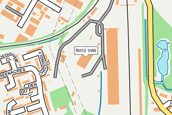
RH10 1HW is located in the Furnace Green electoral ward, within the local authority district of Crawley and the English Parliamentary constituency of Crawley. The Sub Integrated Care Board (ICB) Location is NHS Sussex ICB - 70F and the police force is Sussex. This postcode has been in use since August 1993.


GetTheData
Source: OS OpenMap – Local (Ordnance Survey)
Source: OS VectorMap District (Ordnance Survey)
Licence: Open Government Licence (requires attribution)
| Easting | 528686 |
| Northing | 136389 |
| Latitude | 51.112355 |
| Longitude | -0.162994 |
GetTheData
Source: Open Postcode Geo
Licence: Open Government Licence
| Country | England |
| Postcode District | RH10 |
| ➜ RH10 open data dashboard ➜ See where RH10 is on a map ➜ Where is Crawley? | |
GetTheData
Source: Land Registry Price Paid Data
Licence: Open Government Licence
Elevation or altitude of RH10 1HW as distance above sea level:
| Metres | Feet | |
|---|---|---|
| Elevation | 70m | 230ft |
Elevation is measured from the approximate centre of the postcode, to the nearest point on an OS contour line from OS Terrain 50, which has contour spacing of ten vertical metres.
➜ How high above sea level am I? Find the elevation of your current position using your device's GPS.
GetTheData
Source: Open Postcode Elevation
Licence: Open Government Licence
| Ward | Furnace Green |
| Constituency | Crawley |
GetTheData
Source: ONS Postcode Database
Licence: Open Government Licence
| January 2024 | Violence and sexual offences | On or near Parking Area | 453m |
| January 2024 | Violence and sexual offences | On or near Parking Area | 453m |
| January 2024 | Violence and sexual offences | On or near Parking Area | 453m |
| ➜ Get more crime data in our Crime section | |||
GetTheData
Source: data.police.uk
Licence: Open Government Licence
| Haworth Road (Billinton Drive) | Maidenbower | 279m |
| Greenacres (Coltash Road) | Furnace Green | 400m |
| Stirling Close (Billinton Drive) | Maidenbower | 446m |
| Squareabout (Paymaster General's Roundabout) | Three Bridges | 524m |
| Station Hill | Three Bridges | 549m |
| Three Bridges Station | 0.5km |
| Crawley Station | 1.7km |
| Ifield Station | 3.6km |
GetTheData
Source: NaPTAN
Licence: Open Government Licence
GetTheData
Source: ONS Postcode Database
Licence: Open Government Licence


➜ Get more ratings from the Food Standards Agency
GetTheData
Source: Food Standards Agency
Licence: FSA terms & conditions
| Last Collection | |||
|---|---|---|---|
| Location | Mon-Fri | Sat | Distance |
| Coltash Road | 17:00 | 11:30 | 394m |
| Stephenson Way | 17:45 | 11:30 | 449m |
| Three Bridges Road | 18:15 | 11:15 | 581m |
GetTheData
Source: Dracos
Licence: Creative Commons Attribution-ShareAlike
| Facility | Distance |
|---|---|
| Crawley Jubilee Field Jubilee Walk, Crawley Grass Pitches | 414m |
| Pound Hill Playing Fields Knepp Close, Crawley Grass Pitches | 460m |
| Three Bridges Playing Field Haslett Avenue, Crawley Grass Pitches | 577m |
GetTheData
Source: Active Places
Licence: Open Government Licence
| School | Phase of Education | Distance |
|---|---|---|
| St Andrew's CofE Primary School Weald Drive, Furnace Green, Crawley, RH10 6NU | Primary | 649m |
| Three Bridges Primary School Gales Place, Three Bridges, Crawley, RH10 1QG | Primary | 805m |
| Oriel High School Matthews Drive, Maidenbower, Crawley, RH10 7XW | Secondary | 833m |
GetTheData
Source: Edubase
Licence: Open Government Licence
The below table lists the International Territorial Level (ITL) codes (formerly Nomenclature of Territorial Units for Statistics (NUTS) codes) and Local Administrative Units (LAU) codes for RH10 1HW:
| ITL 1 Code | Name |
|---|---|
| TLJ | South East (England) |
| ITL 2 Code | Name |
| TLJ2 | Surrey, East and West Sussex |
| ITL 3 Code | Name |
| TLJ28 | West Sussex (North East) |
| LAU 1 Code | Name |
| E07000226 | Crawley |
GetTheData
Source: ONS Postcode Directory
Licence: Open Government Licence
The below table lists the Census Output Area (OA), Lower Layer Super Output Area (LSOA), and Middle Layer Super Output Area (MSOA) for RH10 1HW:
| Code | Name | |
|---|---|---|
| OA | E00160962 | |
| LSOA | E01031561 | Crawley 009B |
| MSOA | E02006583 | Crawley 009 |
GetTheData
Source: ONS Postcode Directory
Licence: Open Government Licence
| RH10 6SB | Chiddingly Close | 172m |
| RH10 6SD | Greenacres | 173m |
| RH10 6SL | Greenacres | 217m |
| RH10 6SF | Greenacres | 218m |
| RH10 6SE | Gosden Close | 229m |
| RH10 6SA | Dedisham Close | 272m |
| RH10 6SG | Freshfield Close | 285m |
| RH10 6SW | Waterlea | 295m |
| RH10 6SN | Lamberhurst Walk | 300m |
| RH10 1TN | Stephenson Way | 312m |
GetTheData
Source: Open Postcode Geo; Land Registry Price Paid Data
Licence: Open Government Licence