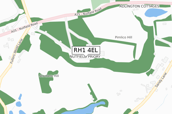
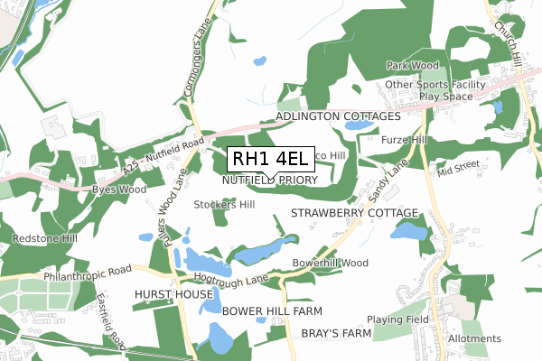
RH1 4EL is located in the Bletchingley and Nutfield electoral ward, within the local authority district of Tandridge and the English Parliamentary constituency of East Surrey. The Sub Integrated Care Board (ICB) Location is NHS Surrey Heartlands ICB - 92A and the police force is Surrey. This postcode has been in use since January 1980.


GetTheData
Source: OS Open Zoomstack (Ordnance Survey)
Licence: Open Government Licence (requires attribution)
Attribution: Contains OS data © Crown copyright and database right 2024
Source: Open Postcode Geo
Licence: Open Government Licence (requires attribution)
Attribution: Contains OS data © Crown copyright and database right 2024; Contains Royal Mail data © Royal Mail copyright and database right 2024; Source: Office for National Statistics licensed under the Open Government Licence v.3.0
| Easting | 529821 |
| Northing | 150147 |
| Latitude | 51.235746 |
| Longitude | -0.141825 |
GetTheData
Source: Open Postcode Geo
Licence: Open Government Licence
| Country | England |
| Postcode District | RH1 |
| ➜ RH1 open data dashboard ➜ See where RH1 is on a map | |
GetTheData
Source: Land Registry Price Paid Data
Licence: Open Government Licence
Elevation or altitude of RH1 4EL as distance above sea level:
| Metres | Feet | |
|---|---|---|
| Elevation | 130m | 427ft |
Elevation is measured from the approximate centre of the postcode, to the nearest point on an OS contour line from OS Terrain 50, which has contour spacing of ten vertical metres.
➜ How high above sea level am I? Find the elevation of your current position using your device's GPS.
GetTheData
Source: Open Postcode Elevation
Licence: Open Government Licence
| Ward | Bletchingley And Nutfield |
| Constituency | East Surrey |
GetTheData
Source: ONS Postcode Database
Licence: Open Government Licence
| May 2022 | Anti-social behaviour | On or near Parking Area | 315m |
| February 2022 | Vehicle crime | On or near Sandy Lane | 456m |
| January 2022 | Violence and sexual offences | On or near Parking Area | 315m |
| ➜ Get more crime data in our Crime section | |||
GetTheData
Source: data.police.uk
Licence: Open Government Licence
| Cemetery (Nutfield Road) | Nutfield | 276m |
| Cemetery (Nutfield Road) | Nutfield | 310m |
| Cormongers Lane (Nutfield Road) | Redhill | 348m |
| Cormongers Lane (Nutfield Road) | Redhill | 354m |
| Mid Street | Nutfield | 758m |
| Nutfield Station | 1.2km |
| Redhill Station | 1.8km |
| Earlswood (Surrey) Station | 2.2km |
GetTheData
Source: NaPTAN
Licence: Open Government Licence
GetTheData
Source: ONS Postcode Database
Licence: Open Government Licence


➜ Get more ratings from the Food Standards Agency
GetTheData
Source: Food Standards Agency
Licence: FSA terms & conditions
| Last Collection | |||
|---|---|---|---|
| Location | Mon-Fri | Sat | Distance |
| South Nutfield P O | 17:15 | 11:15 | 1,011m |
| Nutfield High Street | 17:15 | 10:30 | 1,035m |
| Chart Lodge | 17:15 | 09:00 | 1,056m |
GetTheData
Source: Dracos
Licence: Creative Commons Attribution-ShareAlike
| Facility | Distance |
|---|---|
| Nutfield Priory Hotel & Spa Nutfield Road, Nutfield Health and Fitness Gym, Swimming Pool, Studio, Squash Courts | 84m |
| Nutfield Memorial Hall Field High Street, Nutfield, Redhill Grass Pitches | 865m |
| Mid Street Recreation Ground Mid Street, South Nutfield Grass Pitches | 888m |
GetTheData
Source: Active Places
Licence: Open Government Licence
| School | Phase of Education | Distance |
|---|---|---|
| Nutfield Church CofE Primary School 59 Mid Street, South Nutfield, Redhill, RH1 4JJ | Primary | 1km |
| Carrington School Noke Drive, Redhill, RH1 4AD | Secondary | 1.5km |
| Earlswood Junior School Brambletye Park Road, Redhill, RH1 6JX | Primary | 1.6km |
GetTheData
Source: Edubase
Licence: Open Government Licence
The below table lists the International Territorial Level (ITL) codes (formerly Nomenclature of Territorial Units for Statistics (NUTS) codes) and Local Administrative Units (LAU) codes for RH1 4EL:
| ITL 1 Code | Name |
|---|---|
| TLJ | South East (England) |
| ITL 2 Code | Name |
| TLJ2 | Surrey, East and West Sussex |
| ITL 3 Code | Name |
| TLJ26 | East Surrey |
| LAU 1 Code | Name |
| E07000215 | Tandridge |
GetTheData
Source: ONS Postcode Directory
Licence: Open Government Licence
The below table lists the Census Output Area (OA), Lower Layer Super Output Area (LSOA), and Middle Layer Super Output Area (MSOA) for RH1 4EL:
| Code | Name | |
|---|---|---|
| OA | E00157119 | |
| LSOA | E01030813 | Tandridge 008B |
| MSOA | E02006435 | Tandridge 008 |
GetTheData
Source: ONS Postcode Directory
Licence: Open Government Licence
| RH1 4EF | Fullers Wood Lane | 361m |
| RH1 4HA | Pimlico Cottages | 368m |
| RH1 4HB | Adlington Cottages | 431m |
| RH1 4HD | Parkwood Road | 651m |
| RH1 4ED | Nutfield Road | 718m |
| RH1 4EW | Blacklands Meadow | 745m |
| RH1 4HE | High Street | 753m |
| RH1 4HF | High Street | 759m |
| RH1 4JX | Mid Street | 795m |
| RH1 4HG | High Street | 799m |
GetTheData
Source: Open Postcode Geo; Land Registry Price Paid Data
Licence: Open Government Licence