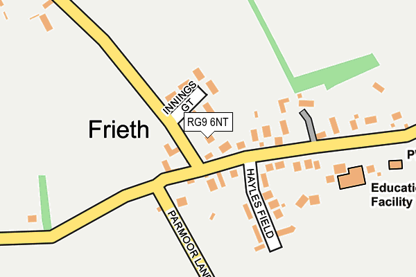
RG9 6NT is located in the Chiltern Villages electoral ward, within the unitary authority of Buckinghamshire and the English Parliamentary constituency of Wycombe. The Sub Integrated Care Board (ICB) Location is NHS Buckinghamshire, Oxfordshire and Berkshire West ICB - 14Y and the police force is Thames Valley. This postcode has been in use since January 1992.


GetTheData
Source: OS OpenMap – Local (Ordnance Survey)
Source: OS VectorMap District (Ordnance Survey)
Licence: Open Government Licence (requires attribution)
| Easting | 479395 |
| Northing | 190235 |
| Latitude | 51.605365 |
| Longitude | -0.854956 |
GetTheData
Source: Open Postcode Geo
Licence: Open Government Licence
| Country | England |
| Postcode District | RG9 |
| ➜ RG9 open data dashboard ➜ See where RG9 is on a map ➜ Where is Frieth? | |
GetTheData
Source: Land Registry Price Paid Data
Licence: Open Government Licence
Elevation or altitude of RG9 6NT as distance above sea level:
| Metres | Feet | |
|---|---|---|
| Elevation | 170m | 558ft |
Elevation is measured from the approximate centre of the postcode, to the nearest point on an OS contour line from OS Terrain 50, which has contour spacing of ten vertical metres.
➜ How high above sea level am I? Find the elevation of your current position using your device's GPS.
GetTheData
Source: Open Postcode Elevation
Licence: Open Government Licence
| Ward | Chiltern Villages |
| Constituency | Wycombe |
GetTheData
Source: ONS Postcode Database
Licence: Open Government Licence
| May 2022 | Burglary | On or near Spurgrove Lane | 358m |
| May 2022 | Anti-social behaviour | On or near Ellery Rise | 431m |
| April 2022 | Vehicle crime | On or near Spurgrove Lane | 358m |
| ➜ Get more crime data in our Crime section | |||
GetTheData
Source: data.police.uk
Licence: Open Government Licence
| Hayles Field (Shogmore Lane) | Frieth | 72m |
| Crossroads (Lane End Road) | Frieth | 581m |
| Crossroads (Frieth Lane) | Frieth | 614m |
| Crossroads (Frieth Lane) | Frieth | 620m |
| The Prince Albert Ph (Frieth Lane) | Frieth | 625m |
GetTheData
Source: NaPTAN
Licence: Open Government Licence
| Percentage of properties with Next Generation Access | 100.0% |
| Percentage of properties with Superfast Broadband | 100.0% |
| Percentage of properties with Ultrafast Broadband | 0.0% |
| Percentage of properties with Full Fibre Broadband | 0.0% |
Superfast Broadband is between 30Mbps and 300Mbps
Ultrafast Broadband is > 300Mbps
| Percentage of properties unable to receive 2Mbps | 0.0% |
| Percentage of properties unable to receive 5Mbps | 0.0% |
| Percentage of properties unable to receive 10Mbps | 0.0% |
| Percentage of properties unable to receive 30Mbps | 0.0% |
GetTheData
Source: Ofcom
Licence: Ofcom Terms of Use (requires attribution)
GetTheData
Source: ONS Postcode Database
Licence: Open Government Licence


➜ Get more ratings from the Food Standards Agency
GetTheData
Source: Food Standards Agency
Licence: FSA terms & conditions
| Last Collection | |||
|---|---|---|---|
| Location | Mon-Fri | Sat | Distance |
| Pheasants | 16:15 | 07:00 | 1,421m |
| Fingest | 16:00 | 07:00 | 1,900m |
| Lane End P.o. | 16:45 | 10:45 | 2,005m |
GetTheData
Source: Dracos
Licence: Creative Commons Attribution-ShareAlike
| Facility | Distance |
|---|---|
| Frieth Cricket Club Parmoor Lane, Frieth Grass Pitches | 906m |
| Lane End Sports Association The Row, Lane End Grass Pitches, Artificial Grass Pitch | 2.2km |
| Cadmore End Cricket Club Cadmore End, High Wycombe Grass Pitches | 2.5km |
GetTheData
Source: Active Places
Licence: Open Government Licence
| School | Phase of Education | Distance |
|---|---|---|
| Frieth Church of England Combined School Frieth Church of England Combined School, Frieth, Henley-on-Thames, RG9 6PR | Primary | 214m |
| Lane End Primary School Edmonds Road, Lane End, High Wycombe, HP14 3EJ | Primary | 2.2km |
| Cadmore End CofE School Cadmore End, High Wycombe, HP14 3PE | Primary | 2.7km |
GetTheData
Source: Edubase
Licence: Open Government Licence
The below table lists the International Territorial Level (ITL) codes (formerly Nomenclature of Territorial Units for Statistics (NUTS) codes) and Local Administrative Units (LAU) codes for RG9 6NT:
| ITL 1 Code | Name |
|---|---|
| TLJ | South East (England) |
| ITL 2 Code | Name |
| TLJ1 | Berkshire, Buckinghamshire and Oxfordshire |
| ITL 3 Code | Name |
| TLJ13 | Buckinghamshire |
| LAU 1 Code | Name |
| E06000060 | Buckinghamshire |
GetTheData
Source: ONS Postcode Directory
Licence: Open Government Licence
The below table lists the Census Output Area (OA), Lower Layer Super Output Area (LSOA), and Middle Layer Super Output Area (MSOA) for RG9 6NT:
| Code | Name | |
|---|---|---|
| OA | E00090197 | |
| LSOA | E01017878 | Wycombe 007D |
| MSOA | E02003702 | Wycombe 007 |
GetTheData
Source: ONS Postcode Directory
Licence: Open Government Licence
| RG9 6PW | 63m | |
| RG9 6NJ | Innings Gate | 86m |
| RG9 6PQ | Chairmakers Way | 117m |
| RG9 6PP | Hayles Field | 123m |
| RG9 6PR | 238m | |
| RG9 6PJ | 272m | |
| RG9 6PL | 313m | |
| RG9 6NY | 366m | |
| RG9 6NR | 384m | |
| RG9 6NS | 391m |
GetTheData
Source: Open Postcode Geo; Land Registry Price Paid Data
Licence: Open Government Licence