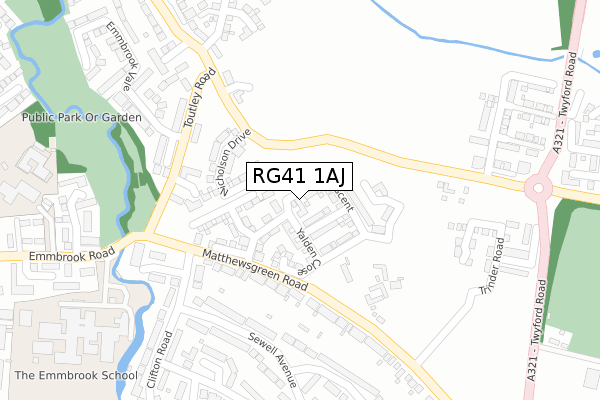
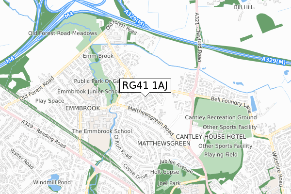
RG41 1AJ is located in the Emmbrook electoral ward, within the unitary authority of Wokingham and the English Parliamentary constituency of Wokingham. The Sub Integrated Care Board (ICB) Location is NHS Buckinghamshire, Oxfordshire and Berkshire West ICB - 15A and the police force is Thames Valley. This postcode has been in use since November 2016.


GetTheData
Source: OS Open Zoomstack (Ordnance Survey)
Licence: Open Government Licence (requires attribution)
Attribution: Contains OS data © Crown copyright and database right 2025
Source: Open Postcode Geo
Licence: Open Government Licence (requires attribution)
Attribution: Contains OS data © Crown copyright and database right 2025; Contains Royal Mail data © Royal Mail copyright and database right 2025; Source: Office for National Statistics licensed under the Open Government Licence v.3.0
| Easting | 480305 |
| Northing | 170029 |
| Latitude | 51.423593 |
| Longitude | -0.846398 |
GetTheData
Source: Open Postcode Geo
Licence: Open Government Licence
| Country | England |
| Postcode District | RG41 |
➜ See where RG41 is on a map ➜ Where is Wokingham? | |
GetTheData
Source: Land Registry Price Paid Data
Licence: Open Government Licence
Elevation or altitude of RG41 1AJ as distance above sea level:
| Metres | Feet | |
|---|---|---|
| Elevation | 50m | 164ft |
Elevation is measured from the approximate centre of the postcode, to the nearest point on an OS contour line from OS Terrain 50, which has contour spacing of ten vertical metres.
➜ How high above sea level am I? Find the elevation of your current position using your device's GPS.
GetTheData
Source: Open Postcode Elevation
Licence: Open Government Licence
| Ward | Emmbrook |
| Constituency | Wokingham |
GetTheData
Source: ONS Postcode Database
Licence: Open Government Licence
2024 1 MAR £730,000 |
2021 18 JUN £480,000 |
14, EAMER CRESCENT, WOKINGHAM, RG41 1AJ 2020 28 AUG £550,000 |
20, EAMER CRESCENT, WOKINGHAM, RG41 1AJ 2020 26 JUN £760,000 |
24, EAMER CRESCENT, WOKINGHAM, RG41 1AJ 2020 16 JUN £560,000 |
16, EAMER CRESCENT, WOKINGHAM, RG41 1AJ 2020 26 MAR £570,000 |
39, EAMER CRESCENT, WOKINGHAM, RG41 1AJ 2019 23 DEC £382,402 |
18, EAMER CRESCENT, WOKINGHAM, RG41 1AJ 2019 20 DEC £750,000 |
3, EAMER CRESCENT, WOKINGHAM, RG41 1AJ 2019 20 DEC £475,000 |
38, EAMER CRESCENT, WOKINGHAM, RG41 1AJ 2019 30 AUG £462,950 |
GetTheData
Source: HM Land Registry Price Paid Data
Licence: Contains HM Land Registry data © Crown copyright and database right 2025. This data is licensed under the Open Government Licence v3.0.
| Matthewsgreen Farm (Matthews Green Road) | Matthews Green | 150m |
| Matthewsgreen Farm (Matthews Green Road) | Matthews Green | 155m |
| Dog And Duck (Matthews Green Road) | Emmbrook | 214m |
| Dog And Duck (Matthews Green Road) | Emmbrook | 236m |
| Marks Road (Clifton Road) | Matthews Green | 347m |
| Wokingham Station | 1.4km |
| Winnersh Station | 2.2km |
| Winnersh Triangle Station | 3.4km |
GetTheData
Source: NaPTAN
Licence: Open Government Licence
| Percentage of properties with Next Generation Access | 58.7% |
| Percentage of properties with Superfast Broadband | 58.7% |
| Percentage of properties with Ultrafast Broadband | 58.7% |
| Percentage of properties with Full Fibre Broadband | 41.3% |
Superfast Broadband is between 30Mbps and 300Mbps
Ultrafast Broadband is > 300Mbps
| Median download speed | 50.0Mbps |
| Average download speed | 67.3Mbps |
| Maximum download speed | 200.00Mbps |
| Median upload speed | 0.8Mbps |
| Average upload speed | 0.9Mbps |
| Maximum upload speed | 1.16Mbps |
| Percentage of properties unable to receive 2Mbps | 0.0% |
| Percentage of properties unable to receive 5Mbps | 0.0% |
| Percentage of properties unable to receive 10Mbps | 0.0% |
| Percentage of properties unable to receive 30Mbps | 15.9% |
GetTheData
Source: Ofcom
Licence: Ofcom Terms of Use (requires attribution)
GetTheData
Source: ONS Postcode Database
Licence: Open Government Licence


➜ Get more ratings from the Food Standards Agency
GetTheData
Source: Food Standards Agency
Licence: FSA terms & conditions
| Last Collection | |||
|---|---|---|---|
| Location | Mon-Fri | Sat | Distance |
| Valley Cresent | 16:00 | 11:00 | 429m |
| Corfield Green | 16:00 | 12:00 | 547m |
| Forest Road Meter Box | 18:30 | 01:00 | 674m |
GetTheData
Source: Dracos
Licence: Creative Commons Attribution-ShareAlike
The below table lists the International Territorial Level (ITL) codes (formerly Nomenclature of Territorial Units for Statistics (NUTS) codes) and Local Administrative Units (LAU) codes for RG41 1AJ:
| ITL 1 Code | Name |
|---|---|
| TLJ | South East (England) |
| ITL 2 Code | Name |
| TLJ1 | Berkshire, Buckinghamshire and Oxfordshire |
| ITL 3 Code | Name |
| TLJ11 | Berkshire |
| LAU 1 Code | Name |
| E06000041 | Wokingham |
GetTheData
Source: ONS Postcode Directory
Licence: Open Government Licence
The below table lists the Census Output Area (OA), Lower Layer Super Output Area (LSOA), and Middle Layer Super Output Area (MSOA) for RG41 1AJ:
| Code | Name | |
|---|---|---|
| OA | E00083939 | |
| LSOA | E01016628 | Wokingham 010B |
| MSOA | E02003448 | Wokingham 010 |
GetTheData
Source: ONS Postcode Directory
Licence: Open Government Licence
| RG41 1JT | Matthews Green Road | 150m |
| RG41 1QJ | Fernhill Cottages | 204m |
| RG41 1QZ | Fullbrook Close | 245m |
| RG41 1NW | Clifton Road | 250m |
| RG41 1NG | Clifton Road | 265m |
| RG41 1NQ | Clifton Road | 292m |
| RG41 1NH | Clifton Road | 300m |
| RG41 1QH | Brimblecombe Close | 315m |
| RG41 1NT | Sewell Avenue | 316m |
| RG41 1NF | Clifton Road | 326m |
GetTheData
Source: Open Postcode Geo; Land Registry Price Paid Data
Licence: Open Government Licence