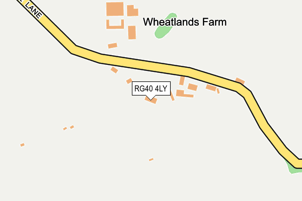
RG40 4LY is located in the Finchampstead South electoral ward, within the unitary authority of Wokingham and the English Parliamentary constituency of Bracknell. The Sub Integrated Care Board (ICB) Location is NHS Buckinghamshire, Oxfordshire and Berkshire West ICB - 15A and the police force is Thames Valley. This postcode has been in use since July 1995.


GetTheData
Source: OS OpenMap – Local (Ordnance Survey)
Source: OS VectorMap District (Ordnance Survey)
Licence: Open Government Licence (requires attribution)
| Easting | 478644 |
| Northing | 164164 |
| Latitude | 51.371099 |
| Longitude | -0.871579 |
GetTheData
Source: Open Postcode Geo
Licence: Open Government Licence
| Country | England |
| Postcode District | RG40 |
| ➜ RG40 open data dashboard ➜ See where RG40 is on a map | |
GetTheData
Source: Land Registry Price Paid Data
Licence: Open Government Licence
Elevation or altitude of RG40 4LY as distance above sea level:
| Metres | Feet | |
|---|---|---|
| Elevation | 70m | 230ft |
Elevation is measured from the approximate centre of the postcode, to the nearest point on an OS contour line from OS Terrain 50, which has contour spacing of ten vertical metres.
➜ How high above sea level am I? Find the elevation of your current position using your device's GPS.
GetTheData
Source: Open Postcode Elevation
Licence: Open Government Licence
| Ward | Finchampstead South |
| Constituency | Bracknell |
GetTheData
Source: ONS Postcode Database
Licence: Open Government Licence
| California Country Park (Nine Mile Ride) | California Country Park | 545m |
| California Country Park (Nine Mile Ride) | California Country Park | 553m |
| Manor Park Drive (Nine Mile Ride) | California Crossroads | 774m |
| Coleshill Farm (Nine Mile Ride) | Hogwood Lane Industrial Estate | 812m |
| Coleshill Farm (Nine Mile Ride) | Hogwood Lane Industrial Estate | 818m |
| Crowthorne Station | 3.7km |
| Wokingham Station | 4.9km |
| Sandhurst Station | 5.4km |
GetTheData
Source: NaPTAN
Licence: Open Government Licence
| Percentage of properties with Next Generation Access | 100.0% |
| Percentage of properties with Superfast Broadband | 100.0% |
| Percentage of properties with Ultrafast Broadband | 0.0% |
| Percentage of properties with Full Fibre Broadband | 0.0% |
Superfast Broadband is between 30Mbps and 300Mbps
Ultrafast Broadband is > 300Mbps
| Percentage of properties unable to receive 2Mbps | 0.0% |
| Percentage of properties unable to receive 5Mbps | 0.0% |
| Percentage of properties unable to receive 10Mbps | 0.0% |
| Percentage of properties unable to receive 30Mbps | 0.0% |
GetTheData
Source: Ofcom
Licence: Ofcom Terms of Use (requires attribution)
GetTheData
Source: ONS Postcode Database
Licence: Open Government Licence


➜ Get more ratings from the Food Standards Agency
GetTheData
Source: Food Standards Agency
Licence: FSA terms & conditions
| Last Collection | |||
|---|---|---|---|
| Location | Mon-Fri | Sat | Distance |
| California Post Office | 18:15 | 11:30 | 1,279m |
| Gorse Ride North | 16:00 | 11:30 | 1,477m |
| Nashgrove Lane | 17:00 | 11:15 | 1,693m |
GetTheData
Source: Dracos
Licence: Creative Commons Attribution-ShareAlike
| Facility | Distance |
|---|---|
| Gorse Ride Junior School Gorse Ride South, Finchampstead, Wokingham Grass Pitches | 1.1km |
| Finchampstead Memorial Ground The Village, Finchampstead, Wokingham Grass Pitches | 1.1km |
| Finchampstead Baptist Church Centre Gorse Ride North, Finchampstead, Wokingham Grass Pitches, Sports Hall, Studio | 1.1km |
GetTheData
Source: Active Places
Licence: Open Government Licence
| School | Phase of Education | Distance |
|---|---|---|
| Gorse Ride Junior School Gorse Ride South, Finchampstead, Wokingham, RG40 4JJ | Primary | 1.1km |
| Gorse Ride Infants' School Gorse Ride South, Finchampstead, Wokingham, RG40 4EH | Primary | 1.1km |
| Finchampstead CofE VA Primary School The Village, Finchampstead, Wokingham, RG40 4JR | Primary | 1.2km |
GetTheData
Source: Edubase
Licence: Open Government Licence
The below table lists the International Territorial Level (ITL) codes (formerly Nomenclature of Territorial Units for Statistics (NUTS) codes) and Local Administrative Units (LAU) codes for RG40 4LY:
| ITL 1 Code | Name |
|---|---|
| TLJ | South East (England) |
| ITL 2 Code | Name |
| TLJ1 | Berkshire, Buckinghamshire and Oxfordshire |
| ITL 3 Code | Name |
| TLJ11 | Berkshire |
| LAU 1 Code | Name |
| E06000041 | Wokingham |
GetTheData
Source: ONS Postcode Directory
Licence: Open Government Licence
The below table lists the Census Output Area (OA), Lower Layer Super Output Area (LSOA), and Middle Layer Super Output Area (MSOA) for RG40 4LY:
| Code | Name | |
|---|---|---|
| OA | E00084001 | |
| LSOA | E01016641 | Wokingham 018C |
| MSOA | E02003456 | Wokingham 018 |
GetTheData
Source: ONS Postcode Directory
Licence: Open Government Licence
| RG40 4HR | Warren Lane | 444m |
| RG40 4HS | Warren Lane | 527m |
| RG40 4NA | White Horse Lane | 529m |
| RG40 4HZ | Nine Mile Ride | 550m |
| RG40 4ND | Nine Mile Ride | 552m |
| RG40 4NB | White Horse Lane | 561m |
| RG40 4HX | Nine Mile Ride | 593m |
| RG40 4LU | Church Lane | 688m |
| RG40 4XF | Church Hams | 728m |
| RG40 4XG | Wimbushes | 729m |
GetTheData
Source: Open Postcode Geo; Land Registry Price Paid Data
Licence: Open Government Licence