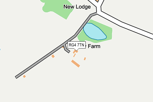
RG4 7TN is located in the Kidmore End & Whitchurch electoral ward, within the local authority district of South Oxfordshire and the English Parliamentary constituency of Henley. The Sub Integrated Care Board (ICB) Location is NHS Buckinghamshire, Oxfordshire and Berkshire West ICB - 10Q and the police force is Thames Valley. This postcode has been in use since January 1980.


GetTheData
Source: OS OpenMap – Local (Ordnance Survey)
Source: OS VectorMap District (Ordnance Survey)
Licence: Open Government Licence (requires attribution)
| Easting | 468001 |
| Northing | 175963 |
| Latitude | 51.478549 |
| Longitude | -1.022187 |
GetTheData
Source: Open Postcode Geo
Licence: Open Government Licence
| Country | England |
| Postcode District | RG4 |
➜ See where RG4 is on a map | |
GetTheData
Source: Land Registry Price Paid Data
Licence: Open Government Licence
Elevation or altitude of RG4 7TN as distance above sea level:
| Metres | Feet | |
|---|---|---|
| Elevation | 40m | 131ft |
Elevation is measured from the approximate centre of the postcode, to the nearest point on an OS contour line from OS Terrain 50, which has contour spacing of ten vertical metres.
➜ How high above sea level am I? Find the elevation of your current position using your device's GPS.
GetTheData
Source: Open Postcode Elevation
Licence: Open Government Licence
| Ward | Kidmore End & Whitchurch |
| Constituency | Henley |
GetTheData
Source: ONS Postcode Database
Licence: Open Government Licence
| Tilehurst Station (Station Forecourt) | Kentwood | 954m |
| Tilehurst Station (A329 Oxford Road) | Kentwood | 974m |
| Tilehurst Station (A329 Oxford Road) | Kentwood | 981m |
| Roebuck Hotel (A329 Oxford Road) | Kentwood | 1,022m |
| Kentwood Circle (A329 Oxford Road) | Kentwood | 1,031m |
| Tilehurst Station | 0.9km |
| Reading West Station | 3.4km |
| Reading Station | 4.1km |
GetTheData
Source: NaPTAN
Licence: Open Government Licence
| Percentage of properties with Next Generation Access | 100.0% |
| Percentage of properties with Superfast Broadband | 0.0% |
| Percentage of properties with Ultrafast Broadband | 0.0% |
| Percentage of properties with Full Fibre Broadband | 0.0% |
Superfast Broadband is between 30Mbps and 300Mbps
Ultrafast Broadband is > 300Mbps
| Percentage of properties unable to receive 2Mbps | 0.0% |
| Percentage of properties unable to receive 5Mbps | 0.0% |
| Percentage of properties unable to receive 10Mbps | 100.0% |
| Percentage of properties unable to receive 30Mbps | 100.0% |
GetTheData
Source: Ofcom
Licence: Ofcom Terms of Use (requires attribution)
GetTheData
Source: ONS Postcode Database
Licence: Open Government Licence


➜ Get more ratings from the Food Standards Agency
GetTheData
Source: Food Standards Agency
Licence: FSA terms & conditions
| Last Collection | |||
|---|---|---|---|
| Location | Mon-Fri | Sat | Distance |
| Elsley Road | 16:00 | 14:00 | 1,037m |
| Lower Tilehurst Post Office | 16:30 | 13:45 | 1,106m |
| Mapledurham | 16:45 | 09:00 | 1,262m |
GetTheData
Source: Dracos
Licence: Creative Commons Attribution-ShareAlike
| Risk of RG4 7TN flooding from rivers and sea | Medium |
| ➜ RG4 7TN flood map | |
GetTheData
Source: Open Flood Risk by Postcode
Licence: Open Government Licence
The below table lists the International Territorial Level (ITL) codes (formerly Nomenclature of Territorial Units for Statistics (NUTS) codes) and Local Administrative Units (LAU) codes for RG4 7TN:
| ITL 1 Code | Name |
|---|---|
| TLJ | South East (England) |
| ITL 2 Code | Name |
| TLJ1 | Berkshire, Buckinghamshire and Oxfordshire |
| ITL 3 Code | Name |
| TLJ14 | Oxfordshire CC |
| LAU 1 Code | Name |
| E07000179 | South Oxfordshire |
GetTheData
Source: ONS Postcode Directory
Licence: Open Government Licence
The below table lists the Census Output Area (OA), Lower Layer Super Output Area (LSOA), and Middle Layer Super Output Area (MSOA) for RG4 7TN:
| Code | Name | |
|---|---|---|
| OA | E00145985 | |
| LSOA | E01028659 | South Oxfordshire 020A |
| MSOA | E02005977 | South Oxfordshire 020 |
GetTheData
Source: ONS Postcode Directory
Licence: Open Government Licence
| RG31 6TB | Oxford Road | 954m |
| RG31 6TN | Oxford Road | 1009m |
| RG31 6TL | Oxford Road | 1017m |
| RG31 6TE | Oxford Road | 1054m |
| RG31 6PS | Overlanders End | 1086m |
| RG31 6RN | Elsley Road | 1092m |
| RG31 6NH | Overdown Road | 1116m |
| RG30 6TP | Oxford Road | 1119m |
| RG31 6UZ | Ferndale Close | 1123m |
| RG31 6JD | Kentwood Hill | 1127m |
GetTheData
Source: Open Postcode Geo; Land Registry Price Paid Data
Licence: Open Government Licence