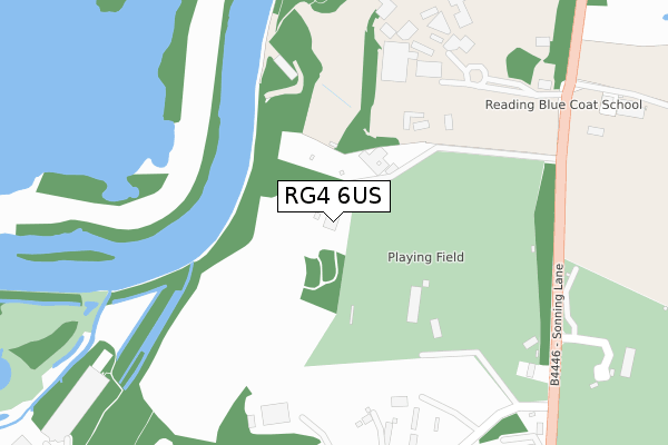
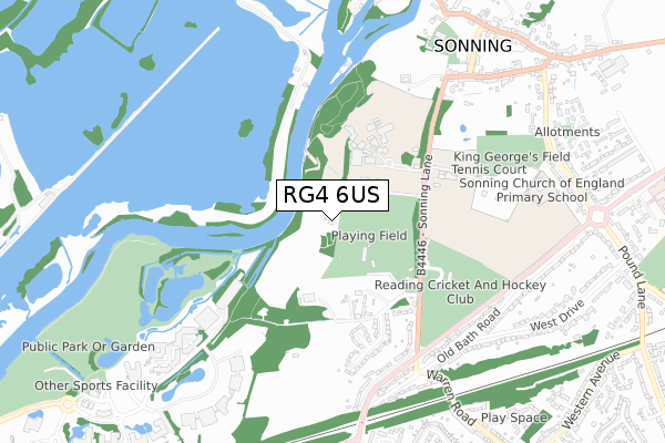
RG4 6US lies on Meade Park in Sonning, Reading. RG4 6US is located in the Sonning electoral ward, within the unitary authority of Wokingham and the English Parliamentary constituency of Maidenhead. The Sub Integrated Care Board (ICB) Location is NHS Buckinghamshire, Oxfordshire and Berkshire West ICB - 15A and the police force is Thames Valley. This postcode has been in use since July 1995.


GetTheData
Source: OS Open Zoomstack (Ordnance Survey)
Licence: Open Government Licence (requires attribution)
Attribution: Contains OS data © Crown copyright and database right 2024
Source: Open Postcode Geo
Licence: Open Government Licence (requires attribution)
Attribution: Contains OS data © Crown copyright and database right 2024; Contains Royal Mail data © Royal Mail copyright and database right 2024; Source: Office for National Statistics licensed under the Open Government Licence v.3.0
| Easting | 475180 |
| Northing | 174868 |
| Latitude | 51.467796 |
| Longitude | -0.919084 |
GetTheData
Source: Open Postcode Geo
Licence: Open Government Licence
| Street | Meade Park |
| Locality | Sonning |
| Town/City | Reading |
| Country | England |
| Postcode District | RG4 |
| ➜ RG4 open data dashboard ➜ See where RG4 is on a map ➜ Where is Sonning? | |
GetTheData
Source: Land Registry Price Paid Data
Licence: Open Government Licence
Elevation or altitude of RG4 6US as distance above sea level:
| Metres | Feet | |
|---|---|---|
| Elevation | 60m | 197ft |
Elevation is measured from the approximate centre of the postcode, to the nearest point on an OS contour line from OS Terrain 50, which has contour spacing of ten vertical metres.
➜ How high above sea level am I? Find the elevation of your current position using your device's GPS.
GetTheData
Source: Open Postcode Elevation
Licence: Open Government Licence
| Ward | Sonning |
| Constituency | Maidenhead |
GetTheData
Source: ONS Postcode Database
Licence: Open Government Licence
UNIT 6, MEADE PARK, SONNING, READING, RG4 6US 2008 13 JUN £475,000 |
GetTheData
Source: HM Land Registry Price Paid Data
Licence: Contains HM Land Registry data © Crown copyright and database right 2024. This data is licensed under the Open Government Licence v3.0.
| June 2022 | Violence and sexual offences | On or near Sports/Recreation Area | 185m |
| May 2022 | Violence and sexual offences | On or near Sports/Recreation Area | 185m |
| March 2022 | Violence and sexual offences | On or near Sports/Recreation Area | 185m |
| ➜ Get more crime data in our Crime section | |||
GetTheData
Source: data.police.uk
Licence: Open Government Licence
| Bluecoat School (Sonning Lane) | Sonning | 405m |
| Bluecoat School (Sonning Lane) | Sonning | 412m |
| Holme Park Farm Lane (Sonning Lane) | Sonning | 460m |
| Sonning Lane | Sonning | 563m |
| Sonning Lane (Bath Road) | Sonning | 592m |
| Earley Station | 3km |
| Reading Station | 3.8km |
| Winnersh Triangle Station | 4km |
GetTheData
Source: NaPTAN
Licence: Open Government Licence
GetTheData
Source: ONS Postcode Database
Licence: Open Government Licence


➜ Get more ratings from the Food Standards Agency
GetTheData
Source: Food Standards Agency
Licence: FSA terms & conditions
| Last Collection | |||
|---|---|---|---|
| Location | Mon-Fri | Sat | Distance |
| Holme Park Reading | 16:45 | 08:30 | 400m |
| Sonning Post Office | 16:45 | 09:30 | 889m |
| Pound Lane | 16:30 | 11:00 | 895m |
GetTheData
Source: Dracos
Licence: Creative Commons Attribution-ShareAlike
| Facility | Distance |
|---|---|
| Reading Rugby Football Club Sonning Lane, Sonning, Reading Grass Pitches | 343m |
| Reading Blue Coat School Sonning Lane, Sonning, Reading Sports Hall, Swimming Pool, Health and Fitness Gym, Grass Pitches, Squash Courts, Outdoor Tennis Courts, Artificial Grass Pitch | 352m |
| Berkshire County Sports Club Sonning Lane, Sonning, Reading Artificial Grass Pitch, Grass Pitches, Squash Courts, Outdoor Tennis Courts | 474m |
GetTheData
Source: Active Places
Licence: Open Government Licence
| School | Phase of Education | Distance |
|---|---|---|
| Reading Blue Coat School Holme Park, Sonning Lane, Sonning-on-Thames, Berkshire, RG4 6SU | Not applicable | 352m |
| Sonning Church of England Primary School Liguge Way, Sonning, Reading, RG4 6XF | Primary | 794m |
| St Dominic Savio Catholic Primary School Western Avenue, Woodley, RG5 3BH | Primary | 1.4km |
GetTheData
Source: Edubase
Licence: Open Government Licence
The below table lists the International Territorial Level (ITL) codes (formerly Nomenclature of Territorial Units for Statistics (NUTS) codes) and Local Administrative Units (LAU) codes for RG4 6US:
| ITL 1 Code | Name |
|---|---|
| TLJ | South East (England) |
| ITL 2 Code | Name |
| TLJ1 | Berkshire, Buckinghamshire and Oxfordshire |
| ITL 3 Code | Name |
| TLJ11 | Berkshire |
| LAU 1 Code | Name |
| E06000041 | Wokingham |
GetTheData
Source: ONS Postcode Directory
Licence: Open Government Licence
The below table lists the Census Output Area (OA), Lower Layer Super Output Area (LSOA), and Middle Layer Super Output Area (MSOA) for RG4 6US:
| Code | Name | |
|---|---|---|
| OA | E00084208 | |
| LSOA | E01016685 | Wokingham 003E |
| MSOA | E02003441 | Wokingham 003 |
GetTheData
Source: ONS Postcode Directory
Licence: Open Government Licence
| RG4 6SX | Holme Park Farm Lane | 368m |
| RG4 6ST | Sonning Lane | 448m |
| RG4 6XB | Sonning Meadows | 466m |
| RG4 6GB | South Drive | 594m |
| RG4 6TA | Old Bath Road | 636m |
| RG4 6GA | Old Bath Road | 647m |
| RG4 6SY | Old Bath Road | 710m |
| RG4 6SZ | Old Bath Road | 739m |
| RG4 6UH | Pearson Road | 785m |
| RG4 6UL | Pearson Road | 806m |
GetTheData
Source: Open Postcode Geo; Land Registry Price Paid Data
Licence: Open Government Licence