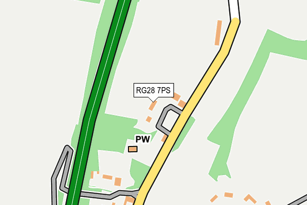
RG28 7PS lies on Jubilee Close in Litchfield, Whitchurch. RG28 7PS is located in the Evingar electoral ward, within the local authority district of Basingstoke and Deane and the English Parliamentary constituency of North West Hampshire. The Sub Integrated Care Board (ICB) Location is NHS Hampshire and Isle of Wight ICB - D9Y0V and the police force is Hampshire. This postcode has been in use since January 1980.


GetTheData
Source: OS OpenMap – Local (Ordnance Survey)
Source: OS VectorMap District (Ordnance Survey)
Licence: Open Government Licence (requires attribution)
| Easting | 446202 |
| Northing | 154119 |
| Latitude | 51.284343 |
| Longitude | -1.338910 |
GetTheData
Source: Open Postcode Geo
Licence: Open Government Licence
| Street | Jubilee Close |
| Locality | Litchfield |
| Town/City | Whitchurch |
| Country | England |
| Postcode District | RG28 |
| ➜ RG28 open data dashboard ➜ See where RG28 is on a map ➜ Where is Litchfield? | |
GetTheData
Source: Land Registry Price Paid Data
Licence: Open Government Licence
Elevation or altitude of RG28 7PS as distance above sea level:
| Metres | Feet | |
|---|---|---|
| Elevation | 120m | 394ft |
Elevation is measured from the approximate centre of the postcode, to the nearest point on an OS contour line from OS Terrain 50, which has contour spacing of ten vertical metres.
➜ How high above sea level am I? Find the elevation of your current position using your device's GPS.
GetTheData
Source: Open Postcode Elevation
Licence: Open Government Licence
| Ward | Evingar |
| Constituency | North West Hampshire |
GetTheData
Source: ONS Postcode Database
Licence: Open Government Licence
| January 2022 | Violence and sexual offences | On or near Pedestrian Subway | 223m |
| October 2021 | Burglary | On or near A34 | 308m |
| October 2021 | Public order | On or near Pedestrian Subway | 409m |
| ➜ Get more crime data in our Crime section | |||
GetTheData
Source: data.police.uk
Licence: Open Government Licence
| Percentage of properties with Next Generation Access | 100.0% |
| Percentage of properties with Superfast Broadband | 100.0% |
| Percentage of properties with Ultrafast Broadband | 0.0% |
| Percentage of properties with Full Fibre Broadband | 0.0% |
Superfast Broadband is between 30Mbps and 300Mbps
Ultrafast Broadband is > 300Mbps
| Percentage of properties unable to receive 2Mbps | 0.0% |
| Percentage of properties unable to receive 5Mbps | 0.0% |
| Percentage of properties unable to receive 10Mbps | 0.0% |
| Percentage of properties unable to receive 30Mbps | 0.0% |
GetTheData
Source: Ofcom
Licence: Ofcom Terms of Use (requires attribution)
GetTheData
Source: ONS Postcode Database
Licence: Open Government Licence
| Last Collection | |||
|---|---|---|---|
| Location | Mon-Fri | Sat | Distance |
| Dunley | 16:15 | 09:00 | 1,107m |
| Cole Henley | 16:15 | 08:15 | 3,185m |
| Old Burghclere | 16:15 | 09:30 | 4,005m |
GetTheData
Source: Dracos
Licence: Creative Commons Attribution-ShareAlike
| Facility | Distance |
|---|---|
| Overton Rfc Watch Lane, Freefolk, Whitchurch Grass Pitches | 5.6km |
| St Mary Bourne Recreation Ground Bourne Meadow, St. Mary Bourne, Andover Grass Pitches, Sports Hall, Outdoor Tennis Courts | 5.6km |
| Overton C Of E Primary School Court Drove, Overton, Basingstoke Grass Pitches, Swimming Pool | 6.3km |
GetTheData
Source: Active Places
Licence: Open Government Licence
| School | Phase of Education | Distance |
|---|---|---|
| St Mary Bourne Primary School School Lane, St Mary Bourne, Andover, SP11 6AU | Primary | 5.7km |
| Overton Church of England Primary School Court Drove, Overton, Basingstoke, RG25 3ES | Primary | 6.3km |
GetTheData
Source: Edubase
Licence: Open Government Licence
The below table lists the International Territorial Level (ITL) codes (formerly Nomenclature of Territorial Units for Statistics (NUTS) codes) and Local Administrative Units (LAU) codes for RG28 7PS:
| ITL 1 Code | Name |
|---|---|
| TLJ | South East (England) |
| ITL 2 Code | Name |
| TLJ3 | Hampshire and Isle of Wight |
| ITL 3 Code | Name |
| TLJ37 | North Hampshire |
| LAU 1 Code | Name |
| E07000084 | Basingstoke and Deane |
GetTheData
Source: ONS Postcode Directory
Licence: Open Government Licence
The below table lists the Census Output Area (OA), Lower Layer Super Output Area (LSOA), and Middle Layer Super Output Area (MSOA) for RG28 7PS:
| Code | Name | |
|---|---|---|
| OA | E00114349 | |
| LSOA | E01022488 | Basingstoke and Deane 003A |
| MSOA | E02004677 | Basingstoke and Deane 003 |
GetTheData
Source: ONS Postcode Directory
Licence: Open Government Licence
| RG28 7PU | 1373m | |
| RG28 7PY | 2426m | |
| RG28 7QF | 2567m | |
| RG28 7QJ | Pauls Heath Cottages | 2812m |
| SP11 6DL | 2907m | |
| SP11 6DP | 2959m | |
| SP11 6DW | 2998m | |
| RG28 7QD | 3040m | |
| SP11 6ET | 3321m | |
| RG20 9NU | Lime Kiln Cottages | 3436m |
GetTheData
Source: Open Postcode Geo; Land Registry Price Paid Data
Licence: Open Government Licence