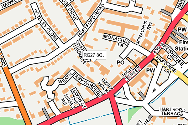
RG27 8QJ is located in the Hartley Wintney electoral ward, within the local authority district of Hart and the English Parliamentary constituency of North East Hampshire. The Sub Integrated Care Board (ICB) Location is NHS Hampshire and Isle of Wight ICB - D9Y0V and the police force is Hampshire. This postcode has been in use since January 1980.


GetTheData
Source: OS OpenMap – Local (Ordnance Survey)
Source: OS VectorMap District (Ordnance Survey)
Licence: Open Government Licence (requires attribution)
| Easting | 476650 |
| Northing | 156954 |
| Latitude | 51.306553 |
| Longitude | -0.901787 |
GetTheData
Source: Open Postcode Geo
Licence: Open Government Licence
| Country | England |
| Postcode District | RG27 |
| ➜ RG27 open data dashboard ➜ See where RG27 is on a map ➜ Where is Hartley Wintney? | |
GetTheData
Source: Land Registry Price Paid Data
Licence: Open Government Licence
Elevation or altitude of RG27 8QJ as distance above sea level:
| Metres | Feet | |
|---|---|---|
| Elevation | 70m | 230ft |
Elevation is measured from the approximate centre of the postcode, to the nearest point on an OS contour line from OS Terrain 50, which has contour spacing of ten vertical metres.
➜ How high above sea level am I? Find the elevation of your current position using your device's GPS.
GetTheData
Source: Open Postcode Elevation
Licence: Open Government Licence
| Ward | Hartley Wintney |
| Constituency | North East Hampshire |
GetTheData
Source: ONS Postcode Database
Licence: Open Government Licence
| November 2023 | Vehicle crime | On or near Oakwood Court | 498m |
| September 2023 | Burglary | On or near Oakwood Court | 498m |
| August 2023 | Other theft | On or near Oakwood Court | 498m |
| ➜ Get more crime data in our Crime section | |||
GetTheData
Source: data.police.uk
Licence: Open Government Licence
| Swan Court (High Street) | Hartley Wintney | 121m |
| Swan Court (High Street) | Hartley Wintney | 141m |
| Park Corner Road (High Street) | Hartley Wintney | 231m |
| Green Lane (Fleet Road) | Hartley Wintney | 235m |
| Park Corner Road (High Street) | Hartley Wintney | 256m |
| Winchfield Station | 2.4km |
| Hook Station | 5.1km |
| Fleet Station | 5.3km |
GetTheData
Source: NaPTAN
Licence: Open Government Licence
GetTheData
Source: ONS Postcode Database
Licence: Open Government Licence


➜ Get more ratings from the Food Standards Agency
GetTheData
Source: Food Standards Agency
Licence: FSA terms & conditions
| Last Collection | |||
|---|---|---|---|
| Location | Mon-Fri | Sat | Distance |
| Monachus Lane | 16:30 | 07:00 | 91m |
| Hartley Wintney Post Office | 17:15 | 10:30 | 97m |
| Bracknell Lane | 17:00 | 07:00 | 295m |
GetTheData
Source: Dracos
Licence: Creative Commons Attribution-ShareAlike
| Facility | Distance |
|---|---|
| Hartley Wintney Cricket Green Cricket Green, Hartley Wintney, Hook Grass Pitches | 250m |
| Hartley Wintney Golf Club London Road, Hartley Wintney, Hook Golf | 421m |
| Greenfields Junior School Green Lane, Hartley Wintney, Hook Grass Pitches | 518m |
GetTheData
Source: Active Places
Licence: Open Government Licence
| School | Phase of Education | Distance |
|---|---|---|
| Greenfields Junior School Green Lane, Hartley Wintney, Hook, RG27 8DQ | Primary | 517m |
| Oakwood Infant School Church Lane, Hartley Wintney, Hook, RG27 8DY | Primary | 573m |
| Elvetham Heath Primary School The Key, Elvetham Heath, Fleet, GU51 1DP | Primary | 3.6km |
GetTheData
Source: Edubase
Licence: Open Government Licence
The below table lists the International Territorial Level (ITL) codes (formerly Nomenclature of Territorial Units for Statistics (NUTS) codes) and Local Administrative Units (LAU) codes for RG27 8QJ:
| ITL 1 Code | Name |
|---|---|
| TLJ | South East (England) |
| ITL 2 Code | Name |
| TLJ3 | Hampshire and Isle of Wight |
| ITL 3 Code | Name |
| TLJ37 | North Hampshire |
| LAU 1 Code | Name |
| E07000089 | Hart |
GetTheData
Source: ONS Postcode Directory
Licence: Open Government Licence
The below table lists the Census Output Area (OA), Lower Layer Super Output Area (LSOA), and Middle Layer Super Output Area (MSOA) for RG27 8QJ:
| Code | Name | |
|---|---|---|
| OA | E00116260 | |
| LSOA | E01022879 | Hart 004C |
| MSOA | E02004754 | Hart 004 |
GetTheData
Source: ONS Postcode Directory
Licence: Open Government Licence
| RG27 8NQ | Chapter Terrace | 30m |
| RG27 8PA | Weatherby Gardens | 53m |
| RG27 8NJ | Chapel Row | 79m |
| RG27 8NZ | High Street | 80m |
| RG27 8QN | Hartford Road | 84m |
| RG27 8NG | Belgrave Mews | 84m |
| RG27 8XY | Swan Court | 109m |
| RG27 8NS | High Street | 123m |
| RG27 8PQ | Hartford Court | 160m |
| RG27 8PE | High Street | 166m |
GetTheData
Source: Open Postcode Geo; Land Registry Price Paid Data
Licence: Open Government Licence