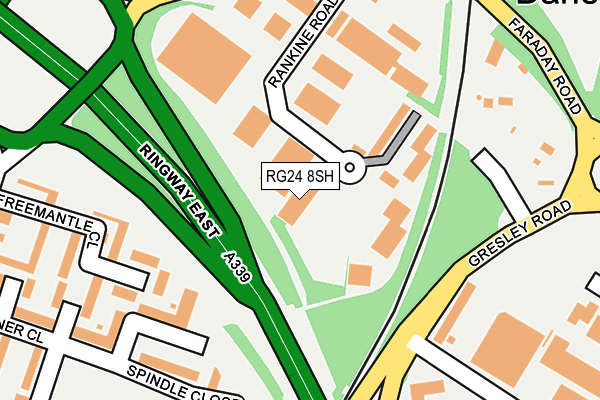
RG24 8SH is located in the Norden electoral ward, within the local authority district of Basingstoke and Deane and the English Parliamentary constituency of Basingstoke. The Sub Integrated Care Board (ICB) Location is NHS Hampshire and Isle of Wight ICB - D9Y0V and the police force is Hampshire. This postcode has been in use since August 1993.


GetTheData
Source: OS OpenMap – Local (Ordnance Survey)
Source: OS VectorMap District (Ordnance Survey)
Licence: Open Government Licence (requires attribution)
| Easting | 464873 |
| Northing | 153358 |
| Latitude | 51.275685 |
| Longitude | -1.071363 |
GetTheData
Source: Open Postcode Geo
Licence: Open Government Licence
| Country | England |
| Postcode District | RG24 |
| ➜ RG24 open data dashboard ➜ See where RG24 is on a map ➜ Where is Basingstoke? | |
GetTheData
Source: Land Registry Price Paid Data
Licence: Open Government Licence
Elevation or altitude of RG24 8SH as distance above sea level:
| Metres | Feet | |
|---|---|---|
| Elevation | 90m | 295ft |
Elevation is measured from the approximate centre of the postcode, to the nearest point on an OS contour line from OS Terrain 50, which has contour spacing of ten vertical metres.
➜ How high above sea level am I? Find the elevation of your current position using your device's GPS.
GetTheData
Source: Open Postcode Elevation
Licence: Open Government Licence
| Ward | Norden |
| Constituency | Basingstoke |
GetTheData
Source: ONS Postcode Database
Licence: Open Government Licence
| June 2022 | Anti-social behaviour | On or near Enterprise Court | 108m |
| June 2022 | Criminal damage and arson | On or near Enterprise Court | 108m |
| June 2022 | Violence and sexual offences | On or near Freemantle Close | 213m |
| ➜ Get more crime data in our Crime section | |||
GetTheData
Source: data.police.uk
Licence: Open Government Licence
| Gresley Road | Daneshill | 209m |
| Gresley Road | Daneshill | 245m |
| Rutherford Road (Faraday Road) | Daneshill | 247m |
| Gresley Road (Armstrong Road) | South View | 253m |
| Rankine Road (Faraday Road) | Daneshill | 279m |
| Basingstoke Station | 1.4km |
GetTheData
Source: NaPTAN
Licence: Open Government Licence
GetTheData
Source: ONS Postcode Database
Licence: Open Government Licence

➜ Get more ratings from the Food Standards Agency
GetTheData
Source: Food Standards Agency
Licence: FSA terms & conditions
| Last Collection | |||
|---|---|---|---|
| Location | Mon-Fri | Sat | Distance |
| Tavener Close | 17:00 | 10:30 | 348m |
| Forsythia Walk | 17:00 | 12:00 | 603m |
| Armstrong Road | 16:30 | 09:00 | 620m |
GetTheData
Source: Dracos
Licence: Creative Commons Attribution-ShareAlike
| Facility | Distance |
|---|---|
| Oakridge Playing Field (Closed) Coronation Road, Basingstoke Grass Pitches | 417m |
| Village Gym (Basingstoke) Basing View, Basingstoke Swimming Pool, Health and Fitness Gym, Studio | 707m |
| Intec Fitness (Closed) Wade Road, Basingstoke Health and Fitness Gym, Squash Courts | 772m |
GetTheData
Source: Active Places
Licence: Open Government Licence
| School | Phase of Education | Distance |
|---|---|---|
| The Austen Academy Shakespeare Road, The Austen Academy, BASINGSTOKE, RG24 9BP | Not applicable | 455m |
| South View Infant and Nursery School Off Shooters Way, Basingstoke, RG21 5LL | Primary | 719m |
| South View Junior School Shooters Way, Basingstoke, RG21 5LL | Primary | 774m |
GetTheData
Source: Edubase
Licence: Open Government Licence
The below table lists the International Territorial Level (ITL) codes (formerly Nomenclature of Territorial Units for Statistics (NUTS) codes) and Local Administrative Units (LAU) codes for RG24 8SH:
| ITL 1 Code | Name |
|---|---|
| TLJ | South East (England) |
| ITL 2 Code | Name |
| TLJ3 | Hampshire and Isle of Wight |
| ITL 3 Code | Name |
| TLJ37 | North Hampshire |
| LAU 1 Code | Name |
| E07000084 | Basingstoke and Deane |
GetTheData
Source: ONS Postcode Directory
Licence: Open Government Licence
The below table lists the Census Output Area (OA), Lower Layer Super Output Area (LSOA), and Middle Layer Super Output Area (MSOA) for RG24 8SH:
| Code | Name | |
|---|---|---|
| OA | E00114523 | |
| LSOA | E01022523 | Basingstoke and Deane 008D |
| MSOA | E02004682 | Basingstoke and Deane 008 |
GetTheData
Source: ONS Postcode Directory
Licence: Open Government Licence
| RG21 4JH | Freemantle Close | 214m |
| RG21 4FL | Spindle Close | 216m |
| RG21 4JN | Freemantle Close | 240m |
| RG21 4RN | Norn Hill | 321m |
| RG21 4JF | Taverner Close | 323m |
| RG21 4RW | Norn Hill | 372m |
| RG21 5JY | Martin Close | 382m |
| RG21 4JB | Westray Close | 398m |
| RG24 8PD | Rutherford Road | 399m |
| RG21 4HY | Westray Close | 400m |
GetTheData
Source: Open Postcode Geo; Land Registry Price Paid Data
Licence: Open Government Licence