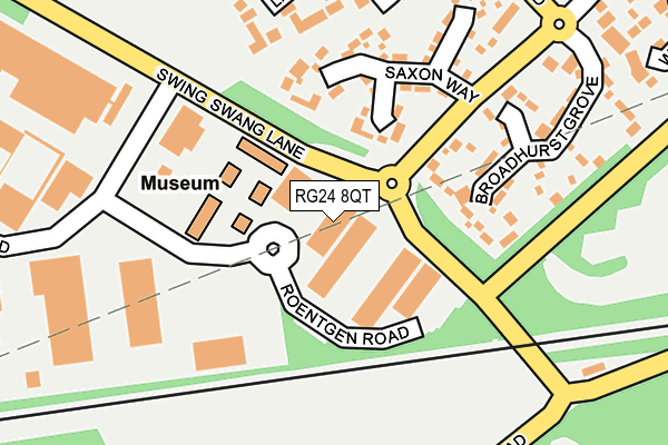
RG24 8QT is located in the Norden electoral ward, within the local authority district of Basingstoke and Deane and the English Parliamentary constituency of Basingstoke. The Sub Integrated Care Board (ICB) Location is NHS Hampshire and Isle of Wight ICB - D9Y0V and the police force is Hampshire. This postcode has been in use since August 1993.


GetTheData
Source: OS OpenMap – Local (Ordnance Survey)
Source: OS VectorMap District (Ordnance Survey)
Licence: Open Government Licence (requires attribution)
| Easting | 465630 |
| Northing | 153040 |
| Latitude | 51.272739 |
| Longitude | -1.060570 |
GetTheData
Source: Open Postcode Geo
Licence: Open Government Licence
| Country | England |
| Postcode District | RG24 |
| ➜ RG24 open data dashboard ➜ See where RG24 is on a map ➜ Where is Basingstoke? | |
GetTheData
Source: Land Registry Price Paid Data
Licence: Open Government Licence
Elevation or altitude of RG24 8QT as distance above sea level:
| Metres | Feet | |
|---|---|---|
| Elevation | 90m | 295ft |
Elevation is measured from the approximate centre of the postcode, to the nearest point on an OS contour line from OS Terrain 50, which has contour spacing of ten vertical metres.
➜ How high above sea level am I? Find the elevation of your current position using your device's GPS.
GetTheData
Source: Open Postcode Elevation
Licence: Open Government Licence
| Ward | Norden |
| Constituency | Basingstoke |
GetTheData
Source: ONS Postcode Database
Licence: Open Government Licence
| August 2023 | Anti-social behaviour | On or near Norton Ride | 335m |
| August 2023 | Anti-social behaviour | On or near Whitehead Close | 369m |
| July 2023 | Anti-social behaviour | On or near Whitehead Close | 369m |
| ➜ Get more crime data in our Crime section | |||
GetTheData
Source: data.police.uk
Licence: Open Government Licence
| Bartons Lane (Swing Swang Lane) | Daneshill | 78m |
| Bartons Lane (Swing Swang Lane) | Daneshill | 103m |
| Saxon Way (Great Binfields Road) | Lychpit | 182m |
| Swing Swang Lane (Armstrong Road) | Daneshill | 196m |
| Saxon Way (Great Binfields Road) | Lychpit | 216m |
| Basingstoke Station | 1.9km |
GetTheData
Source: NaPTAN
Licence: Open Government Licence
GetTheData
Source: ONS Postcode Database
Licence: Open Government Licence


➜ Get more ratings from the Food Standards Agency
GetTheData
Source: Food Standards Agency
Licence: FSA terms & conditions
| Last Collection | |||
|---|---|---|---|
| Location | Mon-Fri | Sat | Distance |
| Armstrong Road | 16:30 | 09:00 | 202m |
| Lychpit Centre | 16:00 | 09:00 | 509m |
| Bartons Lane | 16:00 | 09:00 | 590m |
GetTheData
Source: Dracos
Licence: Creative Commons Attribution-ShareAlike
| Facility | Distance |
|---|---|
| Intec Fitness (Closed) Wade Road, Basingstoke Health and Fitness Gym, Squash Courts | 866m |
| Oakridge Playing Field (Closed) Coronation Road, Basingstoke Grass Pitches | 932m |
| Royals Park Crown Lane, Old Basing, Basingstoke Grass Pitches | 934m |
GetTheData
Source: Active Places
Licence: Open Government Licence
| School | Phase of Education | Distance |
|---|---|---|
| Old Basing Infant School Milkingpen Lane, Old Basing, Basingstoke, RG24 7DL | Primary | 1.1km |
| St Mary's Church of England Voluntary Aided Junior School Belle Vue Road, Old Basing, Basingstoke, RG24 7DE | Primary | 1.2km |
| The Austen Academy Shakespeare Road, The Austen Academy, BASINGSTOKE, RG24 9BP | Not applicable | 1.2km |
GetTheData
Source: Edubase
Licence: Open Government Licence
The below table lists the International Territorial Level (ITL) codes (formerly Nomenclature of Territorial Units for Statistics (NUTS) codes) and Local Administrative Units (LAU) codes for RG24 8QT:
| ITL 1 Code | Name |
|---|---|
| TLJ | South East (England) |
| ITL 2 Code | Name |
| TLJ3 | Hampshire and Isle of Wight |
| ITL 3 Code | Name |
| TLJ37 | North Hampshire |
| LAU 1 Code | Name |
| E07000084 | Basingstoke and Deane |
GetTheData
Source: ONS Postcode Directory
Licence: Open Government Licence
The below table lists the Census Output Area (OA), Lower Layer Super Output Area (LSOA), and Middle Layer Super Output Area (MSOA) for RG24 8QT:
| Code | Name | |
|---|---|---|
| OA | E00114523 | |
| LSOA | E01022523 | Basingstoke and Deane 008D |
| MSOA | E02004682 | Basingstoke and Deane 008 |
GetTheData
Source: ONS Postcode Directory
Licence: Open Government Licence
| RG24 8NT | Roentgen Road | 153m |
| RG24 8SA | Saxon Way | 157m |
| RG24 8SB | Broadhurst Grove | 191m |
| RG24 8SL | Lambs Row | 226m |
| RG24 7AL | Basing Road | 268m |
| RG24 8SQ | Peake Close | 303m |
| RG24 8NU | Armstrong Road | 329m |
| RG24 8SN | Blackberry Walk | 329m |
| RG24 8SG | Whitehead Close | 360m |
| RG24 8SW | Rosehip Way | 366m |
GetTheData
Source: Open Postcode Geo; Land Registry Price Paid Data
Licence: Open Government Licence