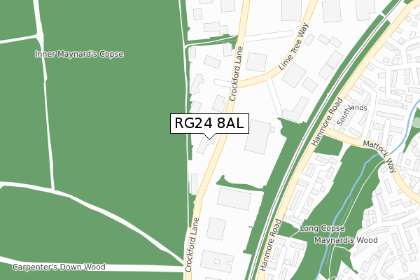
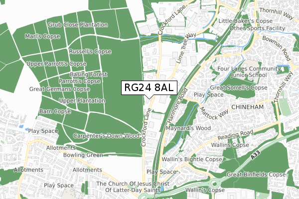
RG24 8AL is located in the Chineham electoral ward, within the local authority district of Basingstoke and Deane and the English Parliamentary constituency of Basingstoke. The Sub Integrated Care Board (ICB) Location is NHS Hampshire and Isle of Wight ICB - D9Y0V and the police force is Hampshire. This postcode has been in use since June 1999.


GetTheData
Source: OS Open Zoomstack (Ordnance Survey)
Licence: Open Government Licence (requires attribution)
Attribution: Contains OS data © Crown copyright and database right 2024
Source: Open Postcode Geo
Licence: Open Government Licence (requires attribution)
Attribution: Contains OS data © Crown copyright and database right 2024; Contains Royal Mail data © Royal Mail copyright and database right 2024; Source: Office for National Statistics licensed under the Open Government Licence v.3.0
| Easting | 465005 |
| Northing | 155164 |
| Latitude | 51.291907 |
| Longitude | -1.069143 |
GetTheData
Source: Open Postcode Geo
Licence: Open Government Licence
| Country | England |
| Postcode District | RG24 |
| ➜ RG24 open data dashboard ➜ See where RG24 is on a map ➜ Where is Basingstoke? | |
GetTheData
Source: Land Registry Price Paid Data
Licence: Open Government Licence
Elevation or altitude of RG24 8AL as distance above sea level:
| Metres | Feet | |
|---|---|---|
| Elevation | 80m | 262ft |
Elevation is measured from the approximate centre of the postcode, to the nearest point on an OS contour line from OS Terrain 50, which has contour spacing of ten vertical metres.
➜ How high above sea level am I? Find the elevation of your current position using your device's GPS.
GetTheData
Source: Open Postcode Elevation
Licence: Open Government Licence
| Ward | Chineham |
| Constituency | Basingstoke |
GetTheData
Source: ONS Postcode Database
Licence: Open Government Licence
| January 2024 | Criminal damage and arson | On or near Southlands | 358m |
| December 2023 | Public order | On or near Southlands | 358m |
| November 2023 | Vehicle crime | On or near Southlands | 358m |
| ➜ Get more crime data in our Crime section | |||
GetTheData
Source: data.police.uk
Licence: Open Government Licence
| Pinewood (Crockford Lane) | Chineham Business Park | 86m |
| Oakwood (Crockford Lane) | Chineham Business Park | 146m |
| Gist (Crockford Lane) | Chineham Business Park | 219m |
| Motorola (Lime Tree Way) | Chineham Business Park | 323m |
| Southlands (Mattock Way) | Chineham | 368m |
| Basingstoke Station | 2.9km |
| Bramley (Hants) Station | 4.3km |
GetTheData
Source: NaPTAN
Licence: Open Government Licence
GetTheData
Source: ONS Postcode Database
Licence: Open Government Licence


➜ Get more ratings from the Food Standards Agency
GetTheData
Source: Food Standards Agency
Licence: FSA terms & conditions
| Last Collection | |||
|---|---|---|---|
| Location | Mon-Fri | Sat | Distance |
| Crockford Lane | 18:30 | 82m | |
| Crockford Lane | 18:30 | 11:00 | 84m |
| Chineham | 16:00 | 10:30 | 575m |
GetTheData
Source: Dracos
Licence: Creative Commons Attribution-ShareAlike
| Facility | Distance |
|---|---|
| Fitness First (Basingstoke) Spindlewood, Stag Oak Lane, Chineham Business Park, Chineham, Basingstoke Health and Fitness Gym, Studio | 610m |
| Four Lanes Community Junior School Hanmore Road, Chineham, Basingstoke Grass Pitches | 872m |
| Marnel Junior School Shetland Road, Basingstoke Grass Pitches | 1.1km |
GetTheData
Source: Active Places
Licence: Open Government Licence
| School | Phase of Education | Distance |
|---|---|---|
| Four Lanes Infant School Hanmore Road, Chineham, Basingstoke, RG24 8PQ | Primary | 848m |
| Four Lanes Community Junior School Hanmore Road, Chineham, Basingstoke, RG24 8PQ | Primary | 872m |
| Marnel Community Infant School Shetland Road, Popley Way, Basingstoke, RG24 9PT | Primary | 1000m |
GetTheData
Source: Edubase
Licence: Open Government Licence
The below table lists the International Territorial Level (ITL) codes (formerly Nomenclature of Territorial Units for Statistics (NUTS) codes) and Local Administrative Units (LAU) codes for RG24 8AL:
| ITL 1 Code | Name |
|---|---|
| TLJ | South East (England) |
| ITL 2 Code | Name |
| TLJ3 | Hampshire and Isle of Wight |
| ITL 3 Code | Name |
| TLJ37 | North Hampshire |
| LAU 1 Code | Name |
| E07000084 | Basingstoke and Deane |
GetTheData
Source: ONS Postcode Directory
Licence: Open Government Licence
The below table lists the Census Output Area (OA), Lower Layer Super Output Area (LSOA), and Middle Layer Super Output Area (MSOA) for RG24 8AL:
| Code | Name | |
|---|---|---|
| OA | E00114590 | |
| LSOA | E01032851 | Basingstoke and Deane 007J |
| MSOA | E02004681 | Basingstoke and Deane 007 |
GetTheData
Source: ONS Postcode Directory
Licence: Open Government Licence
| RG24 8WL | Long Copse Chase | 273m |
| RG24 8GL | Little Copse Chase | 333m |
| RG24 8XN | Southlands | 349m |
| RG24 8XW | Merryfield | 429m |
| RG24 8TG | Wood End | 437m |
| RG24 8BD | Long Acre Rise | 474m |
| RG24 8XL | Meadowland | 488m |
| RG24 8WW | Great Oaks Chase | 490m |
| RG24 8NA | Crockford Lane | 491m |
| RG24 8XR | Highmoors | 512m |
GetTheData
Source: Open Postcode Geo; Land Registry Price Paid Data
Licence: Open Government Licence