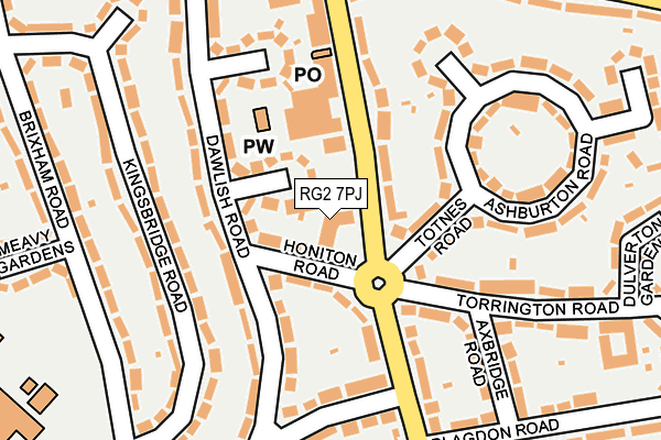
RG2 7PJ is located in the Church electoral ward, within the unitary authority of Reading and the English Parliamentary constituency of Reading West. The Sub Integrated Care Board (ICB) Location is NHS Buckinghamshire, Oxfordshire and Berkshire West ICB - 15A and the police force is Thames Valley. This postcode has been in use since December 1994.


GetTheData
Source: OS OpenMap – Local (Ordnance Survey)
Source: OS VectorMap District (Ordnance Survey)
Licence: Open Government Licence (requires attribution)
| Easting | 472211 |
| Northing | 170775 |
| Latitude | 51.431386 |
| Longitude | -0.962653 |
GetTheData
Source: Open Postcode Geo
Licence: Open Government Licence
| Country | England |
| Postcode District | RG2 |
| ➜ RG2 open data dashboard ➜ See where RG2 is on a map ➜ Where is Reading? | |
GetTheData
Source: Land Registry Price Paid Data
Licence: Open Government Licence
Elevation or altitude of RG2 7PJ as distance above sea level:
| Metres | Feet | |
|---|---|---|
| Elevation | 50m | 164ft |
Elevation is measured from the approximate centre of the postcode, to the nearest point on an OS contour line from OS Terrain 50, which has contour spacing of ten vertical metres.
➜ How high above sea level am I? Find the elevation of your current position using your device's GPS.
GetTheData
Source: Open Postcode Elevation
Licence: Open Government Licence
| Ward | Church |
| Constituency | Reading West |
GetTheData
Source: ONS Postcode Database
Licence: Open Government Licence
| June 2022 | Public order | On or near Honiton Road | 50m |
| June 2022 | Public order | On or near Thurlestone Gardens | 76m |
| June 2022 | Public order | On or near Thurlestone Gardens | 76m |
| ➜ Get more crime data in our Crime section | |||
GetTheData
Source: data.police.uk
Licence: Open Government Licence
| Community Centre (Northumberland Avenue) | Whitley | 43m |
| Community Centre (Northumberland Avenue) | Whitley | 54m |
| Callington Road (Northumberland Avenue) | Whitley | 134m |
| Callington Road (Northumberland Avenue) | Whitley | 161m |
| Buckland Road Circle (Buckland Road) | Whitley | 278m |
| Reading Station | 3.1km |
| Earley Station | 3.3km |
| Reading West Station | 3.3km |
GetTheData
Source: NaPTAN
Licence: Open Government Licence
GetTheData
Source: ONS Postcode Database
Licence: Open Government Licence


➜ Get more ratings from the Food Standards Agency
GetTheData
Source: Food Standards Agency
Licence: FSA terms & conditions
| Last Collection | |||
|---|---|---|---|
| Location | Mon-Fri | Sat | Distance |
| Manor Farm | 17:00 | 13:00 | 491m |
| Lindisfarne Way | 17:30 | 12:00 | 877m |
| Post House | 17:15 | 13:15 | 1,249m |
GetTheData
Source: Dracos
Licence: Creative Commons Attribution-ShareAlike
| Facility | Distance |
|---|---|
| South Reading Leisure Centre Northumberland Avenue, Reading Sports Hall, Swimming Pool, Health and Fitness Gym, Artificial Grass Pitch, Studio, Outdoor Tennis Courts | 498m |
| Puregym (Reading Basingstoke Road) Basingstoke Road, Reading Health and Fitness Gym | 505m |
| Reading Girls' School Northumberland Avenue, Reading Grass Pitches, Sports Hall, Outdoor Tennis Courts | 558m |
GetTheData
Source: Active Places
Licence: Open Government Licence
| School | Phase of Education | Distance |
|---|---|---|
| Whitley Park Primary and Nursery School Brixham Road, Reading, RG2 7RB | Primary | 290m |
| Blagdon Nursery School Blagdon Road, Whitley, Reading, RG2 7NT | Nursery | 296m |
| Reading Girls' School Northumberland Avenue, Reading, RG2 7PY | Secondary | 524m |
GetTheData
Source: Edubase
Licence: Open Government Licence
The below table lists the International Territorial Level (ITL) codes (formerly Nomenclature of Territorial Units for Statistics (NUTS) codes) and Local Administrative Units (LAU) codes for RG2 7PJ:
| ITL 1 Code | Name |
|---|---|
| TLJ | South East (England) |
| ITL 2 Code | Name |
| TLJ1 | Berkshire, Buckinghamshire and Oxfordshire |
| ITL 3 Code | Name |
| TLJ11 | Berkshire |
| LAU 1 Code | Name |
| E06000038 | Reading |
GetTheData
Source: ONS Postcode Directory
Licence: Open Government Licence
The below table lists the Census Output Area (OA), Lower Layer Super Output Area (LSOA), and Middle Layer Super Output Area (MSOA) for RG2 7PJ:
| Code | Name | |
|---|---|---|
| OA | E00083042 | |
| LSOA | E01016442 | Reading 017E |
| MSOA | E02003405 | Reading 017 |
GetTheData
Source: ONS Postcode Directory
Licence: Open Government Licence
| RG2 7SL | Honiton Road | 37m |
| RG2 7SJ | Thurlestone Gardens | 80m |
| RG2 7PZ | Northumberland Avenue | 102m |
| RG2 7NY | Totnes Road | 110m |
| RG2 7QB | Northumberland Avenue | 113m |
| RG2 7SE | Dawlish Road | 124m |
| RG2 7RG | Kingsbridge Road | 138m |
| RG2 7QD | Northumberland Avenue | 140m |
| RG2 7SG | Dawlish Road | 143m |
| RG2 7PE | Ashburton Road | 150m |
GetTheData
Source: Open Postcode Geo; Land Registry Price Paid Data
Licence: Open Government Licence