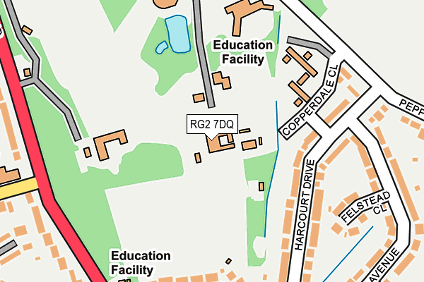
RG2 7DQ is located in the Church electoral ward, within the unitary authority of Reading and the English Parliamentary constituency of Reading East. The Sub Integrated Care Board (ICB) Location is NHS Buckinghamshire, Oxfordshire and Berkshire West ICB - 15A and the police force is Thames Valley. This postcode has been in use since January 1980.


GetTheData
Source: OS OpenMap – Local (Ordnance Survey)
Source: OS VectorMap District (Ordnance Survey)
Licence: Open Government Licence (requires attribution)
| Easting | 473441 |
| Northing | 171105 |
| Latitude | 51.434195 |
| Longitude | -0.944895 |
GetTheData
Source: Open Postcode Geo
Licence: Open Government Licence
| Country | England |
| Postcode District | RG2 |
| ➜ RG2 open data dashboard ➜ See where RG2 is on a map ➜ Where is Reading? | |
GetTheData
Source: Land Registry Price Paid Data
Licence: Open Government Licence
Elevation or altitude of RG2 7DQ as distance above sea level:
| Metres | Feet | |
|---|---|---|
| Elevation | 80m | 262ft |
Elevation is measured from the approximate centre of the postcode, to the nearest point on an OS contour line from OS Terrain 50, which has contour spacing of ten vertical metres.
➜ How high above sea level am I? Find the elevation of your current position using your device's GPS.
GetTheData
Source: Open Postcode Elevation
Licence: Open Government Licence
| Ward | Church |
| Constituency | Reading East |
GetTheData
Source: ONS Postcode Database
Licence: Open Government Licence
| January 2024 | Criminal damage and arson | On or near Wychwood Close | 493m |
| December 2023 | Violence and sexual offences | On or near Wychwood Close | 493m |
| July 2023 | Violence and sexual offences | On or near Devonshire Park | 295m |
| ➜ Get more crime data in our Crime section | |||
GetTheData
Source: data.police.uk
Licence: Open Government Licence
| Harcourt Drive (Pepper Lane) | Earley | 240m |
| Cressingham Road Church (Shinfield Road) | Whitley | 252m |
| Cressingham Road Church (Shinfield Road) | Whitley | 261m |
| Harcourt Drive (Pepper Lane) | Earley | 266m |
| Pepper Lane University (Pepper Lane) | University Of Reading | 274m |
| Earley Station | 2km |
| Reading Station | 3.3km |
| Winnersh Triangle Station | 3.7km |
GetTheData
Source: NaPTAN
Licence: Open Government Licence
GetTheData
Source: ONS Postcode Database
Licence: Open Government Licence


➜ Get more ratings from the Food Standards Agency
GetTheData
Source: Food Standards Agency
Licence: FSA terms & conditions
| Last Collection | |||
|---|---|---|---|
| Location | Mon-Fri | Sat | Distance |
| Wychwood Cresent | 17:30 | 14:30 | 365m |
| Whiteknights House | 16:45 | 14:00 | 761m |
| Elm Road | 17:30 | 14:30 | 1,012m |
GetTheData
Source: Dracos
Licence: Creative Commons Attribution-ShareAlike
| Facility | Distance |
|---|---|
| Leighton Park School Shinfield Road, Reading Sports Hall, Grass Pitches, Health and Fitness Gym, Swimming Pool, Artificial Grass Pitch | 470m |
| Whiteknights Primary School Fairlawn Green, Reading Grass Pitches | 591m |
| Whiteknights Indoor Bowls Club Beech Lane, Earley, Reading Indoor Bowls | 838m |
GetTheData
Source: Active Places
Licence: Open Government Licence
| School | Phase of Education | Distance |
|---|---|---|
| Leighton Park School Shinfield Road, Reading, RG2 7ED | Not applicable | 429m |
| Whiteknights Primary School Fairlawn Green, Shinfield Rise, Reading, RG2 8EP | Primary | 611m |
| University of Reading Whiteknights House, Whiteknights, Reading, RG6 6UR | Not applicable | 725m |
GetTheData
Source: Edubase
Licence: Open Government Licence
The below table lists the International Territorial Level (ITL) codes (formerly Nomenclature of Territorial Units for Statistics (NUTS) codes) and Local Administrative Units (LAU) codes for RG2 7DQ:
| ITL 1 Code | Name |
|---|---|
| TLJ | South East (England) |
| ITL 2 Code | Name |
| TLJ1 | Berkshire, Buckinghamshire and Oxfordshire |
| ITL 3 Code | Name |
| TLJ11 | Berkshire |
| LAU 1 Code | Name |
| E06000038 | Reading |
GetTheData
Source: ONS Postcode Directory
Licence: Open Government Licence
The below table lists the Census Output Area (OA), Lower Layer Super Output Area (LSOA), and Middle Layer Super Output Area (MSOA) for RG2 7DQ:
| Code | Name | |
|---|---|---|
| OA | E00082703 | |
| LSOA | E01016371 | Reading 016B |
| MSOA | E02003404 | Reading 016 |
GetTheData
Source: ONS Postcode Directory
Licence: Open Government Licence
| RG6 5TJ | Harcourt Drive | 153m |
| RG6 5SG | Copperdale Close | 163m |
| RG6 5TL | Harcourt Drive | 171m |
| RG6 5TP | Felstead Close | 200m |
| RG6 5TQ | Falstaff Avenue | 260m |
| RG2 7DT | Shinfield Road | 280m |
| RG6 5TG | Falstaff Avenue | 292m |
| RG2 7DX | Devonshire Park | 294m |
| RG6 5SH | Pepper Lane | 296m |
| RG2 7RS | Cressingham Road | 323m |
GetTheData
Source: Open Postcode Geo; Land Registry Price Paid Data
Licence: Open Government Licence