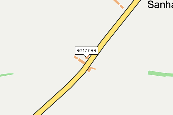
RG17 0RR is located in the Hungerford & Kintbury electoral ward, within the unitary authority of West Berkshire and the English Parliamentary constituency of Newbury. The Sub Integrated Care Board (ICB) Location is NHS Buckinghamshire, Oxfordshire and Berkshire West ICB - 15A and the police force is Thames Valley. This postcode has been in use since January 1980.


GetTheData
Source: OS OpenMap – Local (Ordnance Survey)
Source: OS VectorMap District (Ordnance Survey)
Licence: Open Government Licence (requires attribution)
| Easting | 433401 |
| Northing | 166394 |
| Latitude | 51.395605 |
| Longitude | -1.521303 |
GetTheData
Source: Open Postcode Geo
Licence: Open Government Licence
| Country | England |
| Postcode District | RG17 |
| ➜ RG17 open data dashboard ➜ See where RG17 is on a map ➜ Where is Sanham Green? | |
GetTheData
Source: Land Registry Price Paid Data
Licence: Open Government Licence
Elevation or altitude of RG17 0RR as distance above sea level:
| Metres | Feet | |
|---|---|---|
| Elevation | 130m | 427ft |
Elevation is measured from the approximate centre of the postcode, to the nearest point on an OS contour line from OS Terrain 50, which has contour spacing of ten vertical metres.
➜ How high above sea level am I? Find the elevation of your current position using your device's GPS.
GetTheData
Source: Open Postcode Elevation
Licence: Open Government Licence
| Ward | Hungerford & Kintbury |
| Constituency | Newbury |
GetTheData
Source: ONS Postcode Database
Licence: Open Government Licence
| John O'gaunt School (School Grounds) | Hungerford | 1,179m |
| John O'gaunt School (Priory Rd) | Hungerford | 1,186m |
| John O'gaunt School (Priory Rd) | Hungerford | 1,192m |
| Priory Avenue Foot (Priory Avenue) | Hungerford | 1,281m |
| Kennedy Meadow (A338 Salisbury Road) | Hungerford | 1,338m |
| Hungerford Station | 2.2km |
GetTheData
Source: NaPTAN
Licence: Open Government Licence
| Percentage of properties with Next Generation Access | 100.0% |
| Percentage of properties with Superfast Broadband | 100.0% |
| Percentage of properties with Ultrafast Broadband | 100.0% |
| Percentage of properties with Full Fibre Broadband | 100.0% |
Superfast Broadband is between 30Mbps and 300Mbps
Ultrafast Broadband is > 300Mbps
| Percentage of properties unable to receive 2Mbps | 0.0% |
| Percentage of properties unable to receive 5Mbps | 0.0% |
| Percentage of properties unable to receive 10Mbps | 0.0% |
| Percentage of properties unable to receive 30Mbps | 0.0% |
GetTheData
Source: Ofcom
Licence: Ofcom Terms of Use (requires attribution)
GetTheData
Source: ONS Postcode Database
Licence: Open Government Licence


➜ Get more ratings from the Food Standards Agency
GetTheData
Source: Food Standards Agency
Licence: FSA terms & conditions
| Last Collection | |||
|---|---|---|---|
| Location | Mon-Fri | Sat | Distance |
| Farifield Estate | 17:30 | 11:45 | 1,809m |
| Salisbury Road | 17:00 | 11:00 | 1,825m |
| Church Street | 17:30 | 11:00 | 2,117m |
GetTheData
Source: Dracos
Licence: Creative Commons Attribution-ShareAlike
| Facility | Distance |
|---|---|
| The Triangle Field Priory Road, Hungerford Grass Pitches | 1.1km |
| John O'gaunt School Priory Road, Hungerford Artificial Grass Pitch, Sports Hall, Grass Pitches, Outdoor Tennis Courts | 1.2km |
| Hungerford Leisure Centre Priory Road, Hungerford Sports Hall, Swimming Pool, Health and Fitness Gym, Studio, Outdoor Tennis Courts | 1.2km |
GetTheData
Source: Active Places
Licence: Open Government Licence
| School | Phase of Education | Distance |
|---|---|---|
| John O'Gaunt School Priory Road, Hungerford, RG17 0AN | Secondary | 1.2km |
| Hungerford Primary School Fairview Road, Hungerford, RG17 0BT | Primary | 1.8km |
| Hungerford Nursery School Centre for Children 22 The Croft, Hungerford, RG17 0HY | Nursery | 2.3km |
GetTheData
Source: Edubase
Licence: Open Government Licence
The below table lists the International Territorial Level (ITL) codes (formerly Nomenclature of Territorial Units for Statistics (NUTS) codes) and Local Administrative Units (LAU) codes for RG17 0RR:
| ITL 1 Code | Name |
|---|---|
| TLJ | South East (England) |
| ITL 2 Code | Name |
| TLJ1 | Berkshire, Buckinghamshire and Oxfordshire |
| ITL 3 Code | Name |
| TLJ11 | Berkshire |
| LAU 1 Code | Name |
| E06000037 | West Berkshire |
GetTheData
Source: ONS Postcode Directory
Licence: Open Government Licence
The below table lists the Census Output Area (OA), Lower Layer Super Output Area (LSOA), and Middle Layer Super Output Area (MSOA) for RG17 0RR:
| Code | Name | |
|---|---|---|
| OA | E00082328 | |
| LSOA | E01016298 | West Berkshire 010C |
| MSOA | E02003376 | West Berkshire 010 |
GetTheData
Source: ONS Postcode Directory
Licence: Open Government Licence
| RG17 0RS | Sanham Green | 395m |
| RG17 0RB | Standen Manor | 1053m |
| RG17 0BZ | Combe View | 1176m |
| RG17 0DG | Priory Road | 1218m |
| RG17 0RU | 1228m | |
| RG17 0AP | Priory Road | 1229m |
| RG17 0DQ | De Montfort Grove | 1237m |
| RG17 0LR | Kennedy Meadow | 1263m |
| RG17 0DE | Lancaster Close | 1292m |
| RG17 0DB | Chestnut Walk | 1313m |
GetTheData
Source: Open Postcode Geo; Land Registry Price Paid Data
Licence: Open Government Licence