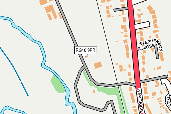
RG10 9PR is located in the Twyford electoral ward, within the unitary authority of Wokingham and the English Parliamentary constituency of Maidenhead. The Sub Integrated Care Board (ICB) Location is NHS Buckinghamshire, Oxfordshire and Berkshire West ICB - 15A and the police force is Thames Valley. This postcode has been in use since January 1980.


GetTheData
Source: OS OpenMap – Local (Ordnance Survey)
Source: OS VectorMap District (Ordnance Survey)
Licence: Open Government Licence (requires attribution)
| Easting | 478459 |
| Northing | 176445 |
| Latitude | 51.481530 |
| Longitude | -0.871520 |
GetTheData
Source: Open Postcode Geo
Licence: Open Government Licence
| Country | England |
| Postcode District | RG10 |
➜ See where RG10 is on a map ➜ Where is Twyford? | |
GetTheData
Source: Land Registry Price Paid Data
Licence: Open Government Licence
Elevation or altitude of RG10 9PR as distance above sea level:
| Metres | Feet | |
|---|---|---|
| Elevation | 40m | 131ft |
Elevation is measured from the approximate centre of the postcode, to the nearest point on an OS contour line from OS Terrain 50, which has contour spacing of ten vertical metres.
➜ How high above sea level am I? Find the elevation of your current position using your device's GPS.
GetTheData
Source: Open Postcode Elevation
Licence: Open Government Licence
| Ward | Twyford |
| Constituency | Maidenhead |
GetTheData
Source: ONS Postcode Database
Licence: Open Government Licence
| Waggon And Horses (Old Bath Road) | Twyford | 372m |
| Waggon And Horses (Old Bath Road) | Twyford | 386m |
| Old Silk Mill (High Street) | Twyford | 420m |
| Old Silk Mill (High Street) | Twyford | 423m |
| Wargrave Road | Twyford | 431m |
| Twyford Station | 0.9km |
| Wargrave Station | 1.9km |
| Shiplake Station | 3.4km |
GetTheData
Source: NaPTAN
Licence: Open Government Licence
| Percentage of properties with Next Generation Access | 100.0% |
| Percentage of properties with Superfast Broadband | 100.0% |
| Percentage of properties with Ultrafast Broadband | 0.0% |
| Percentage of properties with Full Fibre Broadband | 0.0% |
Superfast Broadband is between 30Mbps and 300Mbps
Ultrafast Broadband is > 300Mbps
| Percentage of properties unable to receive 2Mbps | 0.0% |
| Percentage of properties unable to receive 5Mbps | 0.0% |
| Percentage of properties unable to receive 10Mbps | 0.0% |
| Percentage of properties unable to receive 30Mbps | 0.0% |
GetTheData
Source: Ofcom
Licence: Ofcom Terms of Use (requires attribution)
GetTheData
Source: ONS Postcode Database
Licence: Open Government Licence


➜ Get more ratings from the Food Standards Agency
GetTheData
Source: Food Standards Agency
Licence: FSA terms & conditions
| Last Collection | |||
|---|---|---|---|
| Location | Mon-Fri | Sat | Distance |
| Twyford Post Office | 17:00 | 12:00 | 550m |
| Springfield Park | 18:30 | 11:30 | 621m |
| Longfield Road | 17:00 | 11:45 | 621m |
GetTheData
Source: Dracos
Licence: Creative Commons Attribution-ShareAlike
| Risk of RG10 9PR flooding from rivers and sea | Low |
| ➜ RG10 9PR flood map | |
GetTheData
Source: Open Flood Risk by Postcode
Licence: Open Government Licence
The below table lists the International Territorial Level (ITL) codes (formerly Nomenclature of Territorial Units for Statistics (NUTS) codes) and Local Administrative Units (LAU) codes for RG10 9PR:
| ITL 1 Code | Name |
|---|---|
| TLJ | South East (England) |
| ITL 2 Code | Name |
| TLJ1 | Berkshire, Buckinghamshire and Oxfordshire |
| ITL 3 Code | Name |
| TLJ11 | Berkshire |
| LAU 1 Code | Name |
| E06000041 | Wokingham |
GetTheData
Source: ONS Postcode Directory
Licence: Open Government Licence
The below table lists the Census Output Area (OA), Lower Layer Super Output Area (LSOA), and Middle Layer Super Output Area (MSOA) for RG10 9PR:
| Code | Name | |
|---|---|---|
| OA | E00084257 | |
| LSOA | E01016694 | Wokingham 002E |
| MSOA | E02003440 | Wokingham 002 |
GetTheData
Source: ONS Postcode Directory
Licence: Open Government Licence
| RG10 9PD | Wargrave Road | 151m |
| RG10 9PH | Wargrave Road | 200m |
| RG10 9NB | Llewellyn Park | 250m |
| RG10 9FG | Stephenson Close | 264m |
| RG10 9PQ | Wargrave Road | 271m |
| RG10 9PU | Kings Gardens | 272m |
| RG10 9PB | Wargrave Road | 286m |
| RG10 9RU | New Bath Road | 296m |
| RG10 9JE | Greenfinch Drive | 304m |
| RG10 9PE | Wargrave Road | 342m |
GetTheData
Source: Open Postcode Geo; Land Registry Price Paid Data
Licence: Open Government Licence