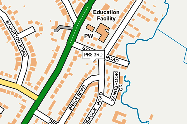
PR8 3RD is located in the Ainsdale electoral ward, within the metropolitan district of Sefton and the English Parliamentary constituency of Southport. The Sub Integrated Care Board (ICB) Location is NHS Cheshire and Merseyside ICB - 01V and the police force is Merseyside. This postcode has been in use since January 1980.


GetTheData
Source: OS OpenMap – Local (Ordnance Survey)
Source: OS VectorMap District (Ordnance Survey)
Licence: Open Government Licence (requires attribution)
| Easting | 331686 |
| Northing | 411768 |
| Latitude | 53.598009 |
| Longitude | -3.033713 |
GetTheData
Source: Open Postcode Geo
Licence: Open Government Licence
| Country | England |
| Postcode District | PR8 |
| ➜ PR8 open data dashboard ➜ See where PR8 is on a map ➜ Where is Southport? | |
GetTheData
Source: Land Registry Price Paid Data
Licence: Open Government Licence
Elevation or altitude of PR8 3RD as distance above sea level:
| Metres | Feet | |
|---|---|---|
| Elevation | 10m | 33ft |
Elevation is measured from the approximate centre of the postcode, to the nearest point on an OS contour line from OS Terrain 50, which has contour spacing of ten vertical metres.
➜ How high above sea level am I? Find the elevation of your current position using your device's GPS.
GetTheData
Source: Open Postcode Elevation
Licence: Open Government Licence
| Ward | Ainsdale |
| Constituency | Southport |
GetTheData
Source: ONS Postcode Database
Licence: Open Government Licence
| January 2024 | Criminal damage and arson | On or near Staveley Road | 32m |
| September 2023 | Violence and sexual offences | On or near Staveley Road | 32m |
| August 2023 | Violence and sexual offences | On or near Staveley Road | 32m |
| ➜ Get more crime data in our Crime section | |||
GetTheData
Source: data.police.uk
Licence: Open Government Licence
| Staveley Road (Liverpool Road) | Ainsdale | 91m |
| Kenilworth Road (Liverpool Road) | Ainsdale | 159m |
| Leamington Road (Liverpool Road) | Ainsdale | 189m |
| Liverpool Road (Kenilworth Road) | Ainsdale | 234m |
| Liverpool Road (Orchard Lane) | Ainsdale | 236m |
| Ainsdale Station | 0.7km |
| Hillside Station | 2.7km |
| Birkdale Station | 4.2km |
GetTheData
Source: NaPTAN
Licence: Open Government Licence
| Percentage of properties with Next Generation Access | 100.0% |
| Percentage of properties with Superfast Broadband | 100.0% |
| Percentage of properties with Ultrafast Broadband | 0.0% |
| Percentage of properties with Full Fibre Broadband | 0.0% |
Superfast Broadband is between 30Mbps and 300Mbps
Ultrafast Broadband is > 300Mbps
| Percentage of properties unable to receive 2Mbps | 0.0% |
| Percentage of properties unable to receive 5Mbps | 0.0% |
| Percentage of properties unable to receive 10Mbps | 0.0% |
| Percentage of properties unable to receive 30Mbps | 0.0% |
GetTheData
Source: Ofcom
Licence: Ofcom Terms of Use (requires attribution)
GetTheData
Source: ONS Postcode Database
Licence: Open Government Licence


➜ Get more ratings from the Food Standards Agency
GetTheData
Source: Food Standards Agency
Licence: FSA terms & conditions
| Last Collection | |||
|---|---|---|---|
| Location | Mon-Fri | Sat | Distance |
| Orchard Lane | 16:15 | 11:00 | 252m |
| Trevor Road | 16:15 | 11:00 | 376m |
| 6 Liverpool Avenue, Ainsdale | 17:45 | 11:30 | 520m |
GetTheData
Source: Dracos
Licence: Creative Commons Attribution-ShareAlike
| Facility | Distance |
|---|---|
| Sandbrook Road Recreation Ground Sandbrook Road, Southport Grass Pitches | 366m |
| The Ainsdale Sports Club Liverpool Road, Ainsdale Grass Pitches, Outdoor Tennis Courts | 513m |
| Ainsdale 3g Liverpool Road, Southport Artificial Grass Pitch | 533m |
GetTheData
Source: Active Places
Licence: Open Government Licence
| School | Phase of Education | Distance |
|---|---|---|
| Ainsdale St John's Church of England Primary School Sandbrook Road, Ainsdale, Southport, PR8 3JE | Primary | 207m |
| Kings Meadow Primary School and Early Years Education Centre Meadow Lane, Ainsdale, Southport, PR8 3RS | Primary | 737m |
| Merefield School Westminster Drive, Southport, PR8 2QZ | Not applicable | 985m |
GetTheData
Source: Edubase
Licence: Open Government Licence
The below table lists the International Territorial Level (ITL) codes (formerly Nomenclature of Territorial Units for Statistics (NUTS) codes) and Local Administrative Units (LAU) codes for PR8 3RD:
| ITL 1 Code | Name |
|---|---|
| TLD | North West (England) |
| ITL 2 Code | Name |
| TLD7 | Merseyside |
| ITL 3 Code | Name |
| TLD73 | Sefton |
| LAU 1 Code | Name |
| E08000014 | Sefton |
GetTheData
Source: ONS Postcode Directory
Licence: Open Government Licence
The below table lists the Census Output Area (OA), Lower Layer Super Output Area (LSOA), and Middle Layer Super Output Area (MSOA) for PR8 3RD:
| Code | Name | |
|---|---|---|
| OA | E00035098 | |
| LSOA | E01006920 | Sefton 011A |
| MSOA | E02001439 | Sefton 011 |
GetTheData
Source: ONS Postcode Directory
Licence: Open Government Licence
| PR8 3NN | Staveley Road | 50m |
| PR8 3RB | Briar Road | 121m |
| PR8 3QE | Liverpool Road | 134m |
| PR8 3NR | Liverpool Road | 149m |
| PR8 3RE | Sandbrook Road | 149m |
| PR8 3NG | Liverpool Road | 153m |
| PR8 3PB | St Johns Court | 168m |
| PR8 3NQ | Liverpool Road | 204m |
| PR8 3JE | Sandbrook Road | 207m |
| PR8 3JY | Leamington Road | 208m |
GetTheData
Source: Open Postcode Geo; Land Registry Price Paid Data
Licence: Open Government Licence