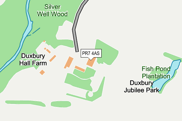
PR7 4AS is located in the Chorley South East & Heath Charnock electoral ward, within the local authority district of Chorley and the English Parliamentary constituency of Chorley. The Sub Integrated Care Board (ICB) Location is NHS Lancashire and South Cumbria ICB - 00X and the police force is Lancashire. This postcode has been in use since January 1980.


GetTheData
Source: OS OpenMap – Local (Ordnance Survey)
Source: OS VectorMap District (Ordnance Survey)
Licence: Open Government Licence (requires attribution)
| Easting | 358781 |
| Northing | 415130 |
| Latitude | 53.631079 |
| Longitude | -2.624781 |
GetTheData
Source: Open Postcode Geo
Licence: Open Government Licence
| Country | England |
| Postcode District | PR7 |
| ➜ PR7 open data dashboard ➜ See where PR7 is on a map | |
GetTheData
Source: Land Registry Price Paid Data
Licence: Open Government Licence
Elevation or altitude of PR7 4AS as distance above sea level:
| Metres | Feet | |
|---|---|---|
| Elevation | 80m | 262ft |
Elevation is measured from the approximate centre of the postcode, to the nearest point on an OS contour line from OS Terrain 50, which has contour spacing of ten vertical metres.
➜ How high above sea level am I? Find the elevation of your current position using your device's GPS.
GetTheData
Source: Open Postcode Elevation
Licence: Open Government Licence
| Ward | Chorley South East & Heath Charnock |
| Constituency | Chorley |
GetTheData
Source: ONS Postcode Database
Licence: Open Government Licence
| October 2021 | Criminal damage and arson | On or near Duxbury Hall Road | 487m |
| October 2021 | Burglary | On or near Duxbury Hall Road | 487m |
| September 2021 | Criminal damage and arson | On or near Duxbury Hall Road | 487m |
| ➜ Get more crime data in our Crime section | |||
GetTheData
Source: data.police.uk
Licence: Open Government Licence
| Wigan Lane (Bolton Road) | Bolton Road | 785m |
| Burgh Lane End (Myles Standish Way) | Lower Burgh | 799m |
| Burgh Lane End (Myles Standish Way) | Lower Burgh | 804m |
| Holy Cross School (The Bowers) | Weldbank | 806m |
| Marley Court (Bolton Road) | Bolton Road | 829m |
| Chorley Station | 2.4km |
| Adlington (Lancs) Station | 2.4km |
| Euxton Balshaw Lane Station | 4.5km |
GetTheData
Source: NaPTAN
Licence: Open Government Licence
| Percentage of properties with Next Generation Access | 100.0% |
| Percentage of properties with Superfast Broadband | 100.0% |
| Percentage of properties with Ultrafast Broadband | 0.0% |
| Percentage of properties with Full Fibre Broadband | 0.0% |
Superfast Broadband is between 30Mbps and 300Mbps
Ultrafast Broadband is > 300Mbps
| Percentage of properties unable to receive 2Mbps | 0.0% |
| Percentage of properties unable to receive 5Mbps | 0.0% |
| Percentage of properties unable to receive 10Mbps | 0.0% |
| Percentage of properties unable to receive 30Mbps | 0.0% |
GetTheData
Source: Ofcom
Licence: Ofcom Terms of Use (requires attribution)
GetTheData
Source: ONS Postcode Database
Licence: Open Government Licence


➜ Get more ratings from the Food Standards Agency
GetTheData
Source: Food Standards Agency
Licence: FSA terms & conditions
| Last Collection | |||
|---|---|---|---|
| Location | Mon-Fri | Sat | Distance |
| Weldbank Lane | 16:45 | 11:30 | 785m |
| Bolton Road, Duxbury | 17:15 | 11:00 | 788m |
| Farnworth House | 17:15 | 09:30 | 860m |
GetTheData
Source: Dracos
Licence: Creative Commons Attribution-ShareAlike
| Facility | Distance |
|---|---|
| Duxbury Park Golf Course Duxbury Hall Road, Chorley Golf | 157m |
| Wigan Lane Wigan Lane, Chorley Grass Pitches | 614m |
| Holy Cross Catholic High School Myles Standish Way, Chorley Artificial Grass Pitch, Health and Fitness Gym, Grass Pitches, Sports Hall | 770m |
GetTheData
Source: Active Places
Licence: Open Government Licence
| School | Phase of Education | Distance |
|---|---|---|
| Holy Cross Catholic High School Myles Standish Way, Chorley, PR7 3LS | Secondary | 819m |
| St George's Church of England Primary School, Chorley Carr Lane, Chorley, PR7 3JU | Primary | 1.2km |
| St Gregory's Catholic Primary School, Chorley Eaves Green Road, Chorley, PR7 3QG | Primary | 1.3km |
GetTheData
Source: Edubase
Licence: Open Government Licence
The below table lists the International Territorial Level (ITL) codes (formerly Nomenclature of Territorial Units for Statistics (NUTS) codes) and Local Administrative Units (LAU) codes for PR7 4AS:
| ITL 1 Code | Name |
|---|---|
| TLD | North West (England) |
| ITL 2 Code | Name |
| TLD4 | Lancashire |
| ITL 3 Code | Name |
| TLD47 | Chorley and West Lancashire |
| LAU 1 Code | Name |
| E07000118 | Chorley |
GetTheData
Source: ONS Postcode Directory
Licence: Open Government Licence
The below table lists the Census Output Area (OA), Lower Layer Super Output Area (LSOA), and Middle Layer Super Output Area (MSOA) for PR7 4AS:
| Code | Name | |
|---|---|---|
| OA | E00126594 | |
| LSOA | E01024939 | Chorley 010C |
| MSOA | E02005198 | Chorley 010 |
GetTheData
Source: ONS Postcode Directory
Licence: Open Government Licence
| PR7 4AT | Duxbury Hall Road | 458m |
| PR7 3PU | Burgh Lane | 568m |
| PR7 4AQ | Winchester Avenue | 608m |
| PR7 4DJ | Rawlinson Lane | 650m |
| PR7 4AG | Chester Avenue | 652m |
| PR7 4DD | Wigan Lane | 663m |
| PR7 3TB | Fir Tree Close | 683m |
| PR7 3QH | Woodlands Meadow | 689m |
| PR7 4BY | Wigan Lane | 702m |
| PR7 4AP | Worcester Place | 717m |
GetTheData
Source: Open Postcode Geo; Land Registry Price Paid Data
Licence: Open Government Licence