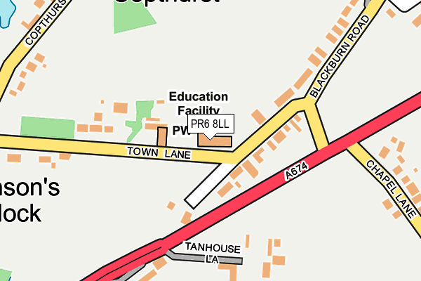
PR6 8LL is located in the Chorley North East electoral ward, within the local authority district of Chorley and the English Parliamentary constituency of Chorley. The Sub Integrated Care Board (ICB) Location is NHS Lancashire and South Cumbria ICB - 00X and the police force is Lancashire. This postcode has been in use since January 1980.


GetTheData
Source: OS OpenMap – Local (Ordnance Survey)
Source: OS VectorMap District (Ordnance Survey)
Licence: Open Government Licence (requires attribution)
| Easting | 359693 |
| Northing | 420813 |
| Latitude | 53.682227 |
| Longitude | -2.611729 |
GetTheData
Source: Open Postcode Geo
Licence: Open Government Licence
| Country | England |
| Postcode District | PR6 |
| ➜ PR6 open data dashboard ➜ See where PR6 is on a map ➜ Where is Wheelton? | |
GetTheData
Source: Land Registry Price Paid Data
Licence: Open Government Licence
Elevation or altitude of PR6 8LL as distance above sea level:
| Metres | Feet | |
|---|---|---|
| Elevation | 120m | 394ft |
Elevation is measured from the approximate centre of the postcode, to the nearest point on an OS contour line from OS Terrain 50, which has contour spacing of ten vertical metres.
➜ How high above sea level am I? Find the elevation of your current position using your device's GPS.
GetTheData
Source: Open Postcode Elevation
Licence: Open Government Licence
| Ward | Chorley North East |
| Constituency | Chorley |
GetTheData
Source: ONS Postcode Database
Licence: Open Government Licence
| May 2022 | Anti-social behaviour | On or near Ryecroft | 405m |
| May 2022 | Violence and sexual offences | On or near Hall'S Square | 491m |
| March 2022 | Drugs | On or near Copthurst Lane | 297m |
| ➜ Get more crime data in our Crime section | |||
GetTheData
Source: data.police.uk
Licence: Open Government Licence
| St Chads Rcps (Town Lane) | South Hill | 24m |
| Town Lane (Blackburn Road) | South Hill | 179m |
| Town Lane (Blackburn Road) | South Hill | 200m |
| Red Lion Hotel (Blackburn Road) | Lower Wheelton | 445m |
| Blackburn Road | South Hill | 453m |
| Buckshaw Parkway Station | 3.4km |
| Chorley Station | 3.4km |
| Euxton Balshaw Lane Station | 4.7km |
GetTheData
Source: NaPTAN
Licence: Open Government Licence
GetTheData
Source: ONS Postcode Database
Licence: Open Government Licence


➜ Get more ratings from the Food Standards Agency
GetTheData
Source: Food Standards Agency
Licence: FSA terms & conditions
| Last Collection | |||
|---|---|---|---|
| Location | Mon-Fri | Sat | Distance |
| Swansey | 17:15 | 10:45 | 1,650m |
| Gillibrand Street | 17:15 | 11:45 | 2,388m |
| Erskine Road | 17:00 | 11:30 | 2,429m |
GetTheData
Source: Dracos
Licence: Creative Commons Attribution-ShareAlike
| Facility | Distance |
|---|---|
| David Lloyd (Chorley) Moss Lane, Whittle-le-woods, Chorley Sports Hall, Swimming Pool, Health and Fitness Gym, Indoor Tennis Centre, Studio, Squash Courts, Outdoor Tennis Courts, Artificial Grass Pitch | 803m |
| Church Of Jesus Christ Latter-day Saints Football Pitch (Closed) Temple Way, Chorley Grass Pitches | 1.7km |
| Highfield Golf Course Buckholes Lane, Wheelton Golf | 2km |
GetTheData
Source: Active Places
Licence: Open Government Licence
| School | Phase of Education | Distance |
|---|---|---|
| St Chad's Catholic Primary School South Hill, Blackburn Road, Chorley, PR6 8LL | Primary | 10m |
| Waterloo Lodge 173 Preston Road, Whittle-Le-Woods, Chorley, PR6 7AX | Not applicable | 1.8km |
| Whittle-le-Woods Church of England Primary School Preston Road, Whittle-le-Woods, Whittle-le-Woods Ce Primary School, CHORLEY, PR6 7PS | Primary | 2km |
GetTheData
Source: Edubase
Licence: Open Government Licence
The below table lists the International Territorial Level (ITL) codes (formerly Nomenclature of Territorial Units for Statistics (NUTS) codes) and Local Administrative Units (LAU) codes for PR6 8LL:
| ITL 1 Code | Name |
|---|---|
| TLD | North West (England) |
| ITL 2 Code | Name |
| TLD4 | Lancashire |
| ITL 3 Code | Name |
| TLD47 | Chorley and West Lancashire |
| LAU 1 Code | Name |
| E07000118 | Chorley |
GetTheData
Source: ONS Postcode Directory
Licence: Open Government Licence
The below table lists the Census Output Area (OA), Lower Layer Super Output Area (LSOA), and Middle Layer Super Output Area (MSOA) for PR6 8LL:
| Code | Name | |
|---|---|---|
| OA | E00126774 | |
| LSOA | E01024977 | Chorley 004D |
| MSOA | E02005192 | Chorley 004 |
GetTheData
Source: ONS Postcode Directory
Licence: Open Government Licence
| PR6 8LN | Blackburn Road | 61m |
| PR6 8EL | Blackburn Road | 107m |
| PR6 8FD | Tanhouse Lane | 177m |
| PR6 8AJ | Town Lane | 183m |
| PR6 8EJ | Blackburn Road | 197m |
| PR6 8LQ | Tanhouse Lane | 198m |
| PR6 8LG | Blackburn Road | 243m |
| PR6 8LR | Copthurst Lane | 302m |
| PR6 8LP | Greenfield Terrace | 374m |
| PR6 8EN | Chapel Lane | 379m |
GetTheData
Source: Open Postcode Geo; Land Registry Price Paid Data
Licence: Open Government Licence