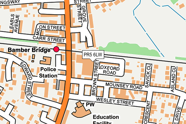
PR5 6LW is located in the Bamber Bridge East electoral ward, within the local authority district of South Ribble and the English Parliamentary constituency of Ribble Valley. The Sub Integrated Care Board (ICB) Location is NHS Lancashire and South Cumbria ICB - 00X and the police force is Lancashire. This postcode has been in use since July 1990.


GetTheData
Source: OS OpenMap – Local (Ordnance Survey)
Source: OS VectorMap District (Ordnance Survey)
Licence: Open Government Licence (requires attribution)
| Easting | 356599 |
| Northing | 425769 |
| Latitude | 53.726505 |
| Longitude | -2.659269 |
GetTheData
Source: Open Postcode Geo
Licence: Open Government Licence
| Country | England |
| Postcode District | PR5 |
| ➜ PR5 open data dashboard ➜ See where PR5 is on a map ➜ Where is Bamber Bridge? | |
GetTheData
Source: Land Registry Price Paid Data
Licence: Open Government Licence
Elevation or altitude of PR5 6LW as distance above sea level:
| Metres | Feet | |
|---|---|---|
| Elevation | 40m | 131ft |
Elevation is measured from the approximate centre of the postcode, to the nearest point on an OS contour line from OS Terrain 50, which has contour spacing of ten vertical metres.
➜ How high above sea level am I? Find the elevation of your current position using your device's GPS.
GetTheData
Source: Open Postcode Elevation
Licence: Open Government Licence
| Ward | Bamber Bridge East |
| Constituency | Ribble Valley |
GetTheData
Source: ONS Postcode Database
Licence: Open Government Licence
| December 2023 | Violence and sexual offences | On or near Cam Close | 406m |
| December 2023 | Violence and sexual offences | On or near Park/Open Space | 434m |
| December 2023 | Vehicle crime | On or near Park/Open Space | 434m |
| ➜ Get more crime data in our Crime section | |||
GetTheData
Source: data.police.uk
Licence: Open Government Licence
| Wesley Street | Bamber Bridge | 119m |
| Railway Station (Station Road) | Bamber Bridge | 151m |
| Edwards Street (Station Road) | Bamber Bridge | 161m |
| Methodist Church (Station Road) | Bamber Bridge | 185m |
| Smith Street | Bamber Bridge | 206m |
| Bamber Bridge Station | 0.1km |
| Lostock Hall Station | 1.9km |
| Leyland Station | 3.6km |
GetTheData
Source: NaPTAN
Licence: Open Government Licence
GetTheData
Source: ONS Postcode Database
Licence: Open Government Licence


➜ Get more ratings from the Food Standards Agency
GetTheData
Source: Food Standards Agency
Licence: FSA terms & conditions
| Last Collection | |||
|---|---|---|---|
| Location | Mon-Fri | Sat | Distance |
| Bamber Bridge Post Office | 17:30 | 12:00 | 142m |
| Bamber Bridge Post Office | 17:30 | 12:00 | 146m |
| Withy Trees | 16:15 | 09:00 | 527m |
GetTheData
Source: Dracos
Licence: Creative Commons Attribution-ShareAlike
| Facility | Distance |
|---|---|
| The Holme Playing Field Havelock Road, Bamber Bridge, Preston Grass Pitches | 555m |
| Withy Grove Park Brindle Road, Bamber Bridge Grass Pitches | 560m |
| St Mary's And St Benedict's Rc Primary School Brownedge Lane, Bamber Bridge, Preston Grass Pitches | 585m |
GetTheData
Source: Active Places
Licence: Open Government Licence
| School | Phase of Education | Distance |
|---|---|---|
| Cuerden Church School, Bamber Bridge Station Road, Bamber Bridge, Preston, PR5 6ED | Primary | 177m |
| Bridgeway School Church Road, Bamber Bridge, Preston, Lancashire, PR5 6EP | Not applicable | 530m |
| St Mary's and St Benedict's Roman Catholic Primary School Brownedge Lane, Bamber Bridge, Preston, PR5 6TA | Primary | 608m |
GetTheData
Source: Edubase
Licence: Open Government Licence
The below table lists the International Territorial Level (ITL) codes (formerly Nomenclature of Territorial Units for Statistics (NUTS) codes) and Local Administrative Units (LAU) codes for PR5 6LW:
| ITL 1 Code | Name |
|---|---|
| TLD | North West (England) |
| ITL 2 Code | Name |
| TLD4 | Lancashire |
| ITL 3 Code | Name |
| TLD45 | Mid Lancashire |
| LAU 1 Code | Name |
| E07000126 | South Ribble |
GetTheData
Source: ONS Postcode Directory
Licence: Open Government Licence
The below table lists the Census Output Area (OA), Lower Layer Super Output Area (LSOA), and Middle Layer Super Output Area (MSOA) for PR5 6LW:
| Code | Name | |
|---|---|---|
| OA | E00128911 | |
| LSOA | E01025401 | South Ribble 008C |
| MSOA | E02005294 | South Ribble 008 |
GetTheData
Source: ONS Postcode Directory
Licence: Open Government Licence
| PR5 6LR | Cambridge Road | 59m |
| PR5 6LE | Station Road | 63m |
| PR5 6LQ | Oxford Road | 72m |
| PR5 6LP | Princess Street | 73m |
| PR5 6LS | Mounsey Road | 73m |
| PR5 6EA | Station Road | 98m |
| PR5 6LT | Mounsey Road | 99m |
| PR5 6WN | Jackson Street | 102m |
| PR5 6NQ | Brown Street | 104m |
| PR5 6WP | Montgomery Street | 111m |
GetTheData
Source: Open Postcode Geo; Land Registry Price Paid Data
Licence: Open Government Licence