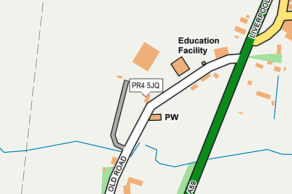
PR4 5JQ is located in the Hoole electoral ward, within the local authority district of South Ribble and the English Parliamentary constituency of South Ribble. The Sub Integrated Care Board (ICB) Location is NHS Lancashire and South Cumbria ICB - 01E and the police force is Lancashire. This postcode has been in use since January 1980.


GetTheData
Source: OS OpenMap – Local (Ordnance Survey)
Source: OS VectorMap District (Ordnance Survey)
Licence: Open Government Licence (requires attribution)
| Easting | 346280 |
| Northing | 422358 |
| Latitude | 53.694887 |
| Longitude | -2.815056 |
GetTheData
Source: Open Postcode Geo
Licence: Open Government Licence
| Country | England |
| Postcode District | PR4 |
| ➜ PR4 open data dashboard ➜ See where PR4 is on a map ➜ Where is Much Hoole? | |
GetTheData
Source: Land Registry Price Paid Data
Licence: Open Government Licence
Elevation or altitude of PR4 5JQ as distance above sea level:
| Metres | Feet | |
|---|---|---|
| Elevation | 10m | 33ft |
Elevation is measured from the approximate centre of the postcode, to the nearest point on an OS contour line from OS Terrain 50, which has contour spacing of ten vertical metres.
➜ How high above sea level am I? Find the elevation of your current position using your device's GPS.
GetTheData
Source: Open Postcode Elevation
Licence: Open Government Licence
| Ward | Hoole |
| Constituency | South Ribble |
GetTheData
Source: ONS Postcode Database
Licence: Open Government Licence
| Bangla Fusion (Liverpool Old Road) | Much Hoole | 168m |
| San Marcos (Liverpool Old Road) | Much Hoole | 285m |
| Liverpool Old Road | Much Hoole | 764m |
| Liverpool Old Road | Much Hoole | 773m |
| Carr House Cottages (Carr House Lane) | Bretherton | 993m |
| Croston Station | 3.9km |
GetTheData
Source: NaPTAN
Licence: Open Government Licence
➜ Broadband speed and availability dashboard for PR4 5JQ
| Percentage of properties with Next Generation Access | 100.0% |
| Percentage of properties with Superfast Broadband | 0.0% |
| Percentage of properties with Ultrafast Broadband | 0.0% |
| Percentage of properties with Full Fibre Broadband | 0.0% |
Superfast Broadband is between 30Mbps and 300Mbps
Ultrafast Broadband is > 300Mbps
| Median download speed | 16.6Mbps |
| Average download speed | 17.6Mbps |
| Maximum download speed | 27.86Mbps |
| Median upload speed | 1.2Mbps |
| Average upload speed | 1.5Mbps |
| Maximum upload speed | 3.18Mbps |
| Percentage of properties unable to receive 2Mbps | 0.0% |
| Percentage of properties unable to receive 5Mbps | 0.0% |
| Percentage of properties unable to receive 10Mbps | 0.0% |
| Percentage of properties unable to receive 30Mbps | 100.0% |
➜ Broadband speed and availability dashboard for PR4 5JQ
GetTheData
Source: Ofcom
Licence: Ofcom Terms of Use (requires attribution)
GetTheData
Source: ONS Postcode Database
Licence: Open Government Licence


➜ Get more ratings from the Food Standards Agency
GetTheData
Source: Food Standards Agency
Licence: FSA terms & conditions
| Last Collection | |||
|---|---|---|---|
| Location | Mon-Fri | Sat | Distance |
| Hesketh Lane Post Office | 17:30 | 12:00 | 1,544m |
| Lock House | 16:00 | 10:30 | 1,581m |
| Walmer Bridge Post Office | 16:45 | 11:00 | 2,357m |
GetTheData
Source: Dracos
Licence: Creative Commons Attribution-ShareAlike
| Facility | Distance |
|---|---|
| Hoole St Michael Church Of England School Liverpool Old Road, Much Hoole, Preston Grass Pitches, Sports Hall | 85m |
| Much Hoole Playing Field Liverpool Old Road, Much Hoole Grass Pitches | 920m |
| Hoole Village Memorial Hall Liverpool Old Road, Much Hoole, Preston Outdoor Tennis Courts | 1.4km |
GetTheData
Source: Active Places
Licence: Open Government Licence
| School | Phase of Education | Distance |
|---|---|---|
| Hoole St Michael CofE Primary School Liverpool Old Road, Much Hoole, Preston, PR4 5JQ | Primary | 1m |
| Tarleton Community Primary School Hesketh Lane, Tarleton, Preston, PR4 6AT | Primary | 1.5km |
| Tarleton Academy Hesketh Lane, Tarleton, Preston, PR4 6AQ | Secondary | 1.5km |
GetTheData
Source: Edubase
Licence: Open Government Licence
The below table lists the International Territorial Level (ITL) codes (formerly Nomenclature of Territorial Units for Statistics (NUTS) codes) and Local Administrative Units (LAU) codes for PR4 5JQ:
| ITL 1 Code | Name |
|---|---|
| TLD | North West (England) |
| ITL 2 Code | Name |
| TLD4 | Lancashire |
| ITL 3 Code | Name |
| TLD45 | Mid Lancashire |
| LAU 1 Code | Name |
| E07000126 | South Ribble |
GetTheData
Source: ONS Postcode Directory
Licence: Open Government Licence
The below table lists the Census Output Area (OA), Lower Layer Super Output Area (LSOA), and Middle Layer Super Output Area (MSOA) for PR4 5JQ:
| Code | Name | |
|---|---|---|
| OA | E00129101 | |
| LSOA | E01025436 | South Ribble 011A |
| MSOA | E02005297 | South Ribble 011 |
GetTheData
Source: ONS Postcode Directory
Licence: Open Government Licence
| PR4 4RL | Liverpool New Road | 259m |
| PR4 5JU | Liverpool Old Road | 454m |
| PR4 4RF | Brooklawns | 493m |
| PR4 4RJ | Liverpool Old Road | 550m |
| PR4 4GJ | Town Lane | 681m |
| PR4 4GB | Liverpool Old Road | 874m |
| PR4 4GL | Northern Avenue | 874m |
| PR26 9AR | Carr House Lane | 923m |
| PR4 4QJ | Smithy Lane | 950m |
| PR4 4QB | Liverpool Old Road | 971m |
GetTheData
Source: Open Postcode Geo; Land Registry Price Paid Data
Licence: Open Government Licence