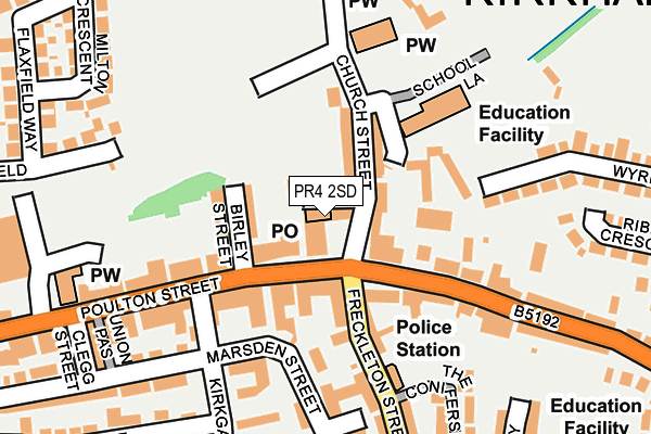
PR4 2SD is located in the Kirkham electoral ward, within the local authority district of Fylde and the English Parliamentary constituency of Fylde. The Sub Integrated Care Board (ICB) Location is NHS Lancashire and South Cumbria ICB - 02M and the police force is Lancashire. This postcode has been in use since January 1980.


GetTheData
Source: OS OpenMap – Local (Ordnance Survey)
Source: OS VectorMap District (Ordnance Survey)
Licence: Open Government Licence (requires attribution)
| Easting | 342663 |
| Northing | 432192 |
| Latitude | 53.782895 |
| Longitude | -2.871652 |
GetTheData
Source: Open Postcode Geo
Licence: Open Government Licence
| Country | England |
| Postcode District | PR4 |
| ➜ PR4 open data dashboard ➜ See where PR4 is on a map ➜ Where is Kirkham? | |
GetTheData
Source: Land Registry Price Paid Data
Licence: Open Government Licence
Elevation or altitude of PR4 2SD as distance above sea level:
| Metres | Feet | |
|---|---|---|
| Elevation | 20m | 66ft |
Elevation is measured from the approximate centre of the postcode, to the nearest point on an OS contour line from OS Terrain 50, which has contour spacing of ten vertical metres.
➜ How high above sea level am I? Find the elevation of your current position using your device's GPS.
GetTheData
Source: Open Postcode Elevation
Licence: Open Government Licence
| Ward | Kirkham |
| Constituency | Fylde |
GetTheData
Source: ONS Postcode Database
Licence: Open Government Licence
| January 2024 | Violence and sexual offences | On or near Parking Area | 346m |
| January 2024 | Other crime | On or near Parking Area | 346m |
| January 2024 | Vehicle crime | On or near Parking Area | 346m |
| ➜ Get more crime data in our Crime section | |||
GetTheData
Source: data.police.uk
Licence: Open Government Licence
| Market Square (Poulton Street) | Kirkham | 41m |
| Market Square (Poulton Street) | Kirkham | 63m |
| Morrisons (Poulton Street) | Kirkham | 240m |
| Swan Hotel (Poulton Street) | Kirkham | 289m |
| Royal Avenue (Freckleton Street) | Kirkham | 382m |
| Kirkham & Wesham Station | 0.9km |
| Salwick Station | 3.6km |
| Moss Side Station | 5.1km |
GetTheData
Source: NaPTAN
Licence: Open Government Licence
GetTheData
Source: ONS Postcode Database
Licence: Open Government Licence


➜ Get more ratings from the Food Standards Agency
GetTheData
Source: Food Standards Agency
Licence: FSA terms & conditions
| Last Collection | |||
|---|---|---|---|
| Location | Mon-Fri | Sat | Distance |
| Kirkham Post Office | 18:15 | 11:30 | 5m |
| Kirkgate, Kirkham | 17:30 | 10:00 | 265m |
| Town End | 17:30 | 09:45 | 336m |
GetTheData
Source: Dracos
Licence: Creative Commons Attribution-ShareAlike
| Facility | Distance |
|---|---|
| Kirkham Community Centre Mill Street, Kirkham, Preston Sports Hall | 96m |
| Kirkham St Michaels C Of E Primary School School Lane, Kirkham, Preston Grass Pitches | 146m |
| Maryfields Barnfield, Kirkham Grass Pitches | 201m |
GetTheData
Source: Active Places
Licence: Open Government Licence
| School | Phase of Education | Distance |
|---|---|---|
| Kirkham St Michael's Church of England Primary School School Lane, Kirkham, Preston, PR4 2SL | Primary | 146m |
| Kirkham Pear Tree School 29 Station Road, Kirkham, Preston, PR4 2HA | Not applicable | 399m |
| Carr Hill High School Royal Avenue, Kirkham, Preston, PR4 2ST | Secondary | 467m |
GetTheData
Source: Edubase
Licence: Open Government Licence
The below table lists the International Territorial Level (ITL) codes (formerly Nomenclature of Territorial Units for Statistics (NUTS) codes) and Local Administrative Units (LAU) codes for PR4 2SD:
| ITL 1 Code | Name |
|---|---|
| TLD | North West (England) |
| ITL 2 Code | Name |
| TLD4 | Lancashire |
| ITL 3 Code | Name |
| TLD45 | Mid Lancashire |
| LAU 1 Code | Name |
| E07000119 | Fylde |
GetTheData
Source: ONS Postcode Directory
Licence: Open Government Licence
The below table lists the Census Output Area (OA), Lower Layer Super Output Area (LSOA), and Middle Layer Super Output Area (MSOA) for PR4 2SD:
| Code | Name | |
|---|---|---|
| OA | E00126933 | |
| LSOA | E01025009 | Fylde 002C |
| MSOA | E02005204 | Fylde 002 |
GetTheData
Source: ONS Postcode Directory
Licence: Open Government Licence
| PR4 2AB | Poulton Street | 41m |
| PR4 2AT | Birley Street | 70m |
| PR4 2SE | Church Street | 71m |
| PR4 2AA | Poulton Street | 76m |
| PR4 2SN | Freckleton Street | 161m |
| PR4 2ZA | Preston Street | 174m |
| PR4 2YA | Preston Street | 176m |
| PR4 2SP | Freckleton Street | 191m |
| PR4 2XS | New Row | 198m |
| PR4 2YT | Hill Croft | 198m |
GetTheData
Source: Open Postcode Geo; Land Registry Price Paid Data
Licence: Open Government Licence