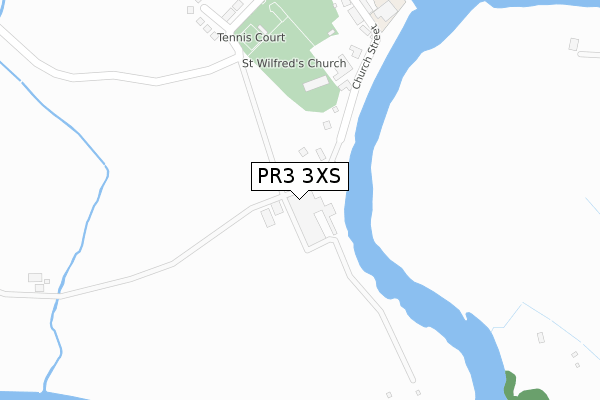
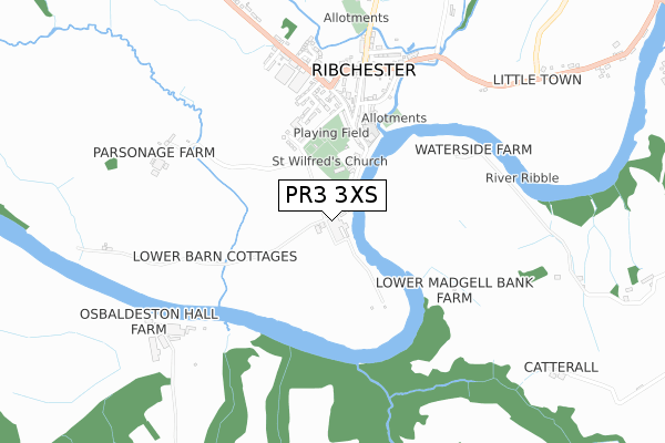
PR3 3XS maps, stats, and open data
PR3 3XS lies on Riverside in Ribchester, Preston. PR3 3XS is located in the Ribchester electoral ward, within the local authority district of Ribble Valley and the English Parliamentary constituency of Ribble Valley. The Sub Integrated Care Board (ICB) Location is NHS Lancashire and South Cumbria ICB - 01E and the police force is Lancashire. This postcode has been in use since January 1980.
PR3 3XS maps


Licence: Open Government Licence (requires attribution)
Attribution: Contains OS data © Crown copyright and database right 2025
Source: Open Postcode Geo
Licence: Open Government Licence (requires attribution)
Attribution: Contains OS data © Crown copyright and database right 2025; Contains Royal Mail data © Royal Mail copyright and database right 2025; Source: Office for National Statistics licensed under the Open Government Licence v.3.0
PR3 3XS geodata
| Easting | 364956 |
| Northing | 434824 |
| Latitude | 53.808518 |
| Longitude | -2.533647 |
Where is PR3 3XS?
| Street | Riverside |
| Locality | Ribchester |
| Town/City | Preston |
| Country | England |
| Postcode District | PR3 |
PR3 3XS Elevation
Elevation or altitude of PR3 3XS as distance above sea level:
| Metres | Feet | |
|---|---|---|
| Elevation | 20m | 66ft |
Elevation is measured from the approximate centre of the postcode, to the nearest point on an OS contour line from OS Terrain 50, which has contour spacing of ten vertical metres.
➜ How high above sea level am I? Find the elevation of your current position using your device's GPS.
Politics
| Ward | Ribchester |
|---|---|
| Constituency | Ribble Valley |
Transport
Nearest bus stops to PR3 3XS
| Black Bull (Church Street) | Ribchester | 548m |
| Black Bull (Church Street) | Ribchester | 554m |
| Post Office (Blackburn Road) | Ribchester | 580m |
| Ribchester Arms (Blackburn Road) | Ribchester | 666m |
| Ribchester Arms (Blackburn Road) | Ribchester | 697m |
Nearest railway stations to PR3 3XS
| Ramsgreave & Wilpshire Station | 4.9km |
Broadband
Broadband access in PR3 3XS (2020 data)
| Percentage of properties with Next Generation Access | 85.7% |
| Percentage of properties with Superfast Broadband | 85.7% |
| Percentage of properties with Ultrafast Broadband | 85.7% |
| Percentage of properties with Full Fibre Broadband | 85.7% |
Superfast Broadband is between 30Mbps and 300Mbps
Ultrafast Broadband is > 300Mbps
Broadband limitations in PR3 3XS (2020 data)
| Percentage of properties unable to receive 2Mbps | 0.0% |
| Percentage of properties unable to receive 5Mbps | 0.0% |
| Percentage of properties unable to receive 10Mbps | 0.0% |
| Percentage of properties unable to receive 30Mbps | 14.3% |
PR3 3XS gas and electricity consumption
Estimated total energy consumption in PR3 3XS by fuel type, 2015.
Electricity
| Consumption (kWh) | 70,083 |
|---|---|
| Meter count | 9 |
| Mean (kWh/meter) | 7,787 |
| Median (kWh/meter) | 5,803 |
- Consumption: The estimated total energy consumption, in kWh, across all meters in PR3 3XS, for 2015.
- Meter count: The total number of meters in PR3 3XS.
- Mean: The mean average consumption per meter, in kWh.
- Median: The median average consumption per meter, in kWh.
Source: Postcode level electricity estimates: 2015 (experimental)
Licence: Open Government Licence
Deprivation
15% of English postcodes are less deprived than PR3 3XS:Food Standards Agency
Three nearest food hygiene ratings to PR3 3XS (metres)


➜ Get more ratings from the Food Standards Agency
Nearest post box to PR3 3XS
| Last Collection | |||
|---|---|---|---|
| Location | Mon-Fri | Sat | Distance |
| Hurst Green Post Office | 16:00 | 11:30 | 4,747m |
| Tootal Heights | 17:30 | 12:00 | 4,796m |
| The Cross | 12:00 | 11:30 | 4,839m |
Environment
| Risk of PR3 3XS flooding from rivers and sea | Medium |
PR3 3XS ITL and PR3 3XS LAU
The below table lists the International Territorial Level (ITL) codes (formerly Nomenclature of Territorial Units for Statistics (NUTS) codes) and Local Administrative Units (LAU) codes for PR3 3XS:
| ITL 1 Code | Name |
|---|---|
| TLD | North West (England) |
| ITL 2 Code | Name |
| TLD4 | Lancashire |
| ITL 3 Code | Name |
| TLD45 | Mid Lancashire |
| LAU 1 Code | Name |
| E07000124 | Ribble Valley |
PR3 3XS census areas
The below table lists the Census Output Area (OA), Lower Layer Super Output Area (LSOA), and Middle Layer Super Output Area (MSOA) for PR3 3XS:
| Code | Name | |
|---|---|---|
| OA | E00128616 | |
| LSOA | E01025342 | Ribble Valley 004D |
| MSOA | E02005273 | Ribble Valley 004 |
Nearest postcodes to PR3 3XS
| PR3 3XP | Church Street | 370m |
| PR3 3ZH | Parsonage Avenue | 377m |
| PR3 3YS | Orchard Close | 431m |
| PR3 3YH | Fort Avenue | 456m |
| PR3 3YE | Church Street | 489m |
| PR3 3ZE | Sunnyside Avenue | 491m |
| PR3 3YJ | Water Street | 499m |
| PR3 3ZJ | Greenside | 510m |
| PR3 3YP | Blackburn Road | 560m |
| PR3 3ZP | Blackburn Road | 619m |