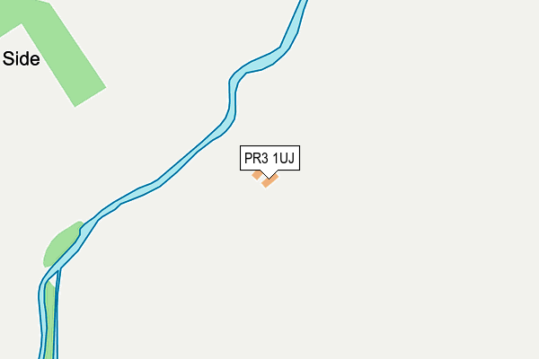
PR3 1UJ is located in the Wyresdale electoral ward, within the local authority district of Wyre and the English Parliamentary constituency of Lancaster and Fleetwood. The Sub Integrated Care Board (ICB) Location is NHS Lancashire and South Cumbria ICB - 02M and the police force is Lancashire. This postcode has been in use since January 1980.


GetTheData
Source: OS OpenMap – Local (Ordnance Survey)
Source: OS VectorMap District (Ordnance Survey)
Licence: Open Government Licence (requires attribution)
| Easting | 354024 |
| Northing | 448028 |
| Latitude | 53.926344 |
| Longitude | -2.701626 |
GetTheData
Source: Open Postcode Geo
Licence: Open Government Licence
| Country | England |
| Postcode District | PR3 |
| ➜ PR3 open data dashboard ➜ See where PR3 is on a map | |
GetTheData
Source: Land Registry Price Paid Data
Licence: Open Government Licence
Elevation or altitude of PR3 1UJ as distance above sea level:
| Metres | Feet | |
|---|---|---|
| Elevation | 180m | 591ft |
Elevation is measured from the approximate centre of the postcode, to the nearest point on an OS contour line from OS Terrain 50, which has contour spacing of ten vertical metres.
➜ How high above sea level am I? Find the elevation of your current position using your device's GPS.
GetTheData
Source: Open Postcode Elevation
Licence: Open Government Licence
| Ward | Wyresdale |
| Constituency | Lancaster And Fleetwood |
GetTheData
Source: ONS Postcode Database
Licence: Open Government Licence
| February 2023 | Criminal damage and arson | On or near Park/Open Space | 417m |
| February 2023 | Burglary | On or near Park/Open Space | 417m |
| January 2023 | Other theft | On or near Park/Open Space | 417m |
| ➜ Get more crime data in our Crime section | |||
GetTheData
Source: data.police.uk
Licence: Open Government Licence
| Paper Mill (Oakenclough Road) | Oakenclough | 589m |
| Moorcock Inn (Delph Lane) | Oakenclough | 932m |
GetTheData
Source: NaPTAN
Licence: Open Government Licence
| Percentage of properties with Next Generation Access | 100.0% |
| Percentage of properties with Superfast Broadband | 100.0% |
| Percentage of properties with Ultrafast Broadband | 100.0% |
| Percentage of properties with Full Fibre Broadband | 100.0% |
Superfast Broadband is between 30Mbps and 300Mbps
Ultrafast Broadband is > 300Mbps
| Percentage of properties unable to receive 2Mbps | 0.0% |
| Percentage of properties unable to receive 5Mbps | 0.0% |
| Percentage of properties unable to receive 10Mbps | 0.0% |
| Percentage of properties unable to receive 30Mbps | 0.0% |
GetTheData
Source: Ofcom
Licence: Ofcom Terms of Use (requires attribution)
GetTheData
Source: ONS Postcode Database
Licence: Open Government Licence
| Last Collection | |||
|---|---|---|---|
| Location | Mon-Fri | Sat | Distance |
| Lingart Lane, Barnacre | 16:45 | 08:00 | 3,438m |
| Scorton Post Office | 17:00 | 10:45 | 3,903m |
| Crofters | 17:00 | 11:15 | 5,150m |
GetTheData
Source: Dracos
Licence: Creative Commons Attribution-ShareAlike
| Facility | Distance |
|---|---|
| Calder Vale St John C Of E Primary School Long House Lane, Calder Vale, Preston Grass Pitches | 1.7km |
| Woodacre Hall Playing Fields Hazelhead Lane, Scorton, Preston Grass Pitches | 4km |
| Scorton Playing Field Gubberford Lane, Scorton, Preston Grass Pitches, Artificial Grass Pitch | 4km |
GetTheData
Source: Active Places
Licence: Open Government Licence
| School | Phase of Education | Distance |
|---|---|---|
| Calder Lodge School Oakenclough, Preston, Lancashire, PR3 1UL | Not applicable | 533m |
| Calder Vale St John Church of England Primary School Calder Vale, Garstang, Preston, PR3 1SR | Primary | 1.7km |
| Scorton Church of England Primary School Snow Hill Lane, Scorton, Preston, PR3 1AY | Primary | 3.8km |
GetTheData
Source: Edubase
Licence: Open Government Licence
The below table lists the International Territorial Level (ITL) codes (formerly Nomenclature of Territorial Units for Statistics (NUTS) codes) and Local Administrative Units (LAU) codes for PR3 1UJ:
| ITL 1 Code | Name |
|---|---|
| TLD | North West (England) |
| ITL 2 Code | Name |
| TLD4 | Lancashire |
| ITL 3 Code | Name |
| TLD44 | Lancaster and Wyre |
| LAU 1 Code | Name |
| E07000128 | Wyre |
GetTheData
Source: ONS Postcode Directory
Licence: Open Government Licence
The below table lists the Census Output Area (OA), Lower Layer Super Output Area (LSOA), and Middle Layer Super Output Area (MSOA) for PR3 1UJ:
| Code | Name | |
|---|---|---|
| OA | E00129960 | |
| LSOA | E01025609 | Wyre 006C |
| MSOA | E02005324 | Wyre 006 |
GetTheData
Source: ONS Postcode Directory
Licence: Open Government Licence
| PR3 1UL | 662m | |
| PR3 1UE | Strickens Lane | 1245m |
| PR3 1RP | Reservoir Road | 1586m |
| PR3 1UN | Delph Lane | 1591m |
| PR3 1SR | 1705m | |
| PR3 1SQ | Long Row | 2193m |
| PR3 1RN | Long Lane | 2341m |
| PR3 1SJ | Victoria Terrace | 2362m |
| PR3 1SA | Albert Terrace | 2447m |
| PR3 1SE | Burnside Avenue | 2511m |
GetTheData
Source: Open Postcode Geo; Land Registry Price Paid Data
Licence: Open Government Licence