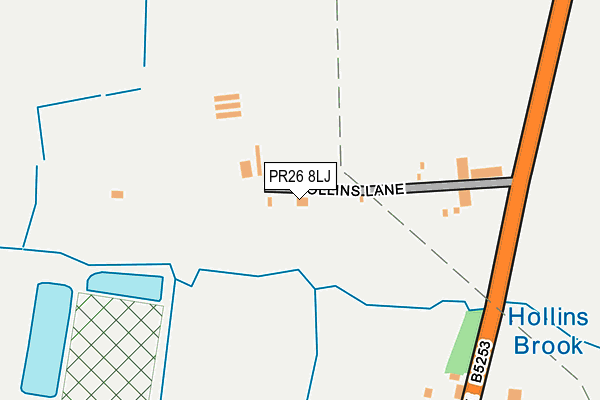
PR26 8LJ is located in the Seven Stars electoral ward, within the local authority district of South Ribble and the English Parliamentary constituency of South Ribble. The Sub Integrated Care Board (ICB) Location is NHS Lancashire and South Cumbria ICB - 00X and the police force is Lancashire. This postcode has been in use since June 2001.


GetTheData
Source: OS OpenMap – Local (Ordnance Survey)
Source: OS VectorMap District (Ordnance Survey)
Licence: Open Government Licence (requires attribution)
| Easting | 352338 |
| Northing | 419974 |
| Latitude | 53.674050 |
| Longitude | -2.722950 |
GetTheData
Source: Open Postcode Geo
Licence: Open Government Licence
| Country | England |
| Postcode District | PR26 |
| ➜ PR26 open data dashboard ➜ See where PR26 is on a map | |
GetTheData
Source: Land Registry Price Paid Data
Licence: Open Government Licence
Elevation or altitude of PR26 8LJ as distance above sea level:
| Metres | Feet | |
|---|---|---|
| Elevation | 20m | 66ft |
Elevation is measured from the approximate centre of the postcode, to the nearest point on an OS contour line from OS Terrain 50, which has contour spacing of ten vertical metres.
➜ How high above sea level am I? Find the elevation of your current position using your device's GPS.
GetTheData
Source: Open Postcode Elevation
Licence: Open Government Licence
| Ward | Seven Stars |
| Constituency | South Ribble |
GetTheData
Source: ONS Postcode Database
Licence: Open Government Licence
| Hollins Lane (Leyland Lane) | Runshaw Moor | 221m |
| Hollins Lane (Leyland Lane) | Runshaw Moor | 229m |
| Altcar Lane (Leyland Lane) | Wade Hall | 675m |
| Altcar Lane (Leyland Lane) | Wade Hall | 709m |
| Blue Slates Farm (Leyland Lane) | Runshaw Moor | 761m |
| Leyland Station | 3.6km |
| Euxton Balshaw Lane Station | 3.7km |
| Croston Station | 3.7km |
GetTheData
Source: NaPTAN
Licence: Open Government Licence
| Percentage of properties with Next Generation Access | 100.0% |
| Percentage of properties with Superfast Broadband | 0.0% |
| Percentage of properties with Ultrafast Broadband | 0.0% |
| Percentage of properties with Full Fibre Broadband | 0.0% |
Superfast Broadband is between 30Mbps and 300Mbps
Ultrafast Broadband is > 300Mbps
| Percentage of properties unable to receive 2Mbps | 0.0% |
| Percentage of properties unable to receive 5Mbps | 0.0% |
| Percentage of properties unable to receive 10Mbps | 0.0% |
| Percentage of properties unable to receive 30Mbps | 100.0% |
GetTheData
Source: Ofcom
Licence: Ofcom Terms of Use (requires attribution)
GetTheData
Source: ONS Postcode Database
Licence: Open Government Licence


➜ Get more ratings from the Food Standards Agency
GetTheData
Source: Food Standards Agency
Licence: FSA terms & conditions
| Last Collection | |||
|---|---|---|---|
| Location | Mon-Fri | Sat | Distance |
| Springfield Road | 17:15 | 11:30 | 1,311m |
| Wade Hall | 17:15 | 11:30 | 1,323m |
| Lydiate Lane, Eccleston | 16:15 | 11:15 | 1,501m |
GetTheData
Source: Dracos
Licence: Creative Commons Attribution-ShareAlike
| Facility | Distance |
|---|---|
| Leyland Warriors Arlfc (Moss Side Recreation Ground) Southlands Drive, Leyland Grass Pitches | 1.4km |
| Seven Stars Primary School Peacock Hall Road, Leyland Grass Pitches | 1.4km |
| St Marys Catholic High School (Leyland) Royal Avenue, Leyland Sports Hall, Artificial Grass Pitch, Grass Pitches, Health and Fitness Gym, Studio | 1.6km |
GetTheData
Source: Active Places
Licence: Open Government Licence
| School | Phase of Education | Distance |
|---|---|---|
| Seven Stars Primary School Peacock Hall Road, Leyland, PR25 1TD | Primary | 1.5km |
| St Mary's Catholic High School Royal Avenue, Leyland, PR25 1BS | Secondary | 1.5km |
| St Anne's Catholic Primary School Slater Lane, Leyland, PR25 1TL | Primary | 1.6km |
GetTheData
Source: Edubase
Licence: Open Government Licence
The below table lists the International Territorial Level (ITL) codes (formerly Nomenclature of Territorial Units for Statistics (NUTS) codes) and Local Administrative Units (LAU) codes for PR26 8LJ:
| ITL 1 Code | Name |
|---|---|
| TLD | North West (England) |
| ITL 2 Code | Name |
| TLD4 | Lancashire |
| ITL 3 Code | Name |
| TLD45 | Mid Lancashire |
| LAU 1 Code | Name |
| E07000126 | South Ribble |
GetTheData
Source: ONS Postcode Directory
Licence: Open Government Licence
The below table lists the Census Output Area (OA), Lower Layer Super Output Area (LSOA), and Middle Layer Super Output Area (MSOA) for PR26 8LJ:
| Code | Name | |
|---|---|---|
| OA | E00129213 | |
| LSOA | E01025460 | South Ribble 017D |
| MSOA | E02005303 | South Ribble 017 |
GetTheData
Source: ONS Postcode Directory
Licence: Open Government Licence
| PR26 8LB | Leyland Lane | 376m |
| PR26 8LL | Holker Lane | 551m |
| PR25 1LE | Altcar Lane | 743m |
| PR26 7JX | Lanchester Court | 782m |
| PR25 1LA | Leyland Lane | 908m |
| PR7 6HA | Runshaw Lane | 936m |
| PR25 1LG | Little Firs Fold | 947m |
| PR7 6EY | Runshaw Lane | 1142m |
| PR25 1LF | Butlers Farm Court | 1201m |
| PR25 1UG | Victoria Park Avenue | 1213m |
GetTheData
Source: Open Postcode Geo; Land Registry Price Paid Data
Licence: Open Government Licence