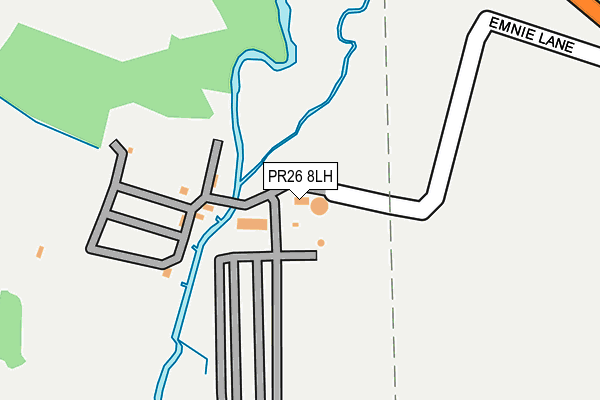
PR26 8LH is located in the Seven Stars electoral ward, within the local authority district of South Ribble and the English Parliamentary constituency of South Ribble. The Sub Integrated Care Board (ICB) Location is NHS Lancashire and South Cumbria ICB - 00X and the police force is Lancashire. This postcode has been in use since July 2021.


GetTheData
Source: OS OpenMap – Local (Ordnance Survey)
Source: OS VectorMap District (Ordnance Survey)
Licence: Open Government Licence (requires attribution)
| Easting | 352216 |
| Northing | 420872 |
| Latitude | 53.682126 |
| Longitude | -2.724932 |
GetTheData
Source: Open Postcode Geo
Licence: Open Government Licence
| Country | England |
| Postcode District | PR26 |
| ➜ PR26 open data dashboard ➜ See where PR26 is on a map | |
GetTheData
Source: Land Registry Price Paid Data
Licence: Open Government Licence
Elevation or altitude of PR26 8LH as distance above sea level:
| Metres | Feet | |
|---|---|---|
| Elevation | 20m | 66ft |
Elevation is measured from the approximate centre of the postcode, to the nearest point on an OS contour line from OS Terrain 50, which has contour spacing of ten vertical metres.
➜ How high above sea level am I? Find the elevation of your current position using your device's GPS.
GetTheData
Source: Open Postcode Elevation
Licence: Open Government Licence
| Ward | Seven Stars |
| Constituency | South Ribble |
GetTheData
Source: ONS Postcode Database
Licence: Open Government Licence
| June 2022 | Anti-social behaviour | On or near Victoria Park Avenue | 491m |
| June 2022 | Anti-social behaviour | On or near Victoria Park Avenue | 491m |
| May 2022 | Violence and sexual offences | On or near Lanchester Court | 483m |
| ➜ Get more crime data in our Crime section | |||
GetTheData
Source: data.police.uk
Licence: Open Government Licence
| Little Firs Fold (Leyland Lane) | Wade Hall | 482m |
| Little Firs Fold (Leyland Lane) | Wade Hall | 502m |
| Altcar Lane (Leyland Lane) | Wade Hall | 552m |
| Altcar Lane (Leyland Lane) | Wade Hall | 585m |
| Victoria Park Avenue (Leyland Lane) | Wade Hall | 604m |
| Leyland Station | 3.1km |
| Croston Station | 3.8km |
| Euxton Balshaw Lane Station | 4.2km |
GetTheData
Source: NaPTAN
Licence: Open Government Licence
GetTheData
Source: ONS Postcode Database
Licence: Open Government Licence


➜ Get more ratings from the Food Standards Agency
GetTheData
Source: Food Standards Agency
Licence: FSA terms & conditions
| Last Collection | |||
|---|---|---|---|
| Location | Mon-Fri | Sat | Distance |
| Springfield Road | 17:15 | 11:30 | 658m |
| Wade Hall | 17:15 | 11:30 | 905m |
| Leyland Lane Post Office | 17:15 | 12:00 | 983m |
GetTheData
Source: Dracos
Licence: Creative Commons Attribution-ShareAlike
| Facility | Distance |
|---|---|
| Leyland Warriors Arlfc (Moss Side Recreation Ground) Southlands Drive, Leyland Grass Pitches | 482m |
| Seven Stars Primary School Peacock Hall Road, Leyland Grass Pitches | 640m |
| St Annes Catholic Primary School Slater Lane, Leyland Grass Pitches | 848m |
GetTheData
Source: Active Places
Licence: Open Government Licence
| School | Phase of Education | Distance |
|---|---|---|
| Seven Stars Primary School Peacock Hall Road, Leyland, PR25 1TD | Primary | 730m |
| St Anne's Catholic Primary School Slater Lane, Leyland, PR25 1TL | Primary | 840m |
| Leyland St James Church of England Primary School Slater Lane, Leyland, PR26 7SH | Primary | 936m |
GetTheData
Source: Edubase
Licence: Open Government Licence
The below table lists the International Territorial Level (ITL) codes (formerly Nomenclature of Territorial Units for Statistics (NUTS) codes) and Local Administrative Units (LAU) codes for PR26 8LH:
| ITL 1 Code | Name |
|---|---|
| TLD | North West (England) |
| ITL 2 Code | Name |
| TLD4 | Lancashire |
| ITL 3 Code | Name |
| TLD45 | Mid Lancashire |
| LAU 1 Code | Name |
| E07000126 | South Ribble |
GetTheData
Source: ONS Postcode Directory
Licence: Open Government Licence
The below table lists the Census Output Area (OA), Lower Layer Super Output Area (LSOA), and Middle Layer Super Output Area (MSOA) for PR26 8LH:
| Code | Name | |
|---|---|---|
| OA | E00129213 | |
| LSOA | E01025460 | South Ribble 017D |
| MSOA | E02005303 | South Ribble 017 |
GetTheData
Source: ONS Postcode Directory
Licence: Open Government Licence
| PR25 1LG | Little Firs Fold | 430m |
| PR26 7JX | Lanchester Court | 437m |
| PR25 1LA | Leyland Lane | 476m |
| PR25 1UG | Victoria Park Avenue | 481m |
| PR26 7XT | Westlands | 544m |
| PR26 7XS | Eastlands | 571m |
| PR26 7SG | Greenside Gardens | 575m |
| PR25 1TJ | Meadowcroft Road | 576m |
| PR25 1TE | Stonecroft Road | 620m |
| PR25 1LF | Butlers Farm Court | 650m |
GetTheData
Source: Open Postcode Geo; Land Registry Price Paid Data
Licence: Open Government Licence