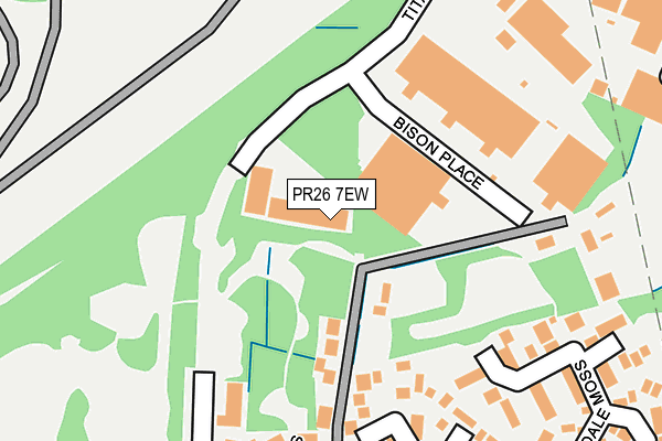
PR26 7EW is located in the Moss Side electoral ward, within the local authority district of South Ribble and the English Parliamentary constituency of South Ribble. The Sub Integrated Care Board (ICB) Location is NHS Lancashire and South Cumbria ICB - 00X and the police force is Lancashire. This postcode has been in use since June 2001.


GetTheData
Source: OS OpenMap – Local (Ordnance Survey)
Source: OS VectorMap District (Ordnance Survey)
Licence: Open Government Licence (requires attribution)
| Easting | 351984 |
| Northing | 422581 |
| Latitude | 53.697464 |
| Longitude | -2.728709 |
GetTheData
Source: Open Postcode Geo
Licence: Open Government Licence
| Country | England |
| Postcode District | PR26 |
| ➜ PR26 open data dashboard ➜ See where PR26 is on a map ➜ Where is Leyland? | |
GetTheData
Source: Land Registry Price Paid Data
Licence: Open Government Licence
Elevation or altitude of PR26 7EW as distance above sea level:
| Metres | Feet | |
|---|---|---|
| Elevation | 20m | 66ft |
Elevation is measured from the approximate centre of the postcode, to the nearest point on an OS contour line from OS Terrain 50, which has contour spacing of ten vertical metres.
➜ How high above sea level am I? Find the elevation of your current position using your device's GPS.
GetTheData
Source: Open Postcode Elevation
Licence: Open Government Licence
| Ward | Moss Side |
| Constituency | South Ribble |
GetTheData
Source: ONS Postcode Database
Licence: Open Government Licence
| January 2024 | Vehicle crime | On or near Fossdale Moss | 309m |
| January 2024 | Violence and sexual offences | On or near Greystones | 368m |
| November 2023 | Vehicle crime | On or near Fossdale Moss | 309m |
| ➜ Get more crime data in our Crime section | |||
GetTheData
Source: data.police.uk
Licence: Open Government Licence
| Newton Close (Dunkirk Lane) | Moss Side | 601m |
| Robin Hey (Dunkirk Lane) | Moss Side | 602m |
| Robin Hey (Dunkirk Lane) | Moss Side | 608m |
| Newton Close (Dunkirk Lane) | Moss Side | 637m |
| Black Bull (School Lane) | Moss Side | 820m |
| Leyland Station | 2.7km |
| Lostock Hall Station | 4km |
| Croston Station | 4.6km |
GetTheData
Source: NaPTAN
Licence: Open Government Licence
GetTheData
Source: ONS Postcode Database
Licence: Open Government Licence


➜ Get more ratings from the Food Standards Agency
GetTheData
Source: Food Standards Agency
Licence: FSA terms & conditions
| Last Collection | |||
|---|---|---|---|
| Location | Mon-Fri | Sat | Distance |
| Cowling Lane | 17:30 | 12:00 | 853m |
| Leyland Lane Post Office | 17:15 | 12:00 | 1,191m |
| Earnshaw Bridge Post Office | 17:30 | 12:00 | 1,197m |
GetTheData
Source: Dracos
Licence: Creative Commons Attribution-ShareAlike
| Facility | Distance |
|---|---|
| Paradise Park (Closed) Paradise Lane, Leyland Grass Pitches | 248m |
| Moss Side Primary School Paradise Lane, Leyland Grass Pitches | 446m |
| Leyland St James C Of E Primary School Slater Lane, Leyland Grass Pitches | 897m |
GetTheData
Source: Active Places
Licence: Open Government Licence
| School | Phase of Education | Distance |
|---|---|---|
| Moss Side Primary School Paradise Lane, Moss Side Primary School, Leyland, PR26 7ST | Primary | 364m |
| Leyland St James Church of England Primary School Slater Lane, Leyland, PR26 7SH | Primary | 830m |
| Aurora Brooklands School 159 Longmeanygate, Midge Hall, Leyland, PR26 7TB | Not applicable | 856m |
GetTheData
Source: Edubase
Licence: Open Government Licence
The below table lists the International Territorial Level (ITL) codes (formerly Nomenclature of Territorial Units for Statistics (NUTS) codes) and Local Administrative Units (LAU) codes for PR26 7EW:
| ITL 1 Code | Name |
|---|---|
| TLD | North West (England) |
| ITL 2 Code | Name |
| TLD4 | Lancashire |
| ITL 3 Code | Name |
| TLD45 | Mid Lancashire |
| LAU 1 Code | Name |
| E07000126 | South Ribble |
GetTheData
Source: ONS Postcode Directory
Licence: Open Government Licence
The below table lists the Census Output Area (OA), Lower Layer Super Output Area (LSOA), and Middle Layer Super Output Area (MSOA) for PR26 7EW:
| Code | Name | |
|---|---|---|
| OA | E00128985 | |
| LSOA | E01025416 | South Ribble 014A |
| MSOA | E02005300 | South Ribble 014 |
GetTheData
Source: ONS Postcode Directory
Licence: Open Government Licence
| PR26 7SX | Rhoden Road | 124m |
| PR26 7AS | Fossdale Moss | 241m |
| PR26 7AR | Blaydike Moss | 256m |
| PR26 7UH | Greystones | 342m |
| PR26 7ST | Paradise Lane | 350m |
| PR26 7AT | Fossdale Moss | 365m |
| PR26 7UP | Robin Hey | 372m |
| PR26 7SR | Rostrevor Close | 395m |
| PR26 7QJ | Birchwood | 419m |
| PR26 7UR | Robin Hey | 448m |
GetTheData
Source: Open Postcode Geo; Land Registry Price Paid Data
Licence: Open Government Licence