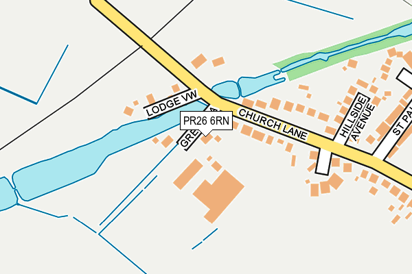
PR26 6RN is located in the Farington West electoral ward, within the local authority district of South Ribble and the English Parliamentary constituency of Ribble Valley. The Sub Integrated Care Board (ICB) Location is NHS Lancashire and South Cumbria ICB - 00X and the police force is Lancashire. This postcode has been in use since June 2001.


GetTheData
Source: OS OpenMap – Local (Ordnance Survey)
Source: OS VectorMap District (Ordnance Survey)
Licence: Open Government Licence (requires attribution)
| Easting | 353488 |
| Northing | 425123 |
| Latitude | 53.720446 |
| Longitude | -2.706315 |
GetTheData
Source: Open Postcode Geo
Licence: Open Government Licence
| Country | England |
| Postcode District | PR26 |
| ➜ PR26 open data dashboard ➜ See where PR26 is on a map ➜ Where is Farington? | |
GetTheData
Source: Land Registry Price Paid Data
Licence: Open Government Licence
Elevation or altitude of PR26 6RN as distance above sea level:
| Metres | Feet | |
|---|---|---|
| Elevation | 30m | 98ft |
Elevation is measured from the approximate centre of the postcode, to the nearest point on an OS contour line from OS Terrain 50, which has contour spacing of ten vertical metres.
➜ How high above sea level am I? Find the elevation of your current position using your device's GPS.
GetTheData
Source: Open Postcode Elevation
Licence: Open Government Licence
| Ward | Farington West |
| Constituency | Ribble Valley |
GetTheData
Source: ONS Postcode Database
Licence: Open Government Licence
| June 2022 | Burglary | On or near St Pauls Close | 311m |
| May 2022 | Anti-social behaviour | On or near Lower Field | 410m |
| March 2022 | Burglary | On or near Church Lane | 97m |
| ➜ Get more crime data in our Crime section | |||
GetTheData
Source: data.police.uk
Licence: Open Government Licence
| Hillside Avenue (Church Lane) | Farington Moss | 165m |
| Hillside Avenue (Church Lane) | Farington Moss | 213m |
| Church Lane East (Church Lane) | Farington Moss | 292m |
| Church Lane | Farington Moss | 305m |
| Croston Road | Farington Moss | 411m |
| Lostock Hall Station | 1.3km |
| Leyland Station | 2.7km |
| Bamber Bridge Station | 3.1km |
GetTheData
Source: NaPTAN
Licence: Open Government Licence
| Percentage of properties with Next Generation Access | 100.0% |
| Percentage of properties with Superfast Broadband | 100.0% |
| Percentage of properties with Ultrafast Broadband | 0.0% |
| Percentage of properties with Full Fibre Broadband | 0.0% |
Superfast Broadband is between 30Mbps and 300Mbps
Ultrafast Broadband is > 300Mbps
| Percentage of properties unable to receive 2Mbps | 0.0% |
| Percentage of properties unable to receive 5Mbps | 0.0% |
| Percentage of properties unable to receive 10Mbps | 0.0% |
| Percentage of properties unable to receive 30Mbps | 0.0% |
GetTheData
Source: Ofcom
Licence: Ofcom Terms of Use (requires attribution)
GetTheData
Source: ONS Postcode Database
Licence: Open Government Licence


➜ Get more ratings from the Food Standards Agency
GetTheData
Source: Food Standards Agency
Licence: FSA terms & conditions
| Last Collection | |||
|---|---|---|---|
| Location | Mon-Fri | Sat | Distance |
| The Cawsey | 16:45 | 11:30 | 1,567m |
| Old Todd Lane Post Office | 16:00 | 11:00 | 1,808m |
| Croston Road | 16:15 | 12:00 | 1,915m |
GetTheData
Source: Dracos
Licence: Creative Commons Attribution-ShareAlike
| Facility | Distance |
|---|---|
| Vicarage Ground (Closed) Church Lane, Farington Moss, Leyland Grass Pitches | 372m |
| Farington Moss St. Paul's C Of E Primary School Croston Road, Farington Moss, Leyland Grass Pitches | 466m |
| Lostock Hall Recreation Ground Hern Avenue, Lostock Hall, Preston Grass Pitches | 915m |
GetTheData
Source: Active Places
Licence: Open Government Licence
| School | Phase of Education | Distance |
|---|---|---|
| Farington Moss St. Paul's C.E. Primary School Croston Road, Farington Moss, Leyland, PR26 6PR | Primary | 466m |
| Our Lady and St Gerard's Roman Catholic Primary School, Lostock Hall Lourdes Avenue, Lostock Hall, Preston, PR5 5TB | Primary | 1.3km |
| Applebee Wood Community Specialist School Far Croft, Lostock Hall, Preston, PR5 5SS | Not applicable | 1.4km |
GetTheData
Source: Edubase
Licence: Open Government Licence
The below table lists the International Territorial Level (ITL) codes (formerly Nomenclature of Territorial Units for Statistics (NUTS) codes) and Local Administrative Units (LAU) codes for PR26 6RN:
| ITL 1 Code | Name |
|---|---|
| TLD | North West (England) |
| ITL 2 Code | Name |
| TLD4 | Lancashire |
| ITL 3 Code | Name |
| TLD45 | Mid Lancashire |
| LAU 1 Code | Name |
| E07000126 | South Ribble |
GetTheData
Source: ONS Postcode Directory
Licence: Open Government Licence
The below table lists the Census Output Area (OA), Lower Layer Super Output Area (LSOA), and Middle Layer Super Output Area (MSOA) for PR26 6RN:
| Code | Name | |
|---|---|---|
| OA | E00129004 | |
| LSOA | E01025420 | South Ribble 012D |
| MSOA | E02005298 | South Ribble 012 |
GetTheData
Source: ONS Postcode Directory
Licence: Open Government Licence
| PR26 6RG | Lodge View | 98m |
| PR26 6SA | Cheshire House Close | 186m |
| PR26 6RD | Church Lane | 191m |
| PR26 6RE | Hillside Avenue | 215m |
| PR4 4LJ | Coote Lane | 291m |
| PR26 6RT | St Pauls Close | 336m |
| PR26 6PR | Croston Road | 412m |
| PR26 6RA | Lodge Lane | 422m |
| PR26 6PQ | Croston Road | 430m |
| PR26 6PA | Leveret Court | 441m |
GetTheData
Source: Open Postcode Geo; Land Registry Price Paid Data
Licence: Open Government Licence