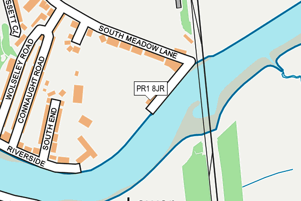
PR1 8JR lies on Riverside in Preston. PR1 8JR is located in the City Centre electoral ward, within the local authority district of Preston and the English Parliamentary constituency of Preston. The Sub Integrated Care Board (ICB) Location is NHS Lancashire and South Cumbria ICB - 01E and the police force is Lancashire. This postcode has been in use since January 1980.


GetTheData
Source: OS OpenMap – Local (Ordnance Survey)
Source: OS VectorMap District (Ordnance Survey)
Licence: Open Government Licence (requires attribution)
| Easting | 353422 |
| Northing | 428366 |
| Latitude | 53.749570 |
| Longitude | -2.707808 |
GetTheData
Source: Open Postcode Geo
Licence: Open Government Licence
| Street | Riverside |
| Town/City | Preston |
| Country | England |
| Postcode District | PR1 |
➜ See where PR1 is on a map ➜ Where is Preston? | |
GetTheData
Source: Land Registry Price Paid Data
Licence: Open Government Licence
Elevation or altitude of PR1 8JR as distance above sea level:
| Metres | Feet | |
|---|---|---|
| Elevation | 10m | 33ft |
Elevation is measured from the approximate centre of the postcode, to the nearest point on an OS contour line from OS Terrain 50, which has contour spacing of ten vertical metres.
➜ How high above sea level am I? Find the elevation of your current position using your device's GPS.
GetTheData
Source: Open Postcode Elevation
Licence: Open Government Licence
| Ward | City Centre |
| Constituency | Preston |
GetTheData
Source: ONS Postcode Database
Licence: Open Government Licence
| Meadow Court (South Meadow Lane) | Broadgate | 303m |
| Terminus (Broadgate) | Broadgate | 447m |
| Bridge Inn (Leyland Road) | Lower Penwortham | 466m |
| Bridge Inn (Leyland Road) | Lower Penwortham | 482m |
| Dove Avenue (Leyland Road) | Middleforth Green | 537m |
| Preston Station | 0.8km |
| Lostock Hall Station | 3.1km |
| Bamber Bridge Station | 4km |
GetTheData
Source: NaPTAN
Licence: Open Government Licence
| Percentage of properties with Next Generation Access | 100.0% |
| Percentage of properties with Superfast Broadband | 100.0% |
| Percentage of properties with Ultrafast Broadband | 0.0% |
| Percentage of properties with Full Fibre Broadband | 0.0% |
Superfast Broadband is between 30Mbps and 300Mbps
Ultrafast Broadband is > 300Mbps
| Percentage of properties unable to receive 2Mbps | 0.0% |
| Percentage of properties unable to receive 5Mbps | 0.0% |
| Percentage of properties unable to receive 10Mbps | 0.0% |
| Percentage of properties unable to receive 30Mbps | 0.0% |
GetTheData
Source: Ofcom
Licence: Ofcom Terms of Use (requires attribution)
GetTheData
Source: ONS Postcode Database
Licence: Open Government Licence


➜ Get more ratings from the Food Standards Agency
GetTheData
Source: Food Standards Agency
Licence: FSA terms & conditions
| Last Collection | |||
|---|---|---|---|
| Location | Mon-Fri | Sat | Distance |
| Pedders Lane | 17:00 | 11:30 | 607m |
| East Cliff | 18:30 | 11:30 | 744m |
| Fishergate Hill Post Office | 17:30 | 11:30 | 745m |
GetTheData
Source: Dracos
Licence: Creative Commons Attribution-ShareAlike
| Risk of PR1 8JR flooding from rivers and sea | Medium |
| ➜ PR1 8JR flood map | |
GetTheData
Source: Open Flood Risk by Postcode
Licence: Open Government Licence
The below table lists the International Territorial Level (ITL) codes (formerly Nomenclature of Territorial Units for Statistics (NUTS) codes) and Local Administrative Units (LAU) codes for PR1 8JR:
| ITL 1 Code | Name |
|---|---|
| TLD | North West (England) |
| ITL 2 Code | Name |
| TLD4 | Lancashire |
| ITL 3 Code | Name |
| TLD45 | Mid Lancashire |
| LAU 1 Code | Name |
| E07000123 | Preston |
GetTheData
Source: ONS Postcode Directory
Licence: Open Government Licence
The below table lists the Census Output Area (OA), Lower Layer Super Output Area (LSOA), and Middle Layer Super Output Area (MSOA) for PR1 8JR:
| Code | Name | |
|---|---|---|
| OA | E00128364 | |
| LSOA | E01025291 | Preston 017C |
| MSOA | E02005269 | Preston 017 |
GetTheData
Source: ONS Postcode Directory
Licence: Open Government Licence
| PR1 8JP | South Meadow Lane | 138m |
| PR1 8EW | Miller Gardens | 154m |
| PR1 8LJ | Woods Green | 184m |
| PR1 8JF | Ribble Close | 212m |
| PR1 8HA | South End | 214m |
| PR1 8EX | Connaught Road | 228m |
| PR1 8EU | Wolseley Road | 266m |
| PR1 8ET | Riverside | 266m |
| PR1 8LU | Hassett Close | 306m |
| PR1 9RA | Fraser Avenue | 317m |
GetTheData
Source: Open Postcode Geo; Land Registry Price Paid Data
Licence: Open Government Licence