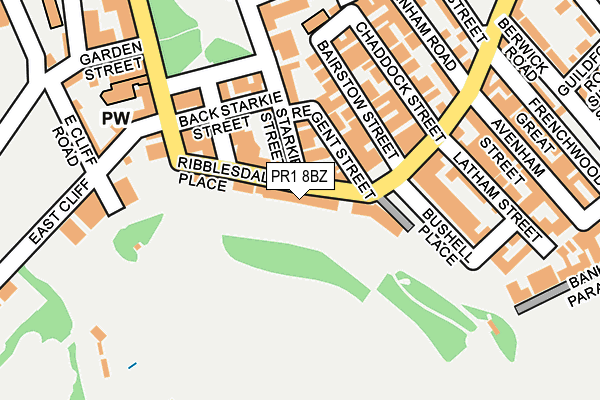
PR1 8BZ is located in the City Centre electoral ward, within the local authority district of Preston and the English Parliamentary constituency of Preston. The Sub Integrated Care Board (ICB) Location is NHS Lancashire and South Cumbria ICB - 01E and the police force is Lancashire. This postcode has been in use since January 1980.


GetTheData
Source: OS OpenMap – Local (Ordnance Survey)
Source: OS VectorMap District (Ordnance Survey)
Licence: Open Government Licence (requires attribution)
| Easting | 353945 |
| Northing | 428884 |
| Latitude | 53.754272 |
| Longitude | -2.699955 |
GetTheData
Source: Open Postcode Geo
Licence: Open Government Licence
| Country | England |
| Postcode District | PR1 |
| ➜ PR1 open data dashboard ➜ See where PR1 is on a map ➜ Where is Preston? | |
GetTheData
Source: Land Registry Price Paid Data
Licence: Open Government Licence
Elevation or altitude of PR1 8BZ as distance above sea level:
| Metres | Feet | |
|---|---|---|
| Elevation | 30m | 98ft |
Elevation is measured from the approximate centre of the postcode, to the nearest point on an OS contour line from OS Terrain 50, which has contour spacing of ten vertical metres.
➜ How high above sea level am I? Find the elevation of your current position using your device's GPS.
GetTheData
Source: Open Postcode Elevation
Licence: Open Government Licence
| Ward | City Centre |
| Constituency | Preston |
GetTheData
Source: ONS Postcode Database
Licence: Open Government Licence
| January 2024 | Anti-social behaviour | On or near Knowsley Street | 442m |
| December 2023 | Anti-social behaviour | On or near Knowsley Street | 442m |
| December 2023 | Burglary | On or near Knowsley Street | 442m |
| ➜ Get more crime data in our Crime section | |||
GetTheData
Source: data.police.uk
Licence: Open Government Licence
| Boots (Fishergate) | Preston City Centre | 437m |
| Waterstones (Fishergate) | Preston City Centre | 447m |
| Rail Station (Butler Street) | Preston City Centre | 463m |
| Lava Ignite (Church Street) | Preston City Centre | 463m |
| St Georges Centre (Lune Street) | Preston City Centre | 497m |
| Preston Station | 0.6km |
| Lostock Hall Station | 3.4km |
| Bamber Bridge Station | 4km |
GetTheData
Source: NaPTAN
Licence: Open Government Licence
GetTheData
Source: ONS Postcode Database
Licence: Open Government Licence


➜ Get more ratings from the Food Standards Agency
GetTheData
Source: Food Standards Agency
Licence: FSA terms & conditions
| Last Collection | |||
|---|---|---|---|
| Location | Mon-Fri | Sat | Distance |
| Harris Institute | 17:30 | 11:30 | 96m |
| 12 Winckley Square | 18:30 | 11:30 | 155m |
| 12 Winckley Square | 159m | ||
GetTheData
Source: Dracos
Licence: Creative Commons Attribution-ShareAlike
| Facility | Distance |
|---|---|
| Preston Sports Club South Meadow Lane, Preston Artificial Grass Pitch, Grass Pitches | 665m |
| Frenchwood Park The Esplanade, Preston Grass Pitches, Outdoor Tennis Courts | 679m |
| Reviva Health Club For Women (Preston) (Closed) Hill Street, Preston Studio, Health and Fitness Gym | 713m |
GetTheData
Source: Active Places
Licence: Open Government Licence
| School | Phase of Education | Distance |
|---|---|---|
| Imam Muhammad Zakariya School 2 Bairstow Street, Preston, PR1 3TN | Not applicable | 179m |
| Stoneygate Nursery School Stoneygate Walk, Preston, PR1 3XU | Nursery | 477m |
| St Augustine's Catholic Primary School, Preston St Austin's Place, Avenham, Preston, PR1 3YJ | Primary | 574m |
GetTheData
Source: Edubase
Licence: Open Government Licence
The below table lists the International Territorial Level (ITL) codes (formerly Nomenclature of Territorial Units for Statistics (NUTS) codes) and Local Administrative Units (LAU) codes for PR1 8BZ:
| ITL 1 Code | Name |
|---|---|
| TLD | North West (England) |
| ITL 2 Code | Name |
| TLD4 | Lancashire |
| ITL 3 Code | Name |
| TLD45 | Mid Lancashire |
| LAU 1 Code | Name |
| E07000123 | Preston |
GetTheData
Source: ONS Postcode Directory
Licence: Open Government Licence
The below table lists the Census Output Area (OA), Lower Layer Super Output Area (LSOA), and Middle Layer Super Output Area (MSOA) for PR1 8BZ:
| Code | Name | |
|---|---|---|
| OA | E00128440 | |
| LSOA | E01025306 | Preston 017D |
| MSOA | E02005269 | Preston 017 |
GetTheData
Source: ONS Postcode Directory
Licence: Open Government Licence
| PR1 3NA | Ribblesdale Place | 63m |
| PR1 3LX | Regent Street | 85m |
| PR1 3LY | Avenham Colonnade | 88m |
| PR1 3JL | Camden Place | 104m |
| PR1 3LU | Starkie Street | 105m |
| PR1 3TN | Bairstow Street | 110m |
| PR1 3TL | Chaddock Street | 150m |
| PR1 3TQ | Bushell Place | 169m |
| PR1 3LB | East Cliff | 179m |
| PR1 3TR | Porter Place | 187m |
GetTheData
Source: Open Postcode Geo; Land Registry Price Paid Data
Licence: Open Government Licence