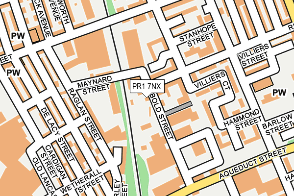
PR1 7NX lies on Bold Street in Preston. PR1 7NX is located in the Plungington electoral ward, within the local authority district of Preston and the English Parliamentary constituency of Preston. The Sub Integrated Care Board (ICB) Location is NHS Lancashire and South Cumbria ICB - 01E and the police force is Lancashire. This postcode has been in use since January 1980.


GetTheData
Source: OS OpenMap – Local (Ordnance Survey)
Source: OS VectorMap District (Ordnance Survey)
Licence: Open Government Licence (requires attribution)
| Easting | 352898 |
| Northing | 430527 |
| Latitude | 53.768945 |
| Longitude | -2.716084 |
GetTheData
Source: Open Postcode Geo
Licence: Open Government Licence
| Street | Bold Street |
| Town/City | Preston |
| Country | England |
| Postcode District | PR1 |
| ➜ PR1 open data dashboard ➜ See where PR1 is on a map ➜ Where is Preston? | |
GetTheData
Source: Land Registry Price Paid Data
Licence: Open Government Licence
Elevation or altitude of PR1 7NX as distance above sea level:
| Metres | Feet | |
|---|---|---|
| Elevation | 30m | 98ft |
Elevation is measured from the approximate centre of the postcode, to the nearest point on an OS contour line from OS Terrain 50, which has contour spacing of ten vertical metres.
➜ How high above sea level am I? Find the elevation of your current position using your device's GPS.
GetTheData
Source: Open Postcode Elevation
Licence: Open Government Licence
| Ward | Plungington |
| Constituency | Preston |
GetTheData
Source: ONS Postcode Database
Licence: Open Government Licence
20 - 28, BOLD STREET, PRESTON, PR1 7NX 2006 5 MAY £140,000 |
GetTheData
Source: HM Land Registry Price Paid Data
Licence: Contains HM Land Registry data © Crown copyright and database right 2024. This data is licensed under the Open Government Licence v3.0.
| January 2024 | Public order | On or near Seymour Court | 92m |
| January 2024 | Violence and sexual offences | On or near Seymour Court | 92m |
| January 2024 | Anti-social behaviour | On or near Villiers Street | 202m |
| ➜ Get more crime data in our Crime section | |||
GetTheData
Source: data.police.uk
Licence: Open Government Licence
| Ashton Empress (Eldon Street) | Ashton-on-ribble | 190m |
| Lulworth Ave (Eldon Street) | Ashton-on-ribble | 192m |
| Ripon Street (Brook Street) | Plungington | 194m |
| Ripon Street | Plungington | 200m |
| Greenbank Street (Eldon Street) | Plungington | 221m |
| Preston Station | 1.4km |
| Lostock Hall Station | 5.3km |
| Bamber Bridge Station | 5.9km |
GetTheData
Source: NaPTAN
Licence: Open Government Licence
GetTheData
Source: ONS Postcode Database
Licence: Open Government Licence


➜ Get more ratings from the Food Standards Agency
GetTheData
Source: Food Standards Agency
Licence: FSA terms & conditions
| Last Collection | |||
|---|---|---|---|
| Location | Mon-Fri | Sat | Distance |
| 131 Waterloo Road, Ashton | 17:00 | 11:30 | 217m |
| Navigation Way, Ashton | 320m | ||
| Cattle Market Post Office | 17:30 | 11:15 | 559m |
GetTheData
Source: Dracos
Licence: Creative Commons Attribution-ShareAlike
| Facility | Distance |
|---|---|
| Ultra Flex Gym Shelley Road, Ashton-on-ribble, Preston Health and Fitness Gym | 326m |
| Puregym (Preston) Broomfield Mill Street, Preston Health and Fitness Gym, Studio | 884m |
| Total Fitness (Preston) West Strand, Preston Swimming Pool, Health and Fitness Gym, Studio, Squash Courts, Athletics | 945m |
GetTheData
Source: Active Places
Licence: Open Government Licence
| School | Phase of Education | Distance |
|---|---|---|
| The Roebuck School Inkerman Street, Ashton, Preston, PR2 2BN | Primary | 391m |
| Eldon Primary School Eldon Street, Preston, PR1 7YE | Primary | 525m |
| English Martyrs Catholic Primary School, Preston Sizer Street, Preston, PR1 7DR | Primary | 648m |
GetTheData
Source: Edubase
Licence: Open Government Licence
The below table lists the International Territorial Level (ITL) codes (formerly Nomenclature of Territorial Units for Statistics (NUTS) codes) and Local Administrative Units (LAU) codes for PR1 7NX:
| ITL 1 Code | Name |
|---|---|
| TLD | North West (England) |
| ITL 2 Code | Name |
| TLD4 | Lancashire |
| ITL 3 Code | Name |
| TLD45 | Mid Lancashire |
| LAU 1 Code | Name |
| E07000123 | Preston |
GetTheData
Source: ONS Postcode Directory
Licence: Open Government Licence
The below table lists the Census Output Area (OA), Lower Layer Super Output Area (LSOA), and Middle Layer Super Output Area (MSOA) for PR1 7NX:
| Code | Name | |
|---|---|---|
| OA | E00128481 | |
| LSOA | E01025313 | Preston 012F |
| MSOA | E02005264 | Preston 012 |
GetTheData
Source: ONS Postcode Directory
Licence: Open Government Licence
| PR2 2AU | Brierley Street | 102m |
| PR1 7PT | Seymour Court | 104m |
| PR1 7JT | Bold Street | 123m |
| PR1 7NU | Hammond Street | 144m |
| PR1 7QQ | Villiers Court | 144m |
| PR1 7PN | Stanhope Street | 146m |
| PR1 7LX | Ripon Street | 152m |
| PR2 2AX | Raglan Street | 157m |
| PR2 2AN | Brookhouse Street | 172m |
| PR2 2AQ | Inkerman Street | 180m |
GetTheData
Source: Open Postcode Geo; Land Registry Price Paid Data
Licence: Open Government Licence