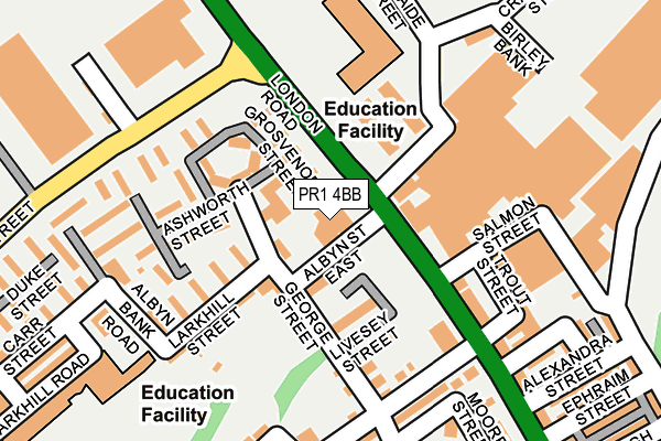
PR1 4BB is located in the City Centre electoral ward, within the local authority district of Preston and the English Parliamentary constituency of Preston. The Sub Integrated Care Board (ICB) Location is NHS Lancashire and South Cumbria ICB - 01E and the police force is Lancashire. This postcode has been in use since January 1980.


GetTheData
Source: OS OpenMap – Local (Ordnance Survey)
Source: OS VectorMap District (Ordnance Survey)
Licence: Open Government Licence (requires attribution)
| Easting | 354908 |
| Northing | 429334 |
| Latitude | 53.758401 |
| Longitude | -2.685417 |
GetTheData
Source: Open Postcode Geo
Licence: Open Government Licence
| Country | England |
| Postcode District | PR1 |
| ➜ PR1 open data dashboard ➜ See where PR1 is on a map ➜ Where is Preston? | |
GetTheData
Source: Land Registry Price Paid Data
Licence: Open Government Licence
Elevation or altitude of PR1 4BB as distance above sea level:
| Metres | Feet | |
|---|---|---|
| Elevation | 30m | 98ft |
Elevation is measured from the approximate centre of the postcode, to the nearest point on an OS contour line from OS Terrain 50, which has contour spacing of ten vertical metres.
➜ How high above sea level am I? Find the elevation of your current position using your device's GPS.
GetTheData
Source: Open Postcode Elevation
Licence: Open Government Licence
| Ward | City Centre |
| Constituency | Preston |
GetTheData
Source: ONS Postcode Database
Licence: Open Government Licence
| November 2023 | Vehicle crime | On or near Coronation Crescent | 216m |
| August 2023 | Anti-social behaviour | On or near Mellor Place | 211m |
| August 2023 | Violence and sexual offences | On or near Mellor Place | 211m |
| ➜ Get more crime data in our Crime section | |||
GetTheData
Source: data.police.uk
Licence: Open Government Licence
| Queen Street (London Road) | Frenchwood | 55m |
| Queen Street (London Road) | Frenchwood | 100m |
| London Road (New Hall Lane) | Fishwick | 250m |
| St Mary's Street (New Hall Lane) | Fishwick | 250m |
| Frenchwood Avenue (London Road) | Frenchwood | 267m |
| Preston Station | 1.5km |
| Lostock Hall Station | 3.8km |
| Bamber Bridge Station | 3.9km |
GetTheData
Source: NaPTAN
Licence: Open Government Licence
GetTheData
Source: ONS Postcode Database
Licence: Open Government Licence


➜ Get more ratings from the Food Standards Agency
GetTheData
Source: Food Standards Agency
Licence: FSA terms & conditions
| Last Collection | |||
|---|---|---|---|
| Location | Mon-Fri | Sat | Distance |
| 1 Derby Street | 17:30 | 11:30 | 575m |
| Manchester Road | 17:30 | 11:30 | 581m |
| Parish Church | 18:30 | 11:30 | 778m |
GetTheData
Source: Dracos
Licence: Creative Commons Attribution-ShareAlike
| Facility | Distance |
|---|---|
| Eden Boys’ School Preston Adelaide Street, Preston Sports Hall | 155m |
| Impact Health Studio (Closed) Kaymar Industrial Estate, Trout Street, Preston Health and Fitness Gym | 178m |
| Cardinal Newman College Lark Hill Road, Preston Sports Hall, Health and Fitness Gym | 270m |
GetTheData
Source: Active Places
Licence: Open Government Licence
| School | Phase of Education | Distance |
|---|---|---|
| Lancaster University School of Mathematics 67 London Road, Preston, PR1 4BA | 16 plus | 105m |
| Eden Boys' School, Preston Adelaide Street, Preston, PR1 4BD | Secondary | 162m |
| Cardinal Newman College Lark Hill Road, Avenham, Preston, PR1 4HD | 16 plus | 269m |
GetTheData
Source: Edubase
Licence: Open Government Licence
The below table lists the International Territorial Level (ITL) codes (formerly Nomenclature of Territorial Units for Statistics (NUTS) codes) and Local Administrative Units (LAU) codes for PR1 4BB:
| ITL 1 Code | Name |
|---|---|
| TLD | North West (England) |
| ITL 2 Code | Name |
| TLD4 | Lancashire |
| ITL 3 Code | Name |
| TLD45 | Mid Lancashire |
| LAU 1 Code | Name |
| E07000123 | Preston |
GetTheData
Source: ONS Postcode Directory
Licence: Open Government Licence
The below table lists the Census Output Area (OA), Lower Layer Super Output Area (LSOA), and Middle Layer Super Output Area (MSOA) for PR1 4BB:
| Code | Name | |
|---|---|---|
| OA | E00128435 | |
| LSOA | E01025305 | Preston 016F |
| MSOA | E02005268 | Preston 016 |
GetTheData
Source: ONS Postcode Directory
Licence: Open Government Licence
| PR1 4HY | 51m | |
| PR1 4HT | Albyn Street East | 57m |
| PR1 4JH | Grosvenor Street | 89m |
| PR1 4JP | George Street | 92m |
| PR1 4JB | Ashworth Street | 104m |
| PR1 4JQ | Livesey Street | 121m |
| PR1 4JJ | Lark Hill Street | 136m |
| PR1 4BA | London Road | 188m |
| PR1 4JL | Greenwood Street | 193m |
| PR1 4BT | Montjoly Street | 193m |
GetTheData
Source: Open Postcode Geo; Land Registry Price Paid Data
Licence: Open Government Licence