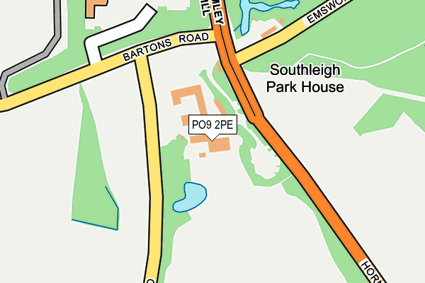
PO9 2PE is located in the St Faith's electoral ward, within the local authority district of Havant and the English Parliamentary constituency of Havant. The Sub Integrated Care Board (ICB) Location is NHS Hampshire and Isle of Wight ICB - D9Y0V and the police force is Hampshire. This postcode has been in use since January 1980.


GetTheData
Source: OS OpenMap – Local (Ordnance Survey)
Source: OS VectorMap District (Ordnance Survey)
Licence: Open Government Licence (requires attribution)
| Easting | 473729 |
| Northing | 107953 |
| Latitude | 50.866390 |
| Longitude | -0.953669 |
GetTheData
Source: Open Postcode Geo
Licence: Open Government Licence
| Country | England |
| Postcode District | PO9 |
| ➜ PO9 open data dashboard ➜ See where PO9 is on a map | |
GetTheData
Source: Land Registry Price Paid Data
Licence: Open Government Licence
Elevation or altitude of PO9 2PE as distance above sea level:
| Metres | Feet | |
|---|---|---|
| Elevation | 30m | 98ft |
Elevation is measured from the approximate centre of the postcode, to the nearest point on an OS contour line from OS Terrain 50, which has contour spacing of ten vertical metres.
➜ How high above sea level am I? Find the elevation of your current position using your device's GPS.
GetTheData
Source: Open Postcode Elevation
Licence: Open Government Licence
| Ward | St Faith's |
| Constituency | Havant |
GetTheData
Source: ONS Postcode Database
Licence: Open Government Licence
| May 2022 | Violence and sexual offences | On or near Bartons Road | 361m |
| May 2022 | Violence and sexual offences | On or near Bartons Road | 361m |
| May 2022 | Anti-social behaviour | On or near Bartons Road | 361m |
| ➜ Get more crime data in our Crime section | |||
GetTheData
Source: data.police.uk
Licence: Open Government Licence
| Dymock Street (Woolmer Street) | New Brighton | 589m |
| Dymock Street (Woolmer Street) | New Brighton | 594m |
| Locks Farm (Southleigh Road) | Southleigh | 696m |
| Locks Farm | Southleigh | 698m |
| Cotton Drive (Spencer Road) | New Brighton | 727m |
| Warblington Station | 1.7km |
| Emsworth Station | 2km |
| Havant Station | 2.4km |
GetTheData
Source: NaPTAN
Licence: Open Government Licence
GetTheData
Source: ONS Postcode Database
Licence: Open Government Licence


➜ Get more ratings from the Food Standards Agency
GetTheData
Source: Food Standards Agency
Licence: FSA terms & conditions
| Last Collection | |||
|---|---|---|---|
| Location | Mon-Fri | Sat | Distance |
| Eastleigh Road | 16:15 | 11:30 | 160m |
| Shaldon Road | 17:30 | 11:30 | 997m |
| Rowan Road | 17:45 | 11:30 | 1,000m |
GetTheData
Source: Dracos
Licence: Creative Commons Attribution-ShareAlike
| Facility | Distance |
|---|---|
| Bartons Green Wakefords Way, Havant Grass Pitches | 809m |
| Sharps Copse Primary School Prospect Lane, Havant Grass Pitches | 1.1km |
| Hollybank Southleigh Road, Emsworth Grass Pitches | 1.1km |
GetTheData
Source: Active Places
Licence: Open Government Licence
| School | Phase of Education | Distance |
|---|---|---|
| Sharps Copse Primary and Nursery School Prospect Lane, Havant, PO9 5PE | Primary | 1.1km |
| St James Church of England Controlled Primary School Bellevue Lane, Emsworth, PO10 7PX | Primary | 1.4km |
| St Alban's Church of England Aided Primary School St Alban's Road, West Leigh, Havant, PO9 2JX | Primary | 1.5km |
GetTheData
Source: Edubase
Licence: Open Government Licence
The below table lists the International Territorial Level (ITL) codes (formerly Nomenclature of Territorial Units for Statistics (NUTS) codes) and Local Administrative Units (LAU) codes for PO9 2PE:
| ITL 1 Code | Name |
|---|---|
| TLJ | South East (England) |
| ITL 2 Code | Name |
| TLJ3 | Hampshire and Isle of Wight |
| ITL 3 Code | Name |
| TLJ35 | South Hampshire |
| LAU 1 Code | Name |
| E07000090 | Havant |
GetTheData
Source: ONS Postcode Directory
Licence: Open Government Licence
The below table lists the Census Output Area (OA), Lower Layer Super Output Area (LSOA), and Middle Layer Super Output Area (MSOA) for PO9 2PE:
| Code | Name | |
|---|---|---|
| OA | E00116641 | |
| LSOA | E01022958 | Havant 014F |
| MSOA | E02004775 | Havant 014 |
GetTheData
Source: ONS Postcode Directory
Licence: Open Government Licence
| PO9 2PB | Emsworth Common Road | 167m |
| PO9 2NY | Eastleigh Road | 411m |
| PO10 7XS | Spencer Road | 471m |
| PO10 7XL | Dymoke Street | 515m |
| PO9 5NA | Bartons Road | 530m |
| PO10 7XP | Woolmer Street | 545m |
| PO10 7XR | Spencer Road | 603m |
| PO10 7XG | Woolmer Street | 649m |
| PO10 7XQ | Lutman Street | 673m |
| PO9 2PA | Southleigh Road | 704m |
GetTheData
Source: Open Postcode Geo; Land Registry Price Paid Data
Licence: Open Government Licence