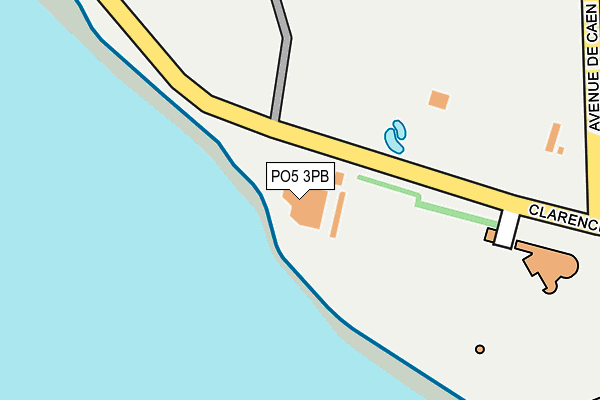
PO5 3PB is located in the St Jude electoral ward, within the unitary authority of Portsmouth and the English Parliamentary constituency of Portsmouth South. The Sub Integrated Care Board (ICB) Location is NHS Hampshire and Isle of Wight ICB - 10R and the police force is Hampshire. This postcode has been in use since January 1980.


GetTheData
Source: OS OpenMap – Local (Ordnance Survey)
Source: OS VectorMap District (Ordnance Survey)
Licence: Open Government Licence (requires attribution)
| Easting | 464186 |
| Northing | 98341 |
| Latitude | 50.781091 |
| Longitude | -1.090923 |
GetTheData
Source: Open Postcode Geo
Licence: Open Government Licence
| Country | England |
| Postcode District | PO5 |
➜ See where PO5 is on a map ➜ Where is Portsmouth? | |
GetTheData
Source: Land Registry Price Paid Data
Licence: Open Government Licence
Elevation or altitude of PO5 3PB as distance above sea level:
| Metres | Feet | |
|---|---|---|
| Elevation | 10m | 33ft |
Elevation is measured from the approximate centre of the postcode, to the nearest point on an OS contour line from OS Terrain 50, which has contour spacing of ten vertical metres.
➜ How high above sea level am I? Find the elevation of your current position using your device's GPS.
GetTheData
Source: Open Postcode Elevation
Licence: Open Government Licence
| Ward | St Jude |
| Constituency | Portsmouth South |
GetTheData
Source: ONS Postcode Database
Licence: Open Government Licence
| Blue Reef (Clarence Esplanade) | Southsea | 127m |
| Blue Reef (Clarence Esplanade) | Southsea | 129m |
| D-day Museum (Clarence Esplanade) | Southsea | 145m |
| D-day Museum (Clarence Esplanade) | Southsea | 166m |
| Americas Cup Event (Avenue De Caen) | Southsea | 205m |
| Southsea Hoverport | 0.8km |
| Portsmouth & Southsea Station | 1.9km |
| Fratton Station | 2.1km |
GetTheData
Source: NaPTAN
Licence: Open Government Licence
GetTheData
Source: ONS Postcode Database
Licence: Open Government Licence


➜ Get more ratings from the Food Standards Agency
GetTheData
Source: Food Standards Agency
Licence: FSA terms & conditions
| Last Collection | |||
|---|---|---|---|
| Location | Mon-Fri | Sat | Distance |
| Palmerston Road | 17:30 | 11:30 | 289m |
| Clarence Parade West | 17:30 | 11:30 | 292m |
| Clarence Parade East | 17:30 | 11:30 | 433m |
GetTheData
Source: Dracos
Licence: Creative Commons Attribution-ShareAlike
| Risk of PO5 3PB flooding from rivers and sea | Low |
| ➜ PO5 3PB flood map | |
GetTheData
Source: Open Flood Risk by Postcode
Licence: Open Government Licence
The below table lists the International Territorial Level (ITL) codes (formerly Nomenclature of Territorial Units for Statistics (NUTS) codes) and Local Administrative Units (LAU) codes for PO5 3PB:
| ITL 1 Code | Name |
|---|---|
| TLJ | South East (England) |
| ITL 2 Code | Name |
| TLJ3 | Hampshire and Isle of Wight |
| ITL 3 Code | Name |
| TLJ31 | Portsmouth |
| LAU 1 Code | Name |
| E06000044 | Portsmouth |
GetTheData
Source: ONS Postcode Directory
Licence: Open Government Licence
The below table lists the Census Output Area (OA), Lower Layer Super Output Area (LSOA), and Middle Layer Super Output Area (MSOA) for PO5 3PB:
| Code | Name | |
|---|---|---|
| OA | E00086477 | |
| LSOA | E01017123 | Portsmouth 024B |
| MSOA | E02003547 | Portsmouth 024 |
GetTheData
Source: ONS Postcode Directory
Licence: Open Government Licence
| PO5 3NX | Clarence Parade | 255m |
| PO5 3BZ | Clarence Parade | 257m |
| PO5 3NR | Clarence Parade | 259m |
| PO5 2ET | Clarence Parade | 270m |
| PO5 3NU | Clarence Parade | 271m |
| PO5 2EY | Clarence Parade | 278m |
| PO5 2EX | Clarence Parade | 284m |
| PO5 3PS | Palmerston Road | 287m |
| PO5 2HL | Auckland Road East | 294m |
| PO5 2HF | Dagmar Mews | 310m |
GetTheData
Source: Open Postcode Geo; Land Registry Price Paid Data
Licence: Open Government Licence