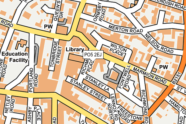
PO5 2EJ is located in the St Jude electoral ward, within the unitary authority of Portsmouth and the English Parliamentary constituency of Portsmouth South. The Sub Integrated Care Board (ICB) Location is NHS Hampshire and Isle of Wight ICB - 10R and the police force is Hampshire. This postcode has been in use since June 1981.


GetTheData
Source: OS OpenMap – Local (Ordnance Survey)
Source: OS VectorMap District (Ordnance Survey)
Licence: Open Government Licence (requires attribution)
| Easting | 464455 |
| Northing | 98876 |
| Latitude | 50.785882 |
| Longitude | -1.087027 |
GetTheData
Source: Open Postcode Geo
Licence: Open Government Licence
| Country | England |
| Postcode District | PO5 |
➜ See where PO5 is on a map ➜ Where is Portsmouth? | |
GetTheData
Source: Land Registry Price Paid Data
Licence: Open Government Licence
Elevation or altitude of PO5 2EJ as distance above sea level:
| Metres | Feet | |
|---|---|---|
| Elevation | 10m | 33ft |
Elevation is measured from the approximate centre of the postcode, to the nearest point on an OS contour line from OS Terrain 50, which has contour spacing of ten vertical metres.
➜ How high above sea level am I? Find the elevation of your current position using your device's GPS.
GetTheData
Source: Open Postcode Elevation
Licence: Open Government Licence
| Ward | St Jude |
| Constituency | Portsmouth South |
GetTheData
Source: ONS Postcode Database
Licence: Open Government Licence
| St. Judes Church (Kent Road) | Southsea | 129m |
| St. Judes Church (Kent Road) | Southsea | 143m |
| Southsea Shops (Clarendon Road) | Southsea | 159m |
| Southsea Shops (Osborne Road) | Southsea | 179m |
| Southsea Shops (Osborne Road) | Southsea | 193m |
| Southsea Hoverport | 0.9km |
| Portsmouth & Southsea Station | 1.4km |
| Fratton Station | 1.5km |
GetTheData
Source: NaPTAN
Licence: Open Government Licence
GetTheData
Source: ONS Postcode Database
Licence: Open Government Licence


➜ Get more ratings from the Food Standards Agency
GetTheData
Source: Food Standards Agency
Licence: FSA terms & conditions
| Last Collection | |||
|---|---|---|---|
| Location | Mon-Fri | Sat | Distance |
| The Friary | 17:15 | 12:00 | 49m |
| Southsea Precinct | 18:30 | 11:45 | 106m |
| Southsea Precinct | 18:30 | 11:45 | 106m |
GetTheData
Source: Dracos
Licence: Creative Commons Attribution-ShareAlike
| Risk of PO5 2EJ flooding from rivers and sea | Low |
| ➜ PO5 2EJ flood map | |
GetTheData
Source: Open Flood Risk by Postcode
Licence: Open Government Licence
The below table lists the International Territorial Level (ITL) codes (formerly Nomenclature of Territorial Units for Statistics (NUTS) codes) and Local Administrative Units (LAU) codes for PO5 2EJ:
| ITL 1 Code | Name |
|---|---|
| TLJ | South East (England) |
| ITL 2 Code | Name |
| TLJ3 | Hampshire and Isle of Wight |
| ITL 3 Code | Name |
| TLJ31 | Portsmouth |
| LAU 1 Code | Name |
| E06000044 | Portsmouth |
GetTheData
Source: ONS Postcode Directory
Licence: Open Government Licence
The below table lists the Census Output Area (OA), Lower Layer Super Output Area (LSOA), and Middle Layer Super Output Area (MSOA) for PO5 2EJ:
| Code | Name | |
|---|---|---|
| OA | E00086498 | |
| LSOA | E01017122 | Portsmouth 022A |
| MSOA | E02003545 | Portsmouth 022 |
GetTheData
Source: ONS Postcode Directory
Licence: Open Government Licence
| PO5 2AT | Marmion Road | 48m |
| PO5 2AY | Marmion Road | 52m |
| PO5 2DX | Wilton Place | 53m |
| PO5 3QQ | Palmerston Road | 63m |
| PO5 2BA | Marmion Road | 72m |
| PO5 2FD | Stanley Street | 76m |
| PO5 2BG | Wilton Place | 88m |
| PO5 2DS | Stanley Street | 104m |
| PO5 2AG | Merton Road | 106m |
| PO5 3QJ | Palmerston Road | 115m |
GetTheData
Source: Open Postcode Geo; Land Registry Price Paid Data
Licence: Open Government Licence