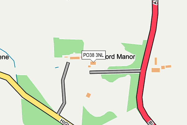
PO38 3NL lies on Blackwater Hollow in Rookley, Ventnor. PO38 3NL is located in the Central Rural electoral ward, within the unitary authority of Isle of Wight and the English Parliamentary constituency of Isle of Wight. The Sub Integrated Care Board (ICB) Location is NHS Hampshire and Isle of Wight ICB - D9Y0V and the police force is Hampshire. This postcode has been in use since January 1980.


GetTheData
Source: OS OpenMap – Local (Ordnance Survey)
Source: OS VectorMap District (Ordnance Survey)
Licence: Open Government Licence (requires attribution)
| Easting | 450442 |
| Northing | 84654 |
| Latitude | 50.659385 |
| Longitude | -1.287734 |
GetTheData
Source: Open Postcode Geo
Licence: Open Government Licence
| Street | Blackwater Hollow |
| Locality | Rookley |
| Town/City | Ventnor |
| Country | England |
| Postcode District | PO38 |
| ➜ PO38 open data dashboard ➜ See where PO38 is on a map | |
GetTheData
Source: Land Registry Price Paid Data
Licence: Open Government Licence
Elevation or altitude of PO38 3NL as distance above sea level:
| Metres | Feet | |
|---|---|---|
| Elevation | 40m | 131ft |
Elevation is measured from the approximate centre of the postcode, to the nearest point on an OS contour line from OS Terrain 50, which has contour spacing of ten vertical metres.
➜ How high above sea level am I? Find the elevation of your current position using your device's GPS.
GetTheData
Source: Open Postcode Elevation
Licence: Open Government Licence
| Ward | Central Rural |
| Constituency | Isle Of Wight |
GetTheData
Source: ONS Postcode Database
Licence: Open Government Licence
| Pidford Manor (Blackwater Hollow) | Rookley | 156m |
| Pidford Manor (Blackwater Hollow) | Rookley | 174m |
| Methodist Church (Niton Road) | Rookley | 606m |
| Methodist Church (Niton Road) | Rookley | 625m |
| Niton Road (Main Road) | Rookley | 675m |
GetTheData
Source: NaPTAN
Licence: Open Government Licence
| Percentage of properties with Next Generation Access | 100.0% |
| Percentage of properties with Superfast Broadband | 66.7% |
| Percentage of properties with Ultrafast Broadband | 0.0% |
| Percentage of properties with Full Fibre Broadband | 0.0% |
Superfast Broadband is between 30Mbps and 300Mbps
Ultrafast Broadband is > 300Mbps
| Percentage of properties unable to receive 2Mbps | 0.0% |
| Percentage of properties unable to receive 5Mbps | 0.0% |
| Percentage of properties unable to receive 10Mbps | 0.0% |
| Percentage of properties unable to receive 30Mbps | 33.3% |
GetTheData
Source: Ofcom
Licence: Ofcom Terms of Use (requires attribution)
GetTheData
Source: ONS Postcode Database
Licence: Open Government Licence


➜ Get more ratings from the Food Standards Agency
GetTheData
Source: Food Standards Agency
Licence: FSA terms & conditions
| Last Collection | |||
|---|---|---|---|
| Location | Mon-Fri | Sat | Distance |
| Rookley Post Office | 16:30 | 10:30 | 605m |
| Rookley Green | 16:15 | 10:30 | 1,249m |
| Chillerton Post Office | 17:15 | 09:00 | 1,462m |
GetTheData
Source: Dracos
Licence: Creative Commons Attribution-ShareAlike
| Facility | Distance |
|---|---|
| Rookley Sports Field Highwood Lane, Rookley, Ventnor Grass Pitches, Sports Hall | 291m |
| Chillerton & Rookley Primary School Main Road, Chillerton, Newport Grass Pitches | 1.4km |
| Whitecroft & Barton Sports Club Sandy Lane, Newport Grass Pitches | 1.5km |
GetTheData
Source: Active Places
Licence: Open Government Licence
| School | Phase of Education | Distance |
|---|---|---|
| St George's School Watergate Rd, Newport, PO30 1XW | Not applicable | 3.4km |
| Godshill Primary School School Road, Godshill, Ventnor, PO38 3HJ | Primary | 3.5km |
| Arreton St George's Church of England (Aided) Primary School School Lane, Main Road, Arreton, Newport, PO30 3AD | Primary | 3.7km |
GetTheData
Source: Edubase
Licence: Open Government Licence
The below table lists the International Territorial Level (ITL) codes (formerly Nomenclature of Territorial Units for Statistics (NUTS) codes) and Local Administrative Units (LAU) codes for PO38 3NL:
| ITL 1 Code | Name |
|---|---|
| TLJ | South East (England) |
| ITL 2 Code | Name |
| TLJ3 | Hampshire and Isle of Wight |
| ITL 3 Code | Name |
| TLJ34 | Isle of Wight |
| LAU 1 Code | Name |
| E06000046 | Isle of Wight |
GetTheData
Source: ONS Postcode Directory
Licence: Open Government Licence
The below table lists the Census Output Area (OA), Lower Layer Super Output Area (LSOA), and Middle Layer Super Output Area (MSOA) for PO38 3NL:
| Code | Name | |
|---|---|---|
| OA | E00087358 | |
| LSOA | E01017297 | Isle of Wight 017A |
| MSOA | E02003597 | Isle of Wight 017 |
GetTheData
Source: ONS Postcode Directory
Licence: Open Government Licence
| PO38 3NN | Highwood Lane | 64m |
| PO38 3NJ | Bunkers Lane | 527m |
| PO38 3NH | Main Road | 552m |
| PO38 3NP | Niton Road | 606m |
| PO38 3NR | Niton Road | 701m |
| PO38 3NT | Dolcroft Road | 754m |
| PO38 3NQ | Main Road | 786m |
| PO38 3NS | Manor Crescent | 822m |
| PO38 3NU | Niton Road | 887m |
| PO38 3NG | Main Road | 893m |
GetTheData
Source: Open Postcode Geo; Land Registry Price Paid Data
Licence: Open Government Licence