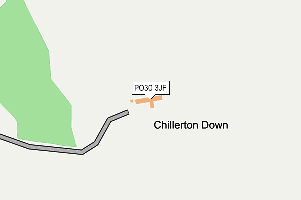
PO30 3JF is located in the Central Rural electoral ward, within the unitary authority of Isle of Wight and the English Parliamentary constituency of Isle of Wight. The Sub Integrated Care Board (ICB) Location is NHS Hampshire and Isle of Wight ICB - D9Y0V and the police force is Hampshire. This postcode has been in use since January 1980.


GetTheData
Source: OS OpenMap – Local (Ordnance Survey)
Source: OS VectorMap District (Ordnance Survey)
Licence: Open Government Licence (requires attribution)
| Easting | 447541 |
| Northing | 83486 |
| Latitude | 50.649125 |
| Longitude | -1.328922 |
GetTheData
Source: Open Postcode Geo
Licence: Open Government Licence
| Country | England |
| Postcode District | PO30 |
| ➜ PO30 open data dashboard ➜ See where PO30 is on a map | |
GetTheData
Source: Land Registry Price Paid Data
Licence: Open Government Licence
Elevation or altitude of PO30 3JF as distance above sea level:
| Metres | Feet | |
|---|---|---|
| Elevation | 160m | 525ft |
Elevation is measured from the approximate centre of the postcode, to the nearest point on an OS contour line from OS Terrain 50, which has contour spacing of ten vertical metres.
➜ How high above sea level am I? Find the elevation of your current position using your device's GPS.
GetTheData
Source: Open Postcode Elevation
Licence: Open Government Licence
| Ward | Central Rural |
| Constituency | Isle Of Wight |
GetTheData
Source: ONS Postcode Database
Licence: Open Government Licence
| Chillerton Barns (Main Road) | Chillerton | 508m |
| Chillerton Barns (Main Road) | Chillerton | 534m |
| Roslin Lane (Berry Shute) | Berry Hill | 957m |
| Roslin Lane (Berry Shute) | Berry Hill | 959m |
| Chillerton Green (Main Road) | Chillerton | 1,039m |
GetTheData
Source: NaPTAN
Licence: Open Government Licence
GetTheData
Source: ONS Postcode Database
Licence: Open Government Licence

➜ Get more ratings from the Food Standards Agency
GetTheData
Source: Food Standards Agency
Licence: FSA terms & conditions
| Last Collection | |||
|---|---|---|---|
| Location | Mon-Fri | Sat | Distance |
| Chillerton Green | 17:15 | 09:30 | 1,232m |
| Chillerton Post Office | 17:15 | 09:00 | 1,666m |
| West Billingham Farm | 17:15 | 10:00 | 1,788m |
GetTheData
Source: Dracos
Licence: Creative Commons Attribution-ShareAlike
| Facility | Distance |
|---|---|
| Chillerton & Rookley Primary School Main Road, Chillerton, Newport Grass Pitches | 1.7km |
| Isle Of Wight Mountain Bike Centre Cheverton Shute, Cheverton Shute, Shorwell, Newport Cycling | 1.9km |
| Shorwell Recreation Ground Fine Lane, Shorwell, Newport Grass Pitches | 2km |
GetTheData
Source: Active Places
Licence: Open Government Licence
| School | Phase of Education | Distance |
|---|---|---|
| Brighstone Church of England Aided Primary School New Road, Brighstone, Newport, PO30 4BB | Primary | 4.8km |
| St Thomas of Canterbury Catholic Primary School High Street, Carisbrooke, Newport, PO30 1NR | Primary | 4.9km |
| St George's School Watergate Rd, Newport, PO30 1XW | Not applicable | 5.3km |
GetTheData
Source: Edubase
Licence: Open Government Licence
The below table lists the International Territorial Level (ITL) codes (formerly Nomenclature of Territorial Units for Statistics (NUTS) codes) and Local Administrative Units (LAU) codes for PO30 3JF:
| ITL 1 Code | Name |
|---|---|
| TLJ | South East (England) |
| ITL 2 Code | Name |
| TLJ3 | Hampshire and Isle of Wight |
| ITL 3 Code | Name |
| TLJ34 | Isle of Wight |
| LAU 1 Code | Name |
| E06000046 | Isle of Wight |
GetTheData
Source: ONS Postcode Directory
Licence: Open Government Licence
The below table lists the Census Output Area (OA), Lower Layer Super Output Area (LSOA), and Middle Layer Super Output Area (MSOA) for PO30 3JF:
| Code | Name | |
|---|---|---|
| OA | E00087356 | |
| LSOA | E01017297 | Isle of Wight 017A |
| MSOA | E02003597 | Isle of Wight 017 |
GetTheData
Source: ONS Postcode Directory
Licence: Open Government Licence
| PO30 3HW | Chillerton Farm Barns | 471m |
| PO30 3HA | Main Road | 554m |
| PO30 3EZ | Quarry Close | 895m |
| PO30 3EY | Main Road | 993m |
| PO30 3EU | Main Road | 1142m |
| PO30 3ES | Main Road | 1273m |
| PO30 3HJ | Lansdown Gardens | 1296m |
| PO30 3HB | Berry Shute | 1381m |
| PO30 3HD | 1489m | |
| PO30 3ER | Main Road | 1514m |
GetTheData
Source: Open Postcode Geo; Land Registry Price Paid Data
Licence: Open Government Licence