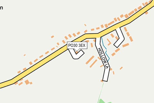
PO30 3EX is located in the Central Rural electoral ward, within the unitary authority of Isle of Wight and the English Parliamentary constituency of Isle of Wight. The Sub Integrated Care Board (ICB) Location is NHS Hampshire and Isle of Wight ICB - D9Y0V and the police force is Hampshire. This postcode has been in use since January 1980.


GetTheData
Source: OS OpenMap – Local (Ordnance Survey)
Source: OS VectorMap District (Ordnance Survey)
Licence: Open Government Licence (requires attribution)
| Easting | 448627 |
| Northing | 83726 |
| Latitude | 50.651194 |
| Longitude | -1.313531 |
GetTheData
Source: Open Postcode Geo
Licence: Open Government Licence
| Country | England |
| Postcode District | PO30 |
| ➜ PO30 open data dashboard ➜ See where PO30 is on a map ➜ Where is Chillerton? | |
GetTheData
Source: Land Registry Price Paid Data
Licence: Open Government Licence
Elevation or altitude of PO30 3EX as distance above sea level:
| Metres | Feet | |
|---|---|---|
| Elevation | 50m | 164ft |
Elevation is measured from the approximate centre of the postcode, to the nearest point on an OS contour line from OS Terrain 50, which has contour spacing of ten vertical metres.
➜ How high above sea level am I? Find the elevation of your current position using your device's GPS.
GetTheData
Source: Open Postcode Elevation
Licence: Open Government Licence
| Ward | Central Rural |
| Constituency | Isle Of Wight |
GetTheData
Source: ONS Postcode Database
Licence: Open Government Licence
| June 2022 | Public order | On or near Greenland Close | 20m |
| March 2022 | Criminal damage and arson | On or near Greenland Close | 20m |
| September 2021 | Theft from the person | On or near Greenland Close | 20m |
| ➜ Get more crime data in our Crime section | |||
GetTheData
Source: data.police.uk
Licence: Open Government Licence
| Chillerton Green (Main Road) | Chillerton | 43m |
| Chillerton Green (Main Road) | Chillerton | 76m |
| Chillerton Barns (Main Road) | Chillerton | 648m |
| Chillerton Barns (Main Road) | Chillerton | 701m |
| Chillerton School (Main Road) | Chillerton | 707m |
GetTheData
Source: NaPTAN
Licence: Open Government Licence
| Percentage of properties with Next Generation Access | 100.0% |
| Percentage of properties with Superfast Broadband | 33.3% |
| Percentage of properties with Ultrafast Broadband | 0.0% |
| Percentage of properties with Full Fibre Broadband | 0.0% |
Superfast Broadband is between 30Mbps and 300Mbps
Ultrafast Broadband is > 300Mbps
| Percentage of properties unable to receive 2Mbps | 0.0% |
| Percentage of properties unable to receive 5Mbps | 0.0% |
| Percentage of properties unable to receive 10Mbps | 0.0% |
| Percentage of properties unable to receive 30Mbps | 66.7% |
GetTheData
Source: Ofcom
Licence: Ofcom Terms of Use (requires attribution)
GetTheData
Source: ONS Postcode Database
Licence: Open Government Licence

➜ Get more ratings from the Food Standards Agency
GetTheData
Source: Food Standards Agency
Licence: FSA terms & conditions
| Last Collection | |||
|---|---|---|---|
| Location | Mon-Fri | Sat | Distance |
| Chillerton Green | 17:15 | 09:30 | 126m |
| Chillerton Post Office | 17:15 | 09:00 | 607m |
| Rectory Lane, Gatcombe | 17:00 | 10:30 | 1,566m |
GetTheData
Source: Dracos
Licence: Creative Commons Attribution-ShareAlike
| Facility | Distance |
|---|---|
| Chillerton & Rookley Primary School Main Road, Chillerton, Newport Grass Pitches | 698m |
| Rookley Sports Field Highwood Lane, Rookley, Ventnor Grass Pitches, Sports Hall | 2km |
| Whitecroft & Barton Sports Club Sandy Lane, Newport Grass Pitches | 2.7km |
GetTheData
Source: Active Places
Licence: Open Government Licence
| School | Phase of Education | Distance |
|---|---|---|
| Godshill Primary School School Road, Godshill, Ventnor, PO38 3HJ | Primary | 4.4km |
| St Thomas of Canterbury Catholic Primary School High Street, Carisbrooke, Newport, PO30 1NR | Primary | 4.5km |
| St George's School Watergate Rd, Newport, PO30 1XW | Not applicable | 4.6km |
GetTheData
Source: Edubase
Licence: Open Government Licence
The below table lists the International Territorial Level (ITL) codes (formerly Nomenclature of Territorial Units for Statistics (NUTS) codes) and Local Administrative Units (LAU) codes for PO30 3EX:
| ITL 1 Code | Name |
|---|---|
| TLJ | South East (England) |
| ITL 2 Code | Name |
| TLJ3 | Hampshire and Isle of Wight |
| ITL 3 Code | Name |
| TLJ34 | Isle of Wight |
| LAU 1 Code | Name |
| E06000046 | Isle of Wight |
GetTheData
Source: ONS Postcode Directory
Licence: Open Government Licence
The below table lists the Census Output Area (OA), Lower Layer Super Output Area (LSOA), and Middle Layer Super Output Area (MSOA) for PO30 3EX:
| Code | Name | |
|---|---|---|
| OA | E00087356 | |
| LSOA | E01017297 | Isle of Wight 017A |
| MSOA | E02003597 | Isle of Wight 017 |
GetTheData
Source: ONS Postcode Directory
Licence: Open Government Licence
| PO30 3EU | Main Road | 41m |
| PO30 3EY | Main Road | 121m |
| PO30 3ES | Main Road | 178m |
| PO30 3HJ | Lansdown Gardens | 185m |
| PO30 3EZ | Quarry Close | 219m |
| PO30 3ER | Main Road | 437m |
| PO30 3EP | Main Road | 595m |
| PO30 3HA | Main Road | 662m |
| PO30 3HW | Chillerton Farm Barns | 723m |
| PO30 3DN | Main Road | 737m |
GetTheData
Source: Open Postcode Geo; Land Registry Price Paid Data
Licence: Open Government Licence