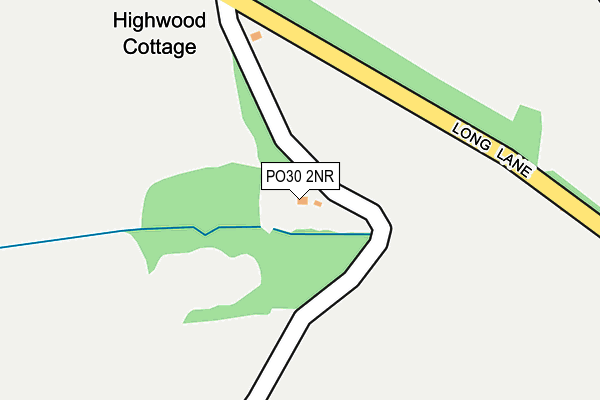
PO30 2NR lies on Long Lane in Newport. PO30 2NR is located in the Central Rural electoral ward, within the unitary authority of Isle of Wight and the English Parliamentary constituency of Isle of Wight. The Sub Integrated Care Board (ICB) Location is NHS Hampshire and Isle of Wight ICB - D9Y0V and the police force is Hampshire. This postcode has been in use since January 1980.


GetTheData
Source: OS OpenMap – Local (Ordnance Survey)
Source: OS VectorMap District (Ordnance Survey)
Licence: Open Government Licence (requires attribution)
| Easting | 452807 |
| Northing | 88244 |
| Latitude | 50.691445 |
| Longitude | -1.253757 |
GetTheData
Source: Open Postcode Geo
Licence: Open Government Licence
| Street | Long Lane |
| Town/City | Newport |
| Country | England |
| Postcode District | PO30 |
| ➜ PO30 open data dashboard ➜ See where PO30 is on a map | |
GetTheData
Source: Land Registry Price Paid Data
Licence: Open Government Licence
Elevation or altitude of PO30 2NR as distance above sea level:
| Metres | Feet | |
|---|---|---|
| Elevation | 90m | 295ft |
Elevation is measured from the approximate centre of the postcode, to the nearest point on an OS contour line from OS Terrain 50, which has contour spacing of ten vertical metres.
➜ How high above sea level am I? Find the elevation of your current position using your device's GPS.
GetTheData
Source: Open Postcode Elevation
Licence: Open Government Licence
| Ward | Central Rural |
| Constituency | Isle Of Wight |
GetTheData
Source: ONS Postcode Database
Licence: Open Government Licence
| Standen Lane (Long Lane) | Downend | 53m |
| Standen Lane (Long Lane) | Downend | 63m |
| Downend (Long Lane) | Downend | 350m |
| Downend (Long Lane) | Downend | 425m |
| Durton Lane (Long Lane) | Staplers | 605m |
GetTheData
Source: NaPTAN
Licence: Open Government Licence
| Percentage of properties with Next Generation Access | 0.0% |
| Percentage of properties with Superfast Broadband | 0.0% |
| Percentage of properties with Ultrafast Broadband | 0.0% |
| Percentage of properties with Full Fibre Broadband | 0.0% |
Superfast Broadband is between 30Mbps and 300Mbps
Ultrafast Broadband is > 300Mbps
| Percentage of properties unable to receive 2Mbps | 100.0% |
| Percentage of properties unable to receive 5Mbps | 100.0% |
| Percentage of properties unable to receive 10Mbps | 100.0% |
| Percentage of properties unable to receive 30Mbps | 100.0% |
GetTheData
Source: Ofcom
Licence: Ofcom Terms of Use (requires attribution)
GetTheData
Source: ONS Postcode Database
Licence: Open Government Licence


➜ Get more ratings from the Food Standards Agency
GetTheData
Source: Food Standards Agency
Licence: FSA terms & conditions
| Last Collection | |||
|---|---|---|---|
| Location | Mon-Fri | Sat | Distance |
| Little East Standen | 16:00 | 08:00 | 42m |
| Arreton Vicarage | 16:00 | 10:15 | 1,694m |
| Staplers Road | 17:15 | 12:15 | 1,719m |
GetTheData
Source: Dracos
Licence: Creative Commons Attribution-ShareAlike
| Facility | Distance |
|---|---|
| Newport Golf Club St. Georges Lane, Newport Golf | 2km |
| Downside Recreation Ground Furrlongs, Newport Grass Pitches | 2.1km |
| Barton Primary School Furrlongs, Newport Grass Pitches | 2.2km |
GetTheData
Source: Active Places
Licence: Open Government Licence
| School | Phase of Education | Distance |
|---|---|---|
| Arreton St George's Church of England (Aided) Primary School School Lane, Main Road, Arreton, Newport, PO30 3AD | Primary | 1.8km |
| Barton Primary School Furrlongs, Newport, PO30 2AX | Primary | 2.4km |
| Summerfields Primary School Atkinson Drive, Newport, PO30 2LJ | Primary | 2.4km |
GetTheData
Source: Edubase
Licence: Open Government Licence
The below table lists the International Territorial Level (ITL) codes (formerly Nomenclature of Territorial Units for Statistics (NUTS) codes) and Local Administrative Units (LAU) codes for PO30 2NR:
| ITL 1 Code | Name |
|---|---|
| TLJ | South East (England) |
| ITL 2 Code | Name |
| TLJ3 | Hampshire and Isle of Wight |
| ITL 3 Code | Name |
| TLJ34 | Isle of Wight |
| LAU 1 Code | Name |
| E06000046 | Isle of Wight |
GetTheData
Source: ONS Postcode Directory
Licence: Open Government Licence
The below table lists the Census Output Area (OA), Lower Layer Super Output Area (LSOA), and Middle Layer Super Output Area (MSOA) for PO30 2NR:
| Code | Name | |
|---|---|---|
| OA | E00087354 | |
| LSOA | E01017296 | Isle of Wight 011C |
| MSOA | E02003591 | Isle of Wight 011 |
GetTheData
Source: ONS Postcode Directory
Licence: Open Government Licence
| PO30 2NT | Long Lane | 484m |
| PO30 2NP | Long Lane | 571m |
| PO30 2PA | Downend Road | 855m |
| PO30 2LU | Staplers Road | 889m |
| PO30 2NW | Long Lane | 903m |
| PO30 2PB | Downend Road | 1187m |
| PO30 2NL | Buckbury Lane | 1304m |
| PO30 2PP | Burnt House Lane | 1330m |
| PO30 2LX | Buckbury Heights | 1348m |
| PO30 2NQ | Long Lane | 1397m |
GetTheData
Source: Open Postcode Geo; Land Registry Price Paid Data
Licence: Open Government Licence