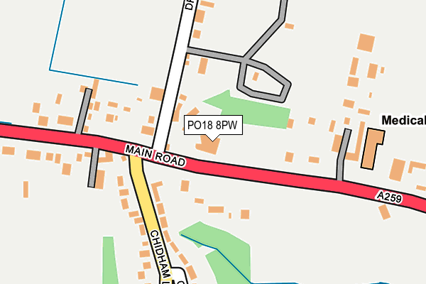
PO18 8PW is located in the Harbour Villages electoral ward, within the local authority district of Chichester and the English Parliamentary constituency of Chichester. The Sub Integrated Care Board (ICB) Location is NHS Sussex ICB - 70F and the police force is Sussex. This postcode has been in use since January 1980.


GetTheData
Source: OS OpenMap – Local (Ordnance Survey)
Source: OS VectorMap District (Ordnance Survey)
Licence: Open Government Licence (requires attribution)
| Easting | 479363 |
| Northing | 105356 |
| Latitude | 50.842297 |
| Longitude | -0.874187 |
GetTheData
Source: Open Postcode Geo
Licence: Open Government Licence
| Country | England |
| Postcode District | PO18 |
| ➜ PO18 open data dashboard ➜ See where PO18 is on a map ➜ Where is Nutbourne? | |
GetTheData
Source: Land Registry Price Paid Data
Licence: Open Government Licence
Elevation or altitude of PO18 8PW as distance above sea level:
| Metres | Feet | |
|---|---|---|
| Elevation | 10m | 33ft |
Elevation is measured from the approximate centre of the postcode, to the nearest point on an OS contour line from OS Terrain 50, which has contour spacing of ten vertical metres.
➜ How high above sea level am I? Find the elevation of your current position using your device's GPS.
GetTheData
Source: Open Postcode Elevation
Licence: Open Government Licence
| Ward | Harbour Villages |
| Constituency | Chichester |
GetTheData
Source: ONS Postcode Database
Licence: Open Government Licence
| June 2022 | Burglary | On or near Main Road | 58m |
| June 2022 | Other theft | On or near Main Road | 58m |
| June 2022 | Violence and sexual offences | On or near Hamstead Meadow | 244m |
| ➜ Get more crime data in our Crime section | |||
GetTheData
Source: data.police.uk
Licence: Open Government Licence
| Drift Lane (A259) | Chidham | 77m |
| Drift Lane (A259) | Chidham | 96m |
| Cockleberry Farm (A259) | Chidham | 162m |
| Cockleberry Farm (A259) | Chidham | 199m |
| The Barleycorn (A259) | Nutbourne | 457m |
| Nutbourne Station | 0.7km |
| Bosham Station | 1.9km |
| Southbourne Station | 2.5km |
GetTheData
Source: NaPTAN
Licence: Open Government Licence
GetTheData
Source: ONS Postcode Database
Licence: Open Government Licence


➜ Get more ratings from the Food Standards Agency
GetTheData
Source: Food Standards Agency
Licence: FSA terms & conditions
| Last Collection | |||
|---|---|---|---|
| Location | Mon-Fri | Sat | Distance |
| Chidham School | 16:00 | 08:00 | 387m |
| Barleycorn Pub | 16:00 | 07:15 | 563m |
| Nutbourne Post Office | 16:00 | 11:00 | 1,290m |
GetTheData
Source: Dracos
Licence: Creative Commons Attribution-ShareAlike
| Facility | Distance |
|---|---|
| Chidham Parochial Primary School Chidham Lane, Chidham, Chichester Sports Hall, Grass Pitches | 366m |
| Delling Close Cricket Ground (Bosham Cricket Club) Delling Close, Bosham, Chichester Grass Pitches | 1.6km |
| Bosham Recreation Ground Walton Lane, Bosham Grass Pitches | 2km |
GetTheData
Source: Active Places
Licence: Open Government Licence
| School | Phase of Education | Distance |
|---|---|---|
| Chidham Parochial Primary School Chidham Lane, Chidham, Chichester, PO18 8TH | Primary | 364m |
| Bosham Primary School Walton Lane, Bosham, Chichester, PO18 8QF | Primary | 2.1km |
| Southbourne Infant School New Road, Southbourne, Emsworth, PO10 8JX | Primary | 2.3km |
GetTheData
Source: Edubase
Licence: Open Government Licence
The below table lists the International Territorial Level (ITL) codes (formerly Nomenclature of Territorial Units for Statistics (NUTS) codes) and Local Administrative Units (LAU) codes for PO18 8PW:
| ITL 1 Code | Name |
|---|---|
| TLJ | South East (England) |
| ITL 2 Code | Name |
| TLJ2 | Surrey, East and West Sussex |
| ITL 3 Code | Name |
| TLJ27 | West Sussex (South West) |
| LAU 1 Code | Name |
| E07000225 | Chichester |
GetTheData
Source: ONS Postcode Directory
Licence: Open Government Licence
The below table lists the Census Output Area (OA), Lower Layer Super Output Area (LSOA), and Middle Layer Super Output Area (MSOA) for PO18 8PW:
| Code | Name | |
|---|---|---|
| OA | E00160515 | |
| LSOA | E01031475 | Chichester 009A |
| MSOA | E02006569 | Chichester 009 |
GetTheData
Source: ONS Postcode Directory
Licence: Open Government Licence
| PO18 8PL | Main Road | 111m |
| PO18 8TL | Chidham Lane | 131m |
| PO18 8PP | Drift Lane | 180m |
| PO18 8PN | Main Road | 190m |
| PO18 8TH | Chidham Lane | 200m |
| PO18 8TJ | Hamstead Meadow | 234m |
| PO18 8TP | Main Road | 289m |
| PO18 8PR | Drift Lane | 447m |
| PO18 8TR | Ivydene Crescent | 479m |
| PO18 8PS | 489m |
GetTheData
Source: Open Postcode Geo; Land Registry Price Paid Data
Licence: Open Government Licence